![](/images/other/stat-length.png)
![Tocht Fietstoerisme Theix-Noyalo - De Noyalo à Pénerf - Photo](https://media.geolcdn.com/t/1900/400/db4e9402-8188-4614-9f55-6ee537cd6b8a.jpg&format=pjpeg&maxdim=2)
De Noyalo à Pénerf
ilur56
Gebruiker
![Lengte](/images/other/stat-length.png)
Lengte
46 km
![Max. hoogte](https://static1.geolcdn.com/siteimages/upload/files/1508320355ic_sort_altitude_max_24dp.png)
Max. hoogte
45 m
![Positief hoogteverschil](https://static1.geolcdn.com/siteimages/upload/files/1508320355ic_sort_den_pos_24dp.png)
Positief hoogteverschil
297 m
![Km-Effort](/images/other/stat-length.png)
Km-Effort
50 km
![Min. hoogte](https://static1.geolcdn.com/siteimages/upload/files/1508320355ic_sort_altitude_min_24dp.png)
Min. hoogte
-1 m
![Negatief hoogteverschil](https://static1.geolcdn.com/siteimages/upload/files/1508320355ic_sort_den_neg_24dp.png)
Negatief hoogteverschil
297 m
![Boucle](https://static1.geolcdn.com/siteimages/upload/files/16400158638029165_repeat_loop_refresh_sync_direction_icon.png)
Boucle
Ja
Datum van aanmaak :
2024-05-09 11:38:03.47
Laatste wijziging :
2024-05-10 15:41:34.121
![Fietstoerisme](https://static1.geolcdn.com/sitytour/trail-icons/204.png)
--
Moeilijkheid : Zeer moeilijk
![Scan deze QR-code om de tocht te openen in de SityTrail-applicatie](https://capi.geolives.com/qq0zvz2zws4bq2lad0pu/sitytour/trails/4047749/qr.png?size=200)
Gratisgps-wandelapplicatie
Over ons
Tocht Fietstoerisme van 46 km beschikbaar op Bretagne, Morbihan, Theix-Noyalo. Deze tocht wordt voorgesteld door ilur56.
Beschrijving
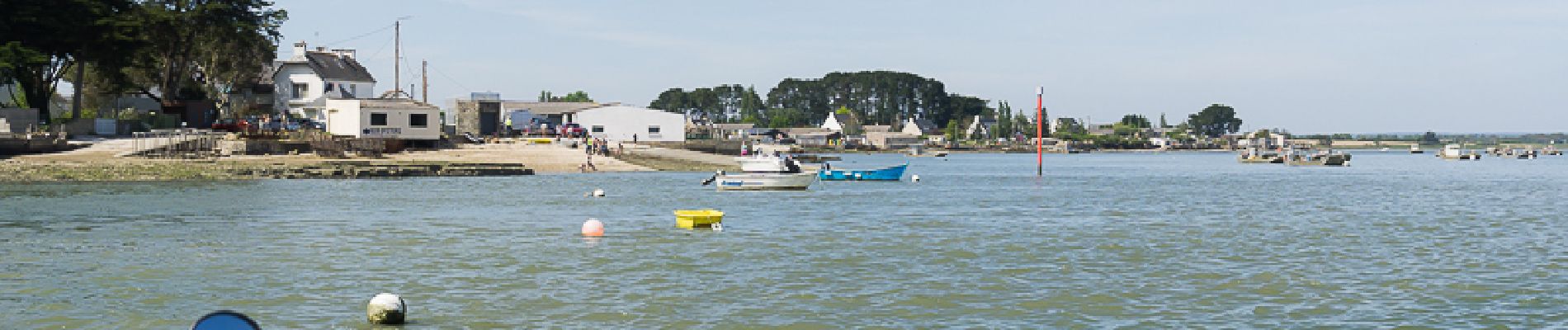
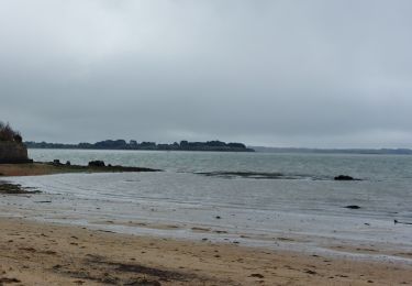
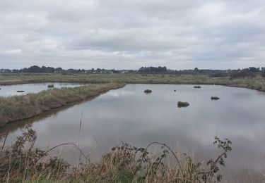
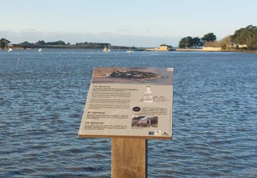
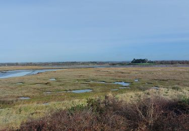
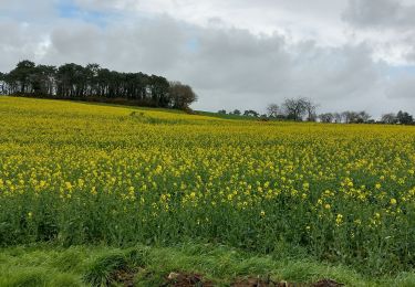
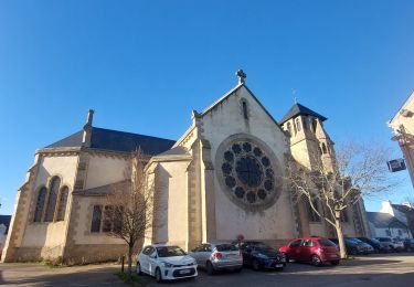
Boucle entre les communes de Theix-Noyalo, Surzur, Ambon, Damgan et le Tour du Parc avec passage en bateau entre Pénerf et Pencadénic grâce au petit passeur.
Plaatsbepaling
Land:
France
Regio :
Bretagne
Departement/Provincie :
Morbihan
Gemeente :
Theix-Noyalo
Locatie:
Unknown
Vertrek:(Dec)
Vertrek:(UTM)
523883 ; 5273092 (30T) N.
Opmerkingen
Wandeltochten in de omgeving
![Tocht Stappen Saint-Armel - Île TASCON- Le Passage 56 - Photo](https://media.geolcdn.com/t/375/260/ext.jpg?maxdim=2&url=https%3A%2F%2Fstatic1.geolcdn.com%2Fsiteimages%2Fupload%2Ffiles%2F1553511878bg_sport_marche.png)
![Stappen Stappen](https://static1.geolcdn.com/sitytour/trail-icons/101.png)
Île TASCON- Le Passage 56
Stappen
Gemakkelijk
(1)
Saint-Armel,
Bretagne,
Morbihan,
France
![](/images/other/stat-length.png)
11,5 km | 12,1 km-effort
2h 31min
![](https://static1.geolcdn.com/siteimages/upload/files/16400158638029165_repeat_loop_refresh_sync_direction_icon.png)
Ja
![Tocht Stappen Saint-Armel - St Armel en passant par l'Ile de Tason (Boucle) - Photo](https://media.geolcdn.com/t/375/260/ext.jpg?maxdim=2&url=https%3A%2F%2Fstatic1.geolcdn.com%2Fsiteimages%2Fupload%2Ffiles%2F1553511878bg_sport_marche.png)
![Stappen Stappen](https://static1.geolcdn.com/sitytour/trail-icons/101.png)
St Armel en passant par l'Ile de Tason (Boucle)
Stappen
Medium
(3)
Saint-Armel,
Bretagne,
Morbihan,
France
![](/images/other/stat-length.png)
20 km | 22 km-effort
4h 49min
![](https://static1.geolcdn.com/siteimages/upload/files/16400158638029165_repeat_loop_refresh_sync_direction_icon.png)
Ja
![Elektrische fiets Elektrische fiets](https://static1.geolcdn.com/sitytour/trail-icons/205.png)
Boucle De Surzur à Ambon
Elektrische fiets
Medium
Surzur,
Bretagne,
Morbihan,
France
![](/images/other/stat-length.png)
16 km | 17,6 km-effort
1h 15min
![](https://static1.geolcdn.com/siteimages/upload/files/16400158638029165_repeat_loop_refresh_sync_direction_icon.png)
Ja
![Tocht Stappen Séné - PR_56_Sene_IA_09_Circuit1b_Sentier-Des-Gabelous_20240311 - Photo](https://media.geolcdn.com/t/375/260/c2ea644e-e03f-4409-ac55-71c5dee67584.jpg&format=jpg&maxdim=2)
![Stappen Stappen](https://static1.geolcdn.com/sitytour/trail-icons/101.png)
PR_56_Sene_IA_09_Circuit1b_Sentier-Des-Gabelous_20240311
Stappen
Heel gemakkelijk
Séné,
Bretagne,
Morbihan,
France
![](/images/other/stat-length.png)
10,1 km | 11 km-effort
1h 53min
![](https://static1.geolcdn.com/siteimages/upload/files/16400158638029165_repeat_loop_refresh_sync_direction_icon.png)
Ja
![Tocht Stappen Saint-Armel - PR_56_St-Armel_AA_01_Circuit1b_Le-Marais-Salant-De-Lasne_20231222 - Photo](https://media.geolcdn.com/t/375/260/0843618c-a073-4181-b237-858d69aa3eda.jpg&format=jpg&maxdim=2)
![Stappen Stappen](https://static1.geolcdn.com/sitytour/trail-icons/101.png)
PR_56_St-Armel_AA_01_Circuit1b_Le-Marais-Salant-De-Lasne_20231222
Stappen
Heel gemakkelijk
Saint-Armel,
Bretagne,
Morbihan,
France
![](/images/other/stat-length.png)
12,6 km | 13,4 km-effort
2h 39min
![](https://static1.geolcdn.com/siteimages/upload/files/16400158638029165_repeat_loop_refresh_sync_direction_icon.png)
Ja
![Tocht Stappen Séné - PR_56_Sene_HA_08_Circuit3a_Du-Passage_20231205 - Photo](https://media.geolcdn.com/t/375/260/d5b7643d-c63d-4161-aaf0-6fe7e6e442e1.jpg&format=jpg&maxdim=2)
![Stappen Stappen](https://static1.geolcdn.com/sitytour/trail-icons/101.png)
PR_56_Sene_HA_08_Circuit3a_Du-Passage_20231205
Stappen
Medium
Séné,
Bretagne,
Morbihan,
France
![](/images/other/stat-length.png)
8,5 km | 9,7 km-effort
1h 47min
![](https://static1.geolcdn.com/siteimages/upload/files/16400158638029165_repeat_loop_refresh_sync_direction_icon.png)
Ja
![Tocht Stappen Séné - PR_56_Sene_GA_07_Circuit3b_Entre-Bocage-Et-Marais_20231115 - Photo](https://media.geolcdn.com/t/375/260/90de986c-3b14-49b7-b42b-f41416db033a.jpg&format=jpg&maxdim=2)
![Stappen Stappen](https://static1.geolcdn.com/sitytour/trail-icons/101.png)
PR_56_Sene_GA_07_Circuit3b_Entre-Bocage-Et-Marais_20231115
Stappen
Medium
Séné,
Bretagne,
Morbihan,
France
![](/images/other/stat-length.png)
7,8 km | 8,3 km-effort
1h 30min
![](https://static1.geolcdn.com/siteimages/upload/files/16400158638029165_repeat_loop_refresh_sync_direction_icon.png)
Ja
![Tocht Stappen Theix-Noyalo - PR_56_Theix-Noyalo_AA_01_Circuit3b_Vers-Corn-Er-Hoet_20230401 - Photo](https://media.geolcdn.com/t/375/260/53a27219-59ef-468a-9654-2c8ca963d998.jpg&format=jpg&maxdim=2)
![Stappen Stappen](https://static1.geolcdn.com/sitytour/trail-icons/101.png)
PR_56_Theix-Noyalo_AA_01_Circuit3b_Vers-Corn-Er-Hoet_20230401
Stappen
Medium
Theix-Noyalo,
Bretagne,
Morbihan,
France
![](/images/other/stat-length.png)
8,3 km | 9,9 km-effort
1h 40min
![](https://static1.geolcdn.com/siteimages/upload/files/16400158638029165_repeat_loop_refresh_sync_direction_icon.png)
Ja
![Tocht Stappen Séné - PR_56_Sene_FA_06_Circuit3b_Le-Bourg-Et-Ses-Rivages_20230206 - Photo](https://media.geolcdn.com/t/375/260/169b12f8-5799-478a-8a15-2ebf012a9c5c.jpg&format=jpg&maxdim=2)
![Stappen Stappen](https://static1.geolcdn.com/sitytour/trail-icons/101.png)
PR_56_Sene_FA_06_Circuit3b_Le-Bourg-Et-Ses-Rivages_20230206
Stappen
Gemakkelijk
Séné,
Bretagne,
Morbihan,
France
![](/images/other/stat-length.png)
3,3 km | 3,6 km-effort
43min
![](https://static1.geolcdn.com/siteimages/upload/files/16400158638029165_repeat_loop_refresh_sync_direction_icon.png)
Ja