![](/images/other/stat-length.png)
![Tocht Stappen Villers-la-Ville - GRP 127 : Villers-la-Ville - Nivelles - Photo](https://media.geolcdn.com/t/1900/400/dc13518d-0966-4ce4-90b6-d9a3ec22cc2d.jpeg&format=pjpeg&maxdim=2)
GRP 127 : Villers-la-Ville - Nivelles
dauzata
Gebruiker
![Lengte](/images/other/stat-length.png)
Lengte
27 km
![Max. hoogte](https://static1.geolcdn.com/siteimages/upload/files/1508320355ic_sort_altitude_max_24dp.png)
Max. hoogte
170 m
![Positief hoogteverschil](https://static1.geolcdn.com/siteimages/upload/files/1508320355ic_sort_den_pos_24dp.png)
Positief hoogteverschil
314 m
![Km-Effort](/images/other/stat-length.png)
Km-Effort
31 km
![Min. hoogte](https://static1.geolcdn.com/siteimages/upload/files/1508320355ic_sort_altitude_min_24dp.png)
Min. hoogte
98 m
![Negatief hoogteverschil](https://static1.geolcdn.com/siteimages/upload/files/1508320355ic_sort_den_neg_24dp.png)
Negatief hoogteverschil
304 m
![Boucle](https://static1.geolcdn.com/siteimages/upload/files/16400158638029165_repeat_loop_refresh_sync_direction_icon.png)
Boucle
Neen
Datum van aanmaak :
2024-05-01 08:45:09.0
Laatste wijziging :
2024-05-01 19:59:25.209
![Stappen](https://static1.geolcdn.com/sitytour/trail-icons/101.png)
7h04
Moeilijkheid : Medium
![Scan deze QR-code om de tocht te openen in de SityTrail-applicatie](https://capi.geolives.com/qq0zvz2zws4bq2lad0pu/sitytour/trails/4036509/qr.png?size=200)
Gratisgps-wandelapplicatie
Over ons
Tocht Stappen van 27 km beschikbaar op Wallonië, Waals-Brabant, Villers-la-Ville. Deze tocht wordt voorgesteld door dauzata.
Beschrijving
Départ: Gare de Villers-la-Ville
Arrivée: Gare de Nivelles
La partie entre Houtain-le-Val et l'entrée dans Nivelles est peu intéressante: des champs à perte de vue !
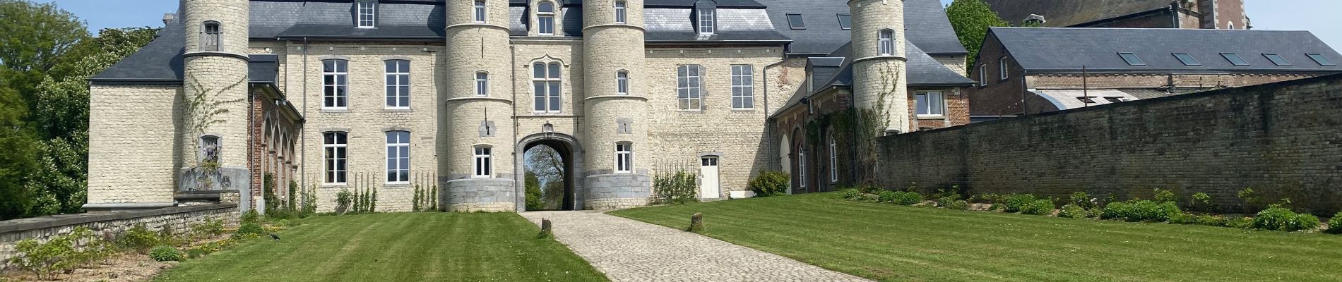
Plaatsbepaling
Land:
Belgium
Regio :
Wallonië
Departement/Provincie :
Waals-Brabant
Gemeente :
Villers-la-Ville
Locatie:
Villers-la-Ville
Vertrek:(Dec)
Vertrek:(UTM)
608548 ; 5604042 (31U) N.
Opmerkingen
Wandeltochten in de omgeving
![Tocht Stappen Villers-la-Ville - RB-Bw-10-raccourci 2 - À travers campagnes et forêts, autour des ruines d’une prestigieuse abbaye - Photo](https://media.geolcdn.com/t/375/260/ext.jpg?maxdim=2&url=https%3A%2F%2Fservices.sitytrail.com%2FGeolivesWS%2FDownloadMedia.ashx%3FTrailID%3D220359%26Media%3Db52f8a40-bd4e-4201-848f-58c9caafd869.jpg)
![Stappen Stappen](https://static1.geolcdn.com/sitytour/trail-icons/101.png)
RB-Bw-10-raccourci 2 - À travers campagnes et forêts, autour des ruines d’une...
Stappen
Moeilijk
(26)
Villers-la-Ville,
Wallonië,
Waals-Brabant,
Belgium
![](/images/other/stat-length.png)
13,3 km | 16,4 km-effort
3h 44min
![](https://static1.geolcdn.com/siteimages/upload/files/16400158638029165_repeat_loop_refresh_sync_direction_icon.png)
Ja
![Tocht Stappen Villers-la-Ville - RB-Bw-10 - Villers-la-Ville - 2025-02-08 - Photo](https://media.geolcdn.com/t/375/260/ext.jpg?maxdim=2&url=https%3A%2F%2Fservices.sitytrail.com%2FGeolivesWS%2FDownloadMedia.ashx%3FTrailID%3D220358%26Media%3D903cc0f2-4910-43b5-bcea-92ca954ab4b4.jpg)
![Stappen Stappen](https://static1.geolcdn.com/sitytour/trail-icons/101.png)
RB-Bw-10 - Villers-la-Ville - 2025-02-08
Stappen
Zeer moeilijk
(13)
Villers-la-Ville,
Wallonië,
Waals-Brabant,
Belgium
![](/images/other/stat-length.png)
24 km | 30 km-effort
6h 43min
![](https://static1.geolcdn.com/siteimages/upload/files/16400158638029165_repeat_loop_refresh_sync_direction_icon.png)
Ja
![Tocht Stappen Genepiën - RB-Bw-09 Raccourci 1 & 2 - Autour de la jeune Dyle et de ses affluents - Photo](https://media.geolcdn.com/t/375/260/ext.jpg?maxdim=2&url=https%3A%2F%2Fservices.sitytrail.com%2FGeolivesWS%2FDownloadMedia.ashx%3FTrailID%3D220340%26Media%3Dd40b4c5b-4793-41f9-ac7b-fe40a955ea25.jpg)
![Stappen Stappen](https://static1.geolcdn.com/sitytour/trail-icons/101.png)
RB-Bw-09 Raccourci 1 & 2 - Autour de la jeune Dyle et de ses affluents
Stappen
Moeilijk
(11)
Genepiën,
Wallonië,
Waals-Brabant,
Belgium
![](/images/other/stat-length.png)
9,7 km | 12,5 km-effort
2h 50min
![](https://static1.geolcdn.com/siteimages/upload/files/16400158638029165_repeat_loop_refresh_sync_direction_icon.png)
Ja
![Tocht Stappen Genepiën - RB-Bw-09 Raccourci 1 - Autour de la jeune Dyle et de ses affluents - Photo](https://media.geolcdn.com/t/375/260/ext.jpg?maxdim=2&url=https%3A%2F%2Fservices.sitytrail.com%2FGeolivesWS%2FDownloadMedia.ashx%3FTrailID%3D220337%26Media%3Dcacfbcff-3084-47a0-8267-9fc97c2da542.jpg)
![Stappen Stappen](https://static1.geolcdn.com/sitytour/trail-icons/101.png)
RB-Bw-09 Raccourci 1 - Autour de la jeune Dyle et de ses affluents
Stappen
Moeilijk
(11)
Genepiën,
Wallonië,
Waals-Brabant,
Belgium
![](/images/other/stat-length.png)
13,2 km | 16,9 km-effort
3h 49min
![](https://static1.geolcdn.com/siteimages/upload/files/16400158638029165_repeat_loop_refresh_sync_direction_icon.png)
Ja
![Tocht Stappen Villers-la-Ville - RB-Bw-10 - Villers-la-Ville - Via allongement - 2025-02-08 - Photo](https://media.geolcdn.com/t/375/260/ext.jpg?maxdim=2&url=https%3A%2F%2Fservices.sitytrail.com%2FGeolivesWS%2FDownloadMedia.ashx%3FTrailID%3D179585%26Media%3D903cc0f2-4910-43b5-bcea-92ca954ab4b4.jpg)
![Stappen Stappen](https://static1.geolcdn.com/sitytour/trail-icons/101.png)
RB-Bw-10 - Villers-la-Ville - Via allongement - 2025-02-08
Stappen
Zeer moeilijk
(6)
Villers-la-Ville,
Wallonië,
Waals-Brabant,
Belgium
![](/images/other/stat-length.png)
26 km | 32 km-effort
7h 15min
![](https://static1.geolcdn.com/siteimages/upload/files/16400158638029165_repeat_loop_refresh_sync_direction_icon.png)
Ja
![Tocht Stappen Genepiën - RB-Bw-09 - Bousval - 2025-02-08 - Photo](https://media.geolcdn.com/t/375/260/ext.jpg?maxdim=2&url=https%3A%2F%2Fservices.sitytrail.com%2FGeolivesWS%2FDownloadMedia.ashx%3FTrailID%3D179584%26Media%3Dcacfbcff-3084-47a0-8267-9fc97c2da542.jpg)
![Stappen Stappen](https://static1.geolcdn.com/sitytour/trail-icons/101.png)
RB-Bw-09 - Bousval - 2025-02-08
Stappen
Zeer moeilijk
(9)
Genepiën,
Wallonië,
Waals-Brabant,
Belgium
![](/images/other/stat-length.png)
22 km | 28 km-effort
6h 26min
![](https://static1.geolcdn.com/siteimages/upload/files/16400158638029165_repeat_loop_refresh_sync_direction_icon.png)
Ja
![Tocht Stappen Genepiën - Genappe - Circuit Natura 2000, des sites qui valent le détour ! - Bw03 - Photo](https://media.geolcdn.com/t/375/260/ext.jpg?maxdim=2&url=https%3A%2F%2Fservices.sitytrail.com%2FGeolivesWS%2FDownloadMedia.ashx%3FTrailID%3D356410%26Media%3D9ffde3d0-226c-45a8-b2a5-1fc6dfbe0f90.jpg)
![Stappen Stappen](https://static1.geolcdn.com/sitytour/trail-icons/101.png)
Genappe - Circuit Natura 2000, des sites qui valent le détour ! - Bw03
Stappen
Medium
(6)
Genepiën,
Wallonië,
Waals-Brabant,
Belgium
![](/images/other/stat-length.png)
7,9 km | 9,7 km-effort
2h 6min
![](https://static1.geolcdn.com/siteimages/upload/files/16400158638029165_repeat_loop_refresh_sync_direction_icon.png)
Ja
![Tocht Stappen Court-Saint-Étienne - RL-GG-22 - La Roche - Blanmont - 2025-02-08 - Photo](https://media.geolcdn.com/t/375/260/30daf148-db06-45a8-82ae-1a9e3bedbca7.jpg&format=jpg&maxdim=2)
![Stappen Stappen](https://static1.geolcdn.com/sitytour/trail-icons/101.png)
RL-GG-22 - La Roche - Blanmont - 2025-02-08
Stappen
Zeer moeilijk
(2)
Court-Saint-Étienne,
Wallonië,
Waals-Brabant,
Belgium
![](/images/other/stat-length.png)
21 km | 26 km-effort
5h 51min
![](https://static1.geolcdn.com/siteimages/upload/files/16400158638029165_repeat_loop_refresh_sync_direction_icon.png)
Neen
![Stappen Stappen](https://static1.geolcdn.com/sitytour/trail-icons/101.png)
Bérines
Stappen
Gemakkelijk
(1)
Villers-la-Ville,
Wallonië,
Waals-Brabant,
Belgium
![](/images/other/stat-length.png)
6,4 km | 7,5 km-effort
1h 41min
![](https://static1.geolcdn.com/siteimages/upload/files/16400158638029165_repeat_loop_refresh_sync_direction_icon.png)
Ja