29 km | 31 km-effort
Lac f
Yvon59
Gebruiker
Lengte
8,2 km
Max. hoogte
34 m
Positief hoogteverschil
54 m
Km-Effort
8,9 km
Min. hoogte
6 m
Negatief hoogteverschil
54 m
Boucle
Ja
Datum van aanmaak :
2024-04-30 11:50:42.528
Laatste wijziging :
2024-04-30 14:48:01.739
2h55
Moeilijkheid : Medium
Gratisgps-wandelapplicatie
Over ons
Tocht Stappen van 8,2 km beschikbaar op Normandië, Manche, Millières. Deze tocht wordt voorgesteld door Yvon59.
Beschrijving
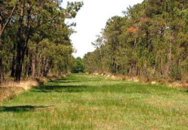
Lac des Bruyères.
Plaatsbepaling
Land:
France
Regio :
Normandië
Departement/Provincie :
Manche
Gemeente :
Millières
Locatie:
Unknown
Vertrek:(Dec)
Vertrek:(UTM)
612223 ; 5452528 (30U) N.
Opmerkingen
Wandeltochten in de omgeving
Randonnée autour de Périers
Mountainbike
Gemakkelijk
(1)
Périers,
Normandië,
Manche,
France
32 km | 35 km-effort
2h 0min
Ja
La Tourbière de Gorges
Stappen
Medium
Gorges,
Normandië,
Manche,
France
8,2 km | 8,7 km-effort
2h 0min
Ja
St Martin d'Aubigny - Marchesieux
Andere activiteiten
Gemakkelijk
Périers,
Normandië,
Manche,
France
30 km | 32 km-effort
1h 52min
Ja
St Martin d'Aubigny - Marchesieux
Andere activiteiten
Gemakkelijk
Périers,
Normandië,
Manche,
France
30 km | 32 km-effort
1h 52min
Ja
Manche 3
Mountainbike
Heel gemakkelijk
Périers,
Normandië,
Manche,
France
48 km | 55 km-effort
11h 52min
Neen
COTENTIN 1
Wegfiets
Zeer moeilijk
Vesly,
Normandië,
Manche,
France
258 km | 292 km-effort
17h 40min
Neen
TR DU COTENTIN 250K
Fietstoerisme
Heel gemakkelijk
Vesly,
Normandië,
Manche,
France
240 km | 271 km-effort
Onbekend
Ja
SityTrail - MIN 2020 JOUR 2 SPM50 à Maison de Pirou
Motorfiets
Heel gemakkelijk
Lessay,
Normandië,
Manche,
France
8,5 km | 9,3 km-effort
Onbekend
Neen