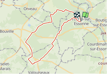
Tocht Stappen Vayres-sur-Essonne - SityTrail - 3969880 - boutignyxchateau-de-farcheville - Photo

SityTrail - 3969880 - boutignyxchateau-de-farcheville

 CSR-94
CSR-94

Gebruiker

© OpenStreetMap contributors
Lengte
Lengte
16,3 km
Max. hoogte
Max. hoogte
139 m
Positief hoogteverschil
187 m
Km-Effort
Km-Effort  
18,8 km
Min. hoogte
Min. hoogte
63 m
Negatief hoogteverschil
187 m
Boucle
Boucle
Ja
Datum van aanmaak :
2024-04-29 10:06:11.413
Laatste wijziging :
2024-04-29 11:50:42.644

(1 Bericht)

Stappen
Stappen
4h16
Moeilijkheid : Moeilijk

Scan deze QR-code om de tocht te openen in de SityTrail-applicatie

Gratisgps-wandelapplicatie

Logo SityTrail SityTrail

IGN / Geografische instituten

SityTrail uit de App Store downloaden SityTrail uit Google Play downloaden

Logo SityTrail SityTrail World

De wereld gaat voor u open

SityTrail uit de App Store downloaden SityTrail uit Google Play downloaden SityTrail op Huawei AppGallery downloaden

Over ons

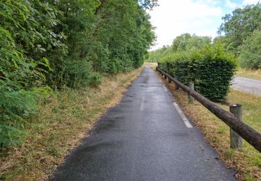
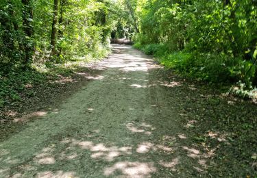
Tocht Stappen van 16,3 km beschikbaar op Île-de-France, Essonne, Vayres-sur-Essonne. Deze tocht wordt voorgesteld door CSR-94.

Hoogteprofiel

Plaatsbepaling

Land:
France
Regio :
Île-de-France
Departement/Provincie :
Essonne
Gemeente :
Vayres-sur-Essonne
Locatie:
Unknown
Vertrek:(UTM)
452232 ; 5365203 (31U) N.

Opmerkingen

Gelieve in te loggen om een commentaar of een beoordeling achter te laten


Wandeltochten in de omgeving

Tocht Stappen Vayres-sur-Essonne - Boucle 30 km à partir de Vayres / Essonne - Photo
Stappen
GUIDE
chessyca

Stappen

Medium
Vayres-sur-Essonne, Île-de-France, Essonne, France
28 km | 34 km-effort
5h 45min
Ja
Tocht Stappen La Ferté-Alais - Boucle Cerny - Photo
Stappen
GUIDE
chessyca

Stappen

Medium
La Ferté-Alais, Île-de-France, Essonne, France
22 km | 26 km-effort
4h 38min
Ja
Tocht Stappen Boutigny-sur-Essonne - Le tour du Grand Paris via le GR1 Etape 16 Boutigny /essonne - Lardy - Photo
Stappen
GUIDE
chessyca

Stappen

Medium
Boutigny-sur-Essonne, Île-de-France, Essonne, France
26 km | 32 km-effort
5h 14min
Neen
Tocht Te voet La Ferté-Alais - Boucle Orveau - Ferté Alais 27 km - Photo
Te voet
GUIDE
chessyca

Te voet

Moeilijk
La Ferté-Alais, Île-de-France, Essonne, France
27 km | 33 km-effort
7h 26min
Ja
Tocht Stappen La Ferté-Alais - la ferté alais la sablière - Photo
Stappen
mdsaintjalmes

Stappen

Medium
(2)
La Ferté-Alais, Île-de-France, Essonne, France
12,5 km | 14,8 km-effort
3h 15min
Ja
Tocht Stappen Bouville - Bouville - Photo
Stappen
guydu41

Stappen

Medium
Bouville, Île-de-France, Essonne, France
8,4 km | 10,3 km-effort
2h 20min
Ja
Tocht Stappen Boutigny-sur-Essonne - Boutigny-sur-Essonne  - Photo
Stappen
guydu41

Stappen

Medium
Boutigny-sur-Essonne, Île-de-France, Essonne, France
6,4 km | 8,5 km-effort
1h 56min
Ja
Tocht Stappen La Ferté-Alais - La Ferté Alais - Photo
Stappen
guydu41

Stappen

Medium
La Ferté-Alais, Île-de-France, Essonne, France
7,7 km | 9 km-effort
2h 2min
Ja
Tocht Stappen Valpuiseaux - Manu-121124-Gâtinais - Valpuiseaux-Farcheville - Photo
Stappen
randodan

Stappen

Heel gemakkelijk
Valpuiseaux, Île-de-France, Essonne, France
20 km | 24 km-effort
5h 18min
Ja


Sluiten
Mijn abonnementen