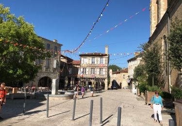
22 km | 26 km-effort
2 eauze
thonyc
Gebruiker GUIDE
Lengte
27 km
Max. hoogte
180 m
Positief hoogteverschil
393 m
Km-Effort
32 km
Min. hoogte
94 m
Negatief hoogteverschil
438 m
Boucle
Neen
Datum van aanmaak :
2024-04-17 06:39:28.977
Laatste wijziging :
2024-04-17 14:44:20.617
8h03
Moeilijkheid : Moeilijk
Gratisgps-wandelapplicatie
Over ons
Tocht Stappen van 27 km beschikbaar op Occitanië, Gers, Eauze. Deze tocht wordt voorgesteld door thonyc.
Plaatsbepaling
Land:
France
Regio :
Occitanië
Departement/Provincie :
Gers
Gemeente :
Eauze
Locatie:
Unknown
Vertrek:(Dec)
Vertrek:(UTM)
269158 ; 4864128 (31T) N.
Opmerkingen
Wandeltochten in de omgeving
Eauze, sentier des moulins.
Stappen
Gemakkelijk
Eauze,
Occitanië,
Gers,
France
11,2 km | 13 km-effort
3h 15min
Neen
Le Chemin des Moulins
Stappen
Gemakkelijk
Eauze,
Occitanië,
Gers,
France
10,4 km | 12,2 km-effort
2h 15min
Ja
Eauze - Le Haget
Stappen
Gemakkelijk
Eauze,
Occitanië,
Gers,
France
15 km | 17,9 km-effort
6h 29min
Neen
StJ-J37-Laboge-Nogaro
Stappen
Zeer moeilijk
Bretagne-d'Armagnac,
Occitanië,
Gers,
France
27 km | 32 km-effort
6h 56min
Neen
le coupé eauze ste christie 15.7.2017
Stappen
Heel gemakkelijk
Eauze,
Occitanië,
Gers,
France
25 km | 29 km-effort
5h 23min
Neen
OR-6946309--Eauze:eauze-nogaro-6
Stappen
Heel gemakkelijk
Eauze,
Occitanië,
Gers,
France
20 km | 23 km-effort
5h 4min
Neen
Compostelle 25 - Eauze -> Nogaro
Stappen
Gemakkelijk
Eauze,
Occitanië,
Gers,
France
22 km | 27 km-effort
5h 43min
Neen