![](/images/other/stat-length.png)
![Tocht Elektrische fiets Vauchassis - Balade VAE Pays d Othe - Photo](https://media.geolcdn.com/t/1900/400/9599c955-63b9-4d47-9a4c-acac74eb533f.jpg&format=pjpeg&maxdim=2)
Balade VAE Pays d Othe
FPortier
Gebruiker
![Lengte](/images/other/stat-length.png)
Lengte
56 km
![Max. hoogte](https://static1.geolcdn.com/siteimages/upload/files/1508320355ic_sort_altitude_max_24dp.png)
Max. hoogte
292 m
![Positief hoogteverschil](https://static1.geolcdn.com/siteimages/upload/files/1508320355ic_sort_den_pos_24dp.png)
Positief hoogteverschil
761 m
![Km-Effort](/images/other/stat-length.png)
Km-Effort
66 km
![Min. hoogte](https://static1.geolcdn.com/siteimages/upload/files/1508320355ic_sort_altitude_min_24dp.png)
Min. hoogte
140 m
![Negatief hoogteverschil](https://static1.geolcdn.com/siteimages/upload/files/1508320355ic_sort_den_neg_24dp.png)
Negatief hoogteverschil
761 m
![Boucle](https://static1.geolcdn.com/siteimages/upload/files/16400158638029165_repeat_loop_refresh_sync_direction_icon.png)
Boucle
Ja
Datum van aanmaak :
2024-04-13 09:01:09.357
Laatste wijziging :
2024-04-14 07:27:49.411
![Elektrische fiets](https://static1.geolcdn.com/sitytour/trail-icons/205.png)
5h15
Moeilijkheid : Heel gemakkelijk
![Scan deze QR-code om de tocht te openen in de SityTrail-applicatie](https://capi.geolives.com/qq0zvz2zws4bq2lad0pu/sitytour/trails/4015089/qr.png?size=200)
Gratisgps-wandelapplicatie
Over ons
Tocht Elektrische fiets van 56 km beschikbaar op Grand Est, Aube, Vauchassis. Deze tocht wordt voorgesteld door FPortier.
Beschrijving
Campagne Pays Othe . restaurant à Surançon.
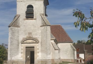
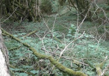
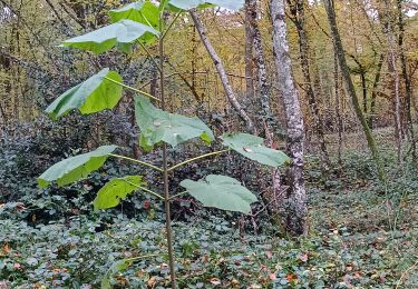
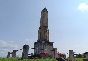
Plaatsbepaling
Land:
France
Regio :
Grand Est
Departement/Provincie :
Aube
Gemeente :
Vauchassis
Locatie:
Unknown
Vertrek:(Dec)
Vertrek:(UTM)
568965 ; 5341692 (31U) N.
Opmerkingen
Wandeltochten in de omgeving
![Tocht Stappen Prugny - Montbernange - Photo](https://media.geolcdn.com/t/375/260/4b4d4fb7-91b5-4cd4-a11d-924324bd5236.jpg&format=jpg&maxdim=2)
![Stappen Stappen](https://static1.geolcdn.com/sitytour/trail-icons/101.png)
![Tocht Stappen Bouilly - Bouilly le 30.07.22 (9.6kms) N° 2 - Photo](https://media.geolcdn.com/t/375/260/ext.jpg?maxdim=2&url=https%3A%2F%2Fstatic1.geolcdn.com%2Fsiteimages%2Fupload%2Ffiles%2F1553511878bg_sport_marche.png)
![Stappen Stappen](https://static1.geolcdn.com/sitytour/trail-icons/101.png)
Bouilly le 30.07.22 (9.6kms) N° 2
Stappen
Medium
(1)
Bouilly,
Grand Est,
Aube,
France
![](/images/other/stat-length.png)
8,1 km | 10,5 km-effort
2h 23min
![](https://static1.geolcdn.com/siteimages/upload/files/16400158638029165_repeat_loop_refresh_sync_direction_icon.png)
Ja
![Tocht Stappen Souligny - Souligny 16km le 11/06/2019 - Photo](https://media.geolcdn.com/t/375/260/cb96a311-1155-457a-b30c-92f04f614db0.jpg&format=jpg&maxdim=2)
![Stappen Stappen](https://static1.geolcdn.com/sitytour/trail-icons/101.png)
Souligny 16km le 11/06/2019
Stappen
Moeilijk
(1)
Souligny,
Grand Est,
Aube,
France
![](/images/other/stat-length.png)
16 km | 0 m-effort
3h 9min
![](https://static1.geolcdn.com/siteimages/upload/files/16400158638029165_repeat_loop_refresh_sync_direction_icon.png)
Ja
![Tocht Mountainbike Laines-aux-Bois - montaigutour toto aout217 - Photo](https://media.geolcdn.com/t/375/260/ext.jpg?maxdim=2&url=https%3A%2F%2Fstatic1.geolcdn.com%2Fsiteimages%2Fupload%2Ffiles%2F1524743154velo.jpg)
![Mountainbike Mountainbike](https://static1.geolcdn.com/sitytour/trail-icons/202.png)
montaigutour toto aout217
Mountainbike
Moeilijk
(1)
Laines-aux-Bois,
Grand Est,
Aube,
France
![](/images/other/stat-length.png)
31 km | 42 km-effort
3h 6min
![](https://static1.geolcdn.com/siteimages/upload/files/16400158638029165_repeat_loop_refresh_sync_direction_icon.png)
Ja
![Tocht Mountainbike Laines-aux-Bois - cource xc cwb Laines Aux Bois 2017 - Photo](https://media.geolcdn.com/t/375/260/ext.jpg?maxdim=2&url=https%3A%2F%2Fstatic1.geolcdn.com%2Fsiteimages%2Fupload%2Ffiles%2F1524743154velo.jpg)
![Mountainbike Mountainbike](https://static1.geolcdn.com/sitytour/trail-icons/202.png)
cource xc cwb Laines Aux Bois 2017
Mountainbike
Moeilijk
(3)
Laines-aux-Bois,
Grand Est,
Aube,
France
![](/images/other/stat-length.png)
6,6 km | 9,9 km-effort
38min
![](https://static1.geolcdn.com/siteimages/upload/files/16400158638029165_repeat_loop_refresh_sync_direction_icon.png)
Ja
![Tocht Mountainbike Laines-aux-Bois - hors piste phiphi - Photo](https://media.geolcdn.com/t/375/260/ext.jpg?maxdim=2&url=https%3A%2F%2Fstatic1.geolcdn.com%2Fsiteimages%2Fupload%2Ffiles%2F1524743154velo.jpg)
![Mountainbike Mountainbike](https://static1.geolcdn.com/sitytour/trail-icons/202.png)
hors piste phiphi
Mountainbike
Moeilijk
(1)
Laines-aux-Bois,
Grand Est,
Aube,
France
![](/images/other/stat-length.png)
26 km | 35 km-effort
3h 11min
![](https://static1.geolcdn.com/siteimages/upload/files/16400158638029165_repeat_loop_refresh_sync_direction_icon.png)
Neen
![Tocht Stappen Vauchassis - Vauchassis Bercenay - Photo](https://media.geolcdn.com/t/375/260/3bc01075-f320-46fc-861d-82d815a161ca.jpg&format=jpg&maxdim=2)
![Stappen Stappen](https://static1.geolcdn.com/sitytour/trail-icons/101.png)
Vauchassis Bercenay
Stappen
Moeilijk
Vauchassis,
Grand Est,
Aube,
France
![](/images/other/stat-length.png)
9,6 km | 12,3 km-effort
2h 44min
![](https://static1.geolcdn.com/siteimages/upload/files/16400158638029165_repeat_loop_refresh_sync_direction_icon.png)
Ja
![Tocht Stappen Laines-aux-Bois - Laines Aux Bois - Photo](https://media.geolcdn.com/t/375/260/ef71ceb7-9a6e-4478-9b41-196e23e80db9.jpg&format=jpg&maxdim=2)
![Stappen Stappen](https://static1.geolcdn.com/sitytour/trail-icons/101.png)
Laines Aux Bois
Stappen
Medium
Laines-aux-Bois,
Grand Est,
Aube,
France
![](/images/other/stat-length.png)
8 km | 10,2 km-effort
2h 11min
![](https://static1.geolcdn.com/siteimages/upload/files/16400158638029165_repeat_loop_refresh_sync_direction_icon.png)
Ja
![Tocht Stappen Laines-aux-Bois - Lainesauxbois7kmPR - Photo](https://media.geolcdn.com/t/375/260/ext.jpg?maxdim=2&url=https%3A%2F%2Fstatic1.geolcdn.com%2Fsiteimages%2Fupload%2Ffiles%2F1553511878bg_sport_marche.png)
![Stappen Stappen](https://static1.geolcdn.com/sitytour/trail-icons/101.png)
Lainesauxbois7kmPR
Stappen
Medium
(1)
Laines-aux-Bois,
Grand Est,
Aube,
France
![](/images/other/stat-length.png)
7 km | 9 km-effort
2h 3min
![](https://static1.geolcdn.com/siteimages/upload/files/16400158638029165_repeat_loop_refresh_sync_direction_icon.png)
Ja