![](/images/other/stat-length.png)
![Tocht Stappen Bairols - Pointe des 4 Cantons - Photo](https://media.geolcdn.com/t/1900/400/a7a9d005-3907-43b9-a75f-ead216069129.jpg&format=pjpeg&maxdim=2)
Pointe des 4 Cantons
bozo1970
Gebruiker
![Lengte](/images/other/stat-length.png)
![Max. hoogte](https://static1.geolcdn.com/siteimages/upload/files/1508320355ic_sort_altitude_max_24dp.png)
![Positief hoogteverschil](https://static1.geolcdn.com/siteimages/upload/files/1508320355ic_sort_den_pos_24dp.png)
![Km-Effort](/images/other/stat-length.png)
![Min. hoogte](https://static1.geolcdn.com/siteimages/upload/files/1508320355ic_sort_altitude_min_24dp.png)
![Negatief hoogteverschil](https://static1.geolcdn.com/siteimages/upload/files/1508320355ic_sort_den_neg_24dp.png)
![Boucle](https://static1.geolcdn.com/siteimages/upload/files/16400158638029165_repeat_loop_refresh_sync_direction_icon.png)
![Stappen](https://static1.geolcdn.com/sitytour/trail-icons/101.png)
5h45
Moeilijkheid : Zeer moeilijk
![Scan deze QR-code om de tocht te openen in de SityTrail-applicatie](https://capi.geolives.com/qq0zvz2zws4bq2lad0pu/sitytour/trails/4006265/qr.png?size=200)
Gratisgps-wandelapplicatie
Over ons
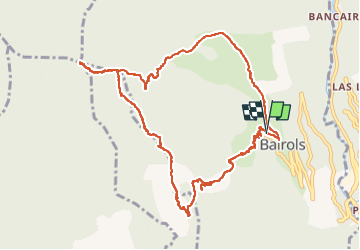
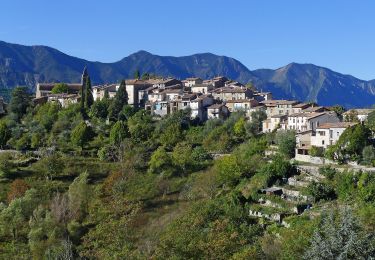
Tocht Stappen van 12,2 km beschikbaar op Provence-Alpes-Côte d'Azur, Alpes-Maritimes, Bairols. Deze tocht wordt voorgesteld door bozo1970.
Beschrijving
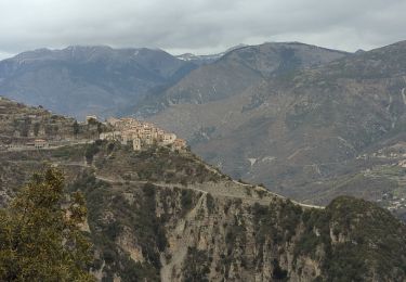
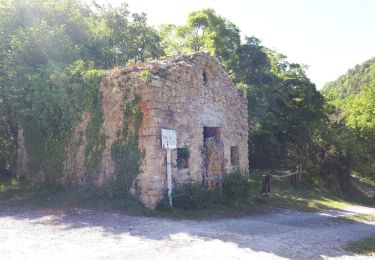
Départ du parking de Bairols
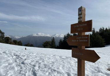
Balise 191 vers St Martin
Direction le Lac balise 196
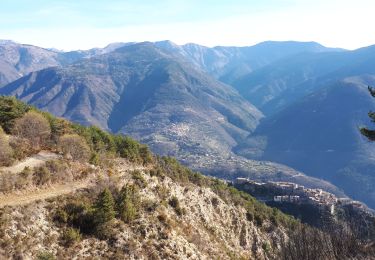
Vers le Rocher de Baume Percée
Éviter le sentier principal à gauche, tous les pins sont en travers.
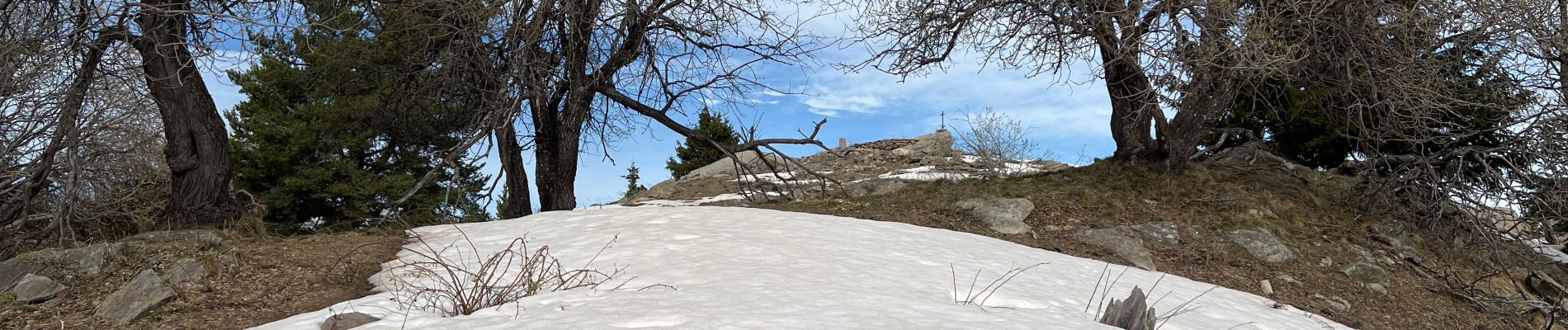
Sommet en 2h54’ D 1000m et 7km
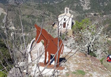
Très belle vue et très belle croix !
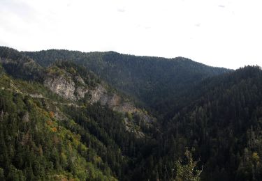
Descente droit dans la forêt vers le Col de l’Espella, très chaotique !!
Balise 197 en 4h36’ et 10km
A/R en 5h21’et 12km700
Plaatsbepaling
Opmerkingen
Wandeltochten in de omgeving
![Tocht Te voet La Tour - Circuit de Mangiarde - Photo](https://media.geolcdn.com/t/375/260/dd771dca-733e-4c57-950f-636b4e42c737.jpeg&format=jpg&maxdim=2)
![Te voet Te voet](https://static1.geolcdn.com/sitytour/trail-icons/100.png)
Te voet
![](/images/other/stat-length.png)
![](https://static1.geolcdn.com/siteimages/upload/files/16400158638029165_repeat_loop_refresh_sync_direction_icon.png)
![Tocht Te voet Bairols - Tour du mont Falourde - Photo](https://media.geolcdn.com/t/375/260/72458cd6-de82-448d-8f0e-f50b00abdc54.jpeg&format=jpg&maxdim=2)
![Te voet Te voet](https://static1.geolcdn.com/sitytour/trail-icons/100.png)
Te voet
![](/images/other/stat-length.png)
![](https://static1.geolcdn.com/siteimages/upload/files/16400158638029165_repeat_loop_refresh_sync_direction_icon.png)
![Tocht Te voet Clans - Chapelle Sainte-Anne - Photo](https://media.geolcdn.com/t/375/260/1efb0dc9-a63e-4821-aafb-f097dcd21c49.jpeg&format=jpg&maxdim=2)
![Te voet Te voet](https://static1.geolcdn.com/sitytour/trail-icons/100.png)
Te voet
![](/images/other/stat-length.png)
![](https://static1.geolcdn.com/siteimages/upload/files/16400158638029165_repeat_loop_refresh_sync_direction_icon.png)
![Tocht Te voet Massoins - Plateau du Lac - Photo](https://media.geolcdn.com/t/375/260/72458cd6-de82-448d-8f0e-f50b00abdc54.jpeg&format=jpg&maxdim=2)
![Te voet Te voet](https://static1.geolcdn.com/sitytour/trail-icons/100.png)
Te voet
![](/images/other/stat-length.png)
![](https://static1.geolcdn.com/siteimages/upload/files/16400158638029165_repeat_loop_refresh_sync_direction_icon.png)
![Tocht Sneeuwschoenen Ilonse - Lauvet d’Ilonse - Photo](https://media.geolcdn.com/t/375/260/27d6716b-7948-437f-a217-9ca86aa8eff9.jpg&format=jpg&maxdim=2)
![Sneeuwschoenen Sneeuwschoenen](https://static1.geolcdn.com/sitytour/trail-icons/504.png)
Sneeuwschoenen
![](/images/other/stat-length.png)
![](https://static1.geolcdn.com/siteimages/upload/files/16400158638029165_repeat_loop_refresh_sync_direction_icon.png)
![Tocht Stappen La Tour - Pic charvet, son Fort, Chapelle St Antoine, Tournefort - Photo](https://media.geolcdn.com/t/375/260/f393b76f-0e11-49af-9bd1-d986a17cd1fb.jpg&format=jpg&maxdim=2)
![Stappen Stappen](https://static1.geolcdn.com/sitytour/trail-icons/101.png)
Stappen
![](/images/other/stat-length.png)
![](https://static1.geolcdn.com/siteimages/upload/files/16400158638029165_repeat_loop_refresh_sync_direction_icon.png)
![Tocht Stappen Bairols - Mont Falourde depuis Bairoldmd - Photo](https://media.geolcdn.com/t/375/260/ee8fbd45-d346-4d87-a199-f1064cf2e4bd.jpg&format=jpg&maxdim=2)
![Stappen Stappen](https://static1.geolcdn.com/sitytour/trail-icons/101.png)
Stappen
![](/images/other/stat-length.png)
![](https://static1.geolcdn.com/siteimages/upload/files/16400158638029165_repeat_loop_refresh_sync_direction_icon.png)
![Tocht Stappen Bairols - Pointe des 4 cantons de Bairols retour col de l'espella - Photo](https://media.geolcdn.com/t/375/260/f66efb90-77ab-4307-b314-11309c7279a0.jpg&format=jpg&maxdim=2)
![Stappen Stappen](https://static1.geolcdn.com/sitytour/trail-icons/101.png)
Stappen
![](/images/other/stat-length.png)
![](https://static1.geolcdn.com/siteimages/upload/files/16400158638029165_repeat_loop_refresh_sync_direction_icon.png)
![Tocht Stappen Thiéry - Pointe de Chavanette Par chapelle Ste Madeleine/Thiery - Photo](https://media.geolcdn.com/t/375/260/bf4c4b25-1f2c-4c16-b282-1fd0acf4f8e0.jpg&format=jpg&maxdim=2)
![Stappen Stappen](https://static1.geolcdn.com/sitytour/trail-icons/101.png)
Stappen
![](/images/other/stat-length.png)
![](https://static1.geolcdn.com/siteimages/upload/files/16400158638029165_repeat_loop_refresh_sync_direction_icon.png)