![](/images/other/stat-length.png)
![Tocht Stappen Puy-Saint-Martin - Puy-Saint-Martin - Crête de Chevrière - La Pigne - Photo](https://media.geolcdn.com/t/1900/400/b3cf8e59-7c3b-42a9-bfd9-094f5c8a5934.jpg&format=pjpeg&maxdim=2)
Puy-Saint-Martin - Crête de Chevrière - La Pigne
Philindy26
Gebruiker
![Lengte](/images/other/stat-length.png)
![Max. hoogte](https://static1.geolcdn.com/siteimages/upload/files/1508320355ic_sort_altitude_max_24dp.png)
![Positief hoogteverschil](https://static1.geolcdn.com/siteimages/upload/files/1508320355ic_sort_den_pos_24dp.png)
![Km-Effort](/images/other/stat-length.png)
![Min. hoogte](https://static1.geolcdn.com/siteimages/upload/files/1508320355ic_sort_altitude_min_24dp.png)
![Negatief hoogteverschil](https://static1.geolcdn.com/siteimages/upload/files/1508320355ic_sort_den_neg_24dp.png)
![Boucle](https://static1.geolcdn.com/siteimages/upload/files/16400158638029165_repeat_loop_refresh_sync_direction_icon.png)
![Stappen](https://static1.geolcdn.com/sitytour/trail-icons/101.png)
4h05
Moeilijkheid : Medium
![Scan deze QR-code om de tocht te openen in de SityTrail-applicatie](https://capi.geolives.com/qq0zvz2zws4bq2lad0pu/sitytour/trails/4006257/qr.png?size=200)
Gratisgps-wandelapplicatie
Over ons
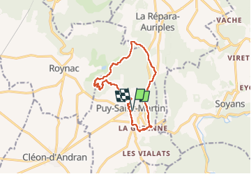
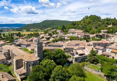
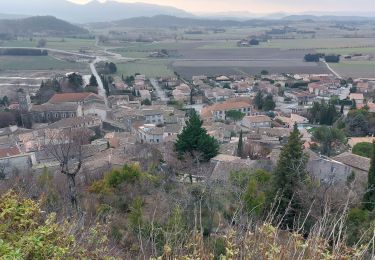
Tocht Stappen van 13 km beschikbaar op Auvergne-Rhône-Alpes, Drôme, Puy-Saint-Martin. Deze tocht wordt voorgesteld door Philindy26.
Beschrijving
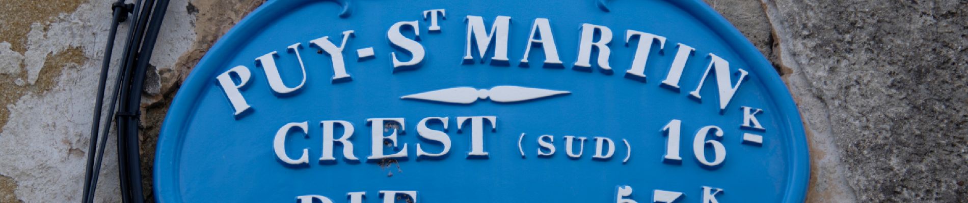
Départ du parking de la Mairie, commune de Puy-Saint-Martin (207 m).
Géolocalisation (Google Maps) : https://maps.app.goo.gl/CM7i1ADAmDYxV7HV6
Balisage jaune tout le long de la randonnée.
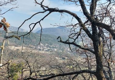
Monter par le centre du village jusqu'au belvédère. Puis descente au Nord pour rejoindre le chemin des Ours et prendre la direction de la Grange pour monter sur Chevrière.
Là, prendre le sentier à gauche en direction des crêtes Sud-ouest pour effectuer une boucle et revenir au carrefour du quatre-chemins.
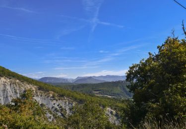
Puis continuer plein nord pour rejoindre Combeaux. Là, prendre plein Est, puis direction Sud pour rejoindre le site des éoliennes.
Continuer par les crêtes de la Pigne et retour à Puy-Saint-Martin par le quartier de la Garenne.
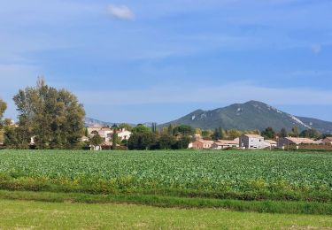
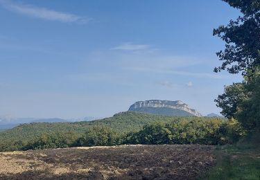
Plaatsbepaling
Opmerkingen
Wandeltochten in de omgeving
![Tocht Stappen Charols - 2022-10-01_18h01m37_13052196 - Photo](https://media.geolcdn.com/t/375/260/44333c54-0203-4720-b217-7a484d4324d6.jpg&format=jpg&maxdim=2)
![Stappen Stappen](https://static1.geolcdn.com/sitytour/trail-icons/101.png)
Stappen
![](/images/other/stat-length.png)
![](https://static1.geolcdn.com/siteimages/upload/files/16400158638029165_repeat_loop_refresh_sync_direction_icon.png)
![Tocht Stappen Puy-Saint-Martin - 2022-09-27_14h04m59_10644793 - Photo](https://media.geolcdn.com/t/375/260/6480930c-30c1-44b7-a230-4fcbebdc50ce.jpg&format=jpg&maxdim=2)
![Stappen Stappen](https://static1.geolcdn.com/sitytour/trail-icons/101.png)
Stappen
![](/images/other/stat-length.png)
![](https://static1.geolcdn.com/siteimages/upload/files/16400158638029165_repeat_loop_refresh_sync_direction_icon.png)
![Tocht Stappen Pont-de-Barret - Pont-de-Barret 7km5 - Photo](https://media.geolcdn.com/t/375/260/bd4539ba-b505-451b-88b8-8a669ff8e607.jpg&format=jpg&maxdim=2)
![Stappen Stappen](https://static1.geolcdn.com/sitytour/trail-icons/101.png)
Stappen
![](/images/other/stat-length.png)
![](https://static1.geolcdn.com/siteimages/upload/files/16400158638029165_repeat_loop_refresh_sync_direction_icon.png)
![Tocht Stappen Puy-Saint-Martin - 2022-10-01_17h58m38_13274577 - Photo](https://media.geolcdn.com/t/375/260/248bb3c4-3f75-4f03-8f85-e68449b4e6e0.jpg&format=jpg&maxdim=2)
![Stappen Stappen](https://static1.geolcdn.com/sitytour/trail-icons/101.png)
Stappen
![](/images/other/stat-length.png)
![](https://static1.geolcdn.com/siteimages/upload/files/16400158638029165_repeat_loop_refresh_sync_direction_icon.png)
![Tocht Stappen Puy-Saint-Martin - Puy st Martin les Ours 8km - Photo](https://media.geolcdn.com/t/375/260/bf268e09-61bd-4eea-a081-31676e501b35.jpg&format=jpg&maxdim=2)
![Stappen Stappen](https://static1.geolcdn.com/sitytour/trail-icons/101.png)
Stappen
![](/images/other/stat-length.png)
![](https://static1.geolcdn.com/siteimages/upload/files/16400158638029165_repeat_loop_refresh_sync_direction_icon.png)
![Tocht Stappen Puy-Saint-Martin - Puy St Martin Chevriere-Saudon 16 km - Photo](https://media.geolcdn.com/t/375/260/69bb143d-562e-45de-9da3-14e8db74501d.jpg&format=jpg&maxdim=2)
![Stappen Stappen](https://static1.geolcdn.com/sitytour/trail-icons/101.png)
Stappen
![](/images/other/stat-length.png)
![](https://static1.geolcdn.com/siteimages/upload/files/16400158638029165_repeat_loop_refresh_sync_direction_icon.png)
![Tocht Stappen Soyans - Soyans- Rochecolombe 15 km - Photo](https://media.geolcdn.com/t/375/260/72e33805-cd1b-4df3-9acd-288f3ea7428d.jpg&format=jpg&maxdim=2)
![Stappen Stappen](https://static1.geolcdn.com/sitytour/trail-icons/101.png)
Stappen
![](/images/other/stat-length.png)
![](https://static1.geolcdn.com/siteimages/upload/files/16400158638029165_repeat_loop_refresh_sync_direction_icon.png)
![Tocht Stappen Soyans - 26 la repara - Photo](https://media.geolcdn.com/t/375/260/b5326b1e-c626-429d-9f7a-276ac352b759.jpg&format=jpg&maxdim=2)
![Stappen Stappen](https://static1.geolcdn.com/sitytour/trail-icons/101.png)
Stappen
![](/images/other/stat-length.png)
![](https://static1.geolcdn.com/siteimages/upload/files/16400158638029165_repeat_loop_refresh_sync_direction_icon.png)
![Tocht Stappen Roynac - 2022-10-20_15h11m02_GPX-Baron-Chevriere-Roynac - Photo](https://media.geolcdn.com/t/375/260/391c3607-7246-4503-ab3c-b0a2bdd942e1.jpg&format=jpg&maxdim=2)
![Stappen Stappen](https://static1.geolcdn.com/sitytour/trail-icons/101.png)
Stappen
![](/images/other/stat-length.png)
![](https://static1.geolcdn.com/siteimages/upload/files/16400158638029165_repeat_loop_refresh_sync_direction_icon.png)