


11,8 km | 12,9 km-effort


Gebruiker


Gratisgps-wandelapplicatie
 SityTrail
IGN / Geografische instituten
SityTrail World
De wereld gaat voor u open
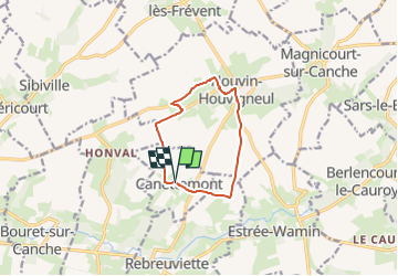
Tocht Stappen van 8,2 km beschikbaar op Hauts-de-France, Pas-de-Calais, Canettemont. Deze tocht wordt voorgesteld door temmichel.
Randonnée au départ de l'église de CANETTEMONT pour rejoindre par le chemin de Saint Pol la commune d'HOUVIN HOUVIGNEUL, Descendre vers la vallée de la Canche pour retrouver le point de départ
Bonne randonnée
Jean-Michel
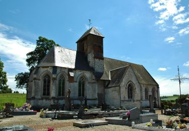
 Le chemin de Saint Pol - Photo 1")

Stappen

Stappen
Stappen

Stappen

Stappen
Stappen
Stappen
Stappen
Stappen