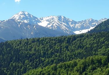
11,6 km | 18,8 km-effort
Astugue Trebons avec Danou
Denis couderc
Gebruiker
Lengte
9,9 km
Max. hoogte
714 m
Positief hoogteverschil
327 m
Km-Effort
14,3 km
Min. hoogte
482 m
Negatief hoogteverschil
327 m
Boucle
Ja
Datum van aanmaak :
2024-03-22 13:57:42.88
Laatste wijziging :
2024-03-22 16:56:45.61
2h58
Moeilijkheid : Moeilijk
Gratisgps-wandelapplicatie
Over ons
Tocht Stappen van 9,9 km beschikbaar op Occitanië, Hautes-Pyrénées, Astugue. Deze tocht wordt voorgesteld door Denis couderc.
Plaatsbepaling
Land:
France
Regio :
Occitanië
Departement/Provincie :
Hautes-Pyrénées
Gemeente :
Astugue
Locatie:
Unknown
Vertrek:(Dec)
Vertrek:(UTM)
261984 ; 4774314 (31T) N.
Opmerkingen
Wandeltochten in de omgeving
OURDIS Cotdoussan le pic de la clique-fait 933294 (fait le 30/03/2018)" 933294"
Stappen
Medium
Ourdis-Cotdoussan,
Occitanië,
Hautes-Pyrénées,
France
3h 54min
Ja
FEU 2015 - Etape 6
Stappen
Gemakkelijk
(3)
Germs-sur-l'Oussouet,
Occitanië,
Hautes-Pyrénées,
France
17,3 km | 25 km-effort
5h 6min
Neen
Camp César Pouzac
Stappen
Medium
Pouzac,
Occitanië,
Hautes-Pyrénées,
France
6,6 km | 9,8 km-effort
1h 46min
Ja
montgaillard G2
Stappen
Heel gemakkelijk
(1)
Montgaillard,
Occitanië,
Hautes-Pyrénées,
France
10,4 km | 14,2 km-effort
3h 0min
Ja
tour du castelmouly
Stappen
Gemakkelijk
(2)
Bagnères-de-Bigorre,
Occitanië,
Hautes-Pyrénées,
France
12,7 km | 20 km-effort
4h 3min
Ja
Randonnée autour de Pouzac
Stappen
Moeilijk
Pouzac,
Occitanië,
Hautes-Pyrénées,
France
9,2 km | 13,7 km-effort
2h 51min
Ja
2022 Pic de Labassere
Stappen
Gemakkelijk
Labassère,
Occitanië,
Hautes-Pyrénées,
France
9 km | 14,9 km-effort
2h 54min
Ja
Monnnė de Bagnères Bigorre
Stappen
Heel gemakkelijk
Bagnères-de-Bigorre,
Occitanië,
Hautes-Pyrénées,
France
15,6 km | 26 km-effort
5h 59min
Ja
montgaillard brouillon
Noords wandelen
Gemakkelijk
Montgaillard,
Occitanië,
Hautes-Pyrénées,
France
6,9 km | 9 km-effort
1h 38min
Ja