Caltagirone SityTrail > Tochten > Outdoor > Italy > Sicilië > Catania > Caltagirone SityTrail > Tochten > Outdoor > Italy > Sicilië > Catania > Caltagirone Caltagirone jcm17 Gebruiker 3D © OpenStreetMap contributors Lengte 2,1 km Max. hoogte 572 m Positief hoogteverschil 47 m Km-Effort 2,8 km Min. hoogte 515 m Negatief hoogteverschil 42 m Boucle Ja Datum van aanmaak : 2024-03-14 09:43:40.113 Laatste wijziging : 2024-03-14 18:45:10.25 (0 Bericht) Stappen 1h41 Moeilijkheid : Gemakkelijk Gratisgps-wandelapplicatie SityTrail IGN / Geografische instituten SityTrail World De wereld gaat voor u open Over ons 
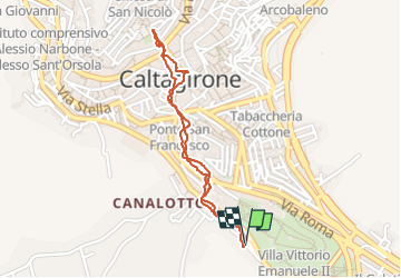
Tocht Stappen van 2,1 km beschikbaar op Sicilië, Catania, Caltagirone. Deze tocht wordt voorgesteld door jcm17. Legenden | Meer details (PDF) Hoogteprofiel Legenden > 15% 15% - 10% 10% - 5% vlak 5% - 10% 10% - 15% 15% - 30% > 30% Plaatsbepaling Land: Italy Regio : Sicilië Departement/Provincie : Catania Gemeente : Caltagirone Locatie: Unknown Vertrek:(Dec) 37.2320801 / 14.5157599 Vertrek:(UTM) 457045 ; 4120728 (33S) N. Opmerkingen Gelieve in te loggen om een commentaar of een beoordeling achter te laten Wandeltochten in de omgeving jcm17 piazza armerina Auto Heel gemakkelijk Caltagirone, Sicilië, Catania, Italy 37 km | 46 km-effort 2h 49min Neen