


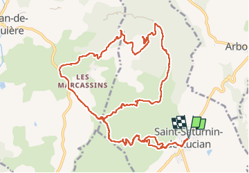

12,1 km | 17,4 km-effort


Gebruiker


Gratisgps-wandelapplicatie
 SityTrail
IGN / Geografische instituten
SityTrail World
De wereld gaat voor u open
Tocht Stappen van 15,8 km beschikbaar op Occitanië, Hérault, Saint-Saturnin-de-Lucian. Deze tocht wordt voorgesteld door Cabaretou.
La rando en vidéo :
https://youtu.be/7BbvhBquuSg
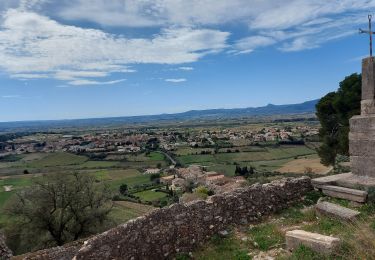
Difficile pour les 17km et les hauts et bas jusqu'au bout, mais on évite la montée jusqu'aux vierges très raide et longue (on redescend par cette montée)

Stappen

Stappen

Stappen

Stappen

Stappen

Stappen
Stappen

Stappen

Stappen