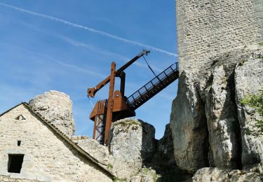
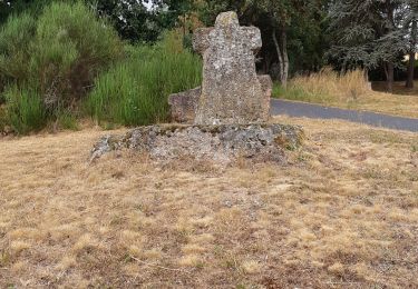
Tocht Stappen Blavignac - Les balcons de la Truyère - Photo

Les balcons de la Truyère

 guitounette
guitounette

Gebruiker

© OpenStreetMap contributors
Lengte
Lengte
16,6 km
Max. hoogte
Max. hoogte
1012 m
Positief hoogteverschil
675 m
Km-Effort
Km-Effort  
26 km
Min. hoogte
Min. hoogte
780 m
Negatief hoogteverschil
675 m
Boucle
Boucle
Ja
Datum van aanmaak :
2024-02-28 08:45:20.599
Laatste wijziging :
2024-02-28 08:46:28.925

(0 Bericht)

Stappen
Stappen
5h49
Moeilijkheid : Zeer moeilijk

Scan deze QR-code om de tocht te openen in de SityTrail-applicatie

Gratisgps-wandelapplicatie

Logo SityTrail SityTrail

IGN / Geografische instituten

SityTrail uit de App Store downloaden SityTrail uit Google Play downloaden

Logo SityTrail SityTrail World

De wereld gaat voor u open

SityTrail uit de App Store downloaden SityTrail uit Google Play downloaden SityTrail op Huawei AppGallery downloaden

Over ons

Tocht Stappen van 16,6 km beschikbaar op Occitanië, Lozère, Blavignac. Deze tocht wordt voorgesteld door guitounette.

Hoogteprofiel

POI's

POI Blavignac - Parking devant la mairie - Photo
guitounette
POI Blavignac - Hameau Saint-Martin - Photo
guitounette
POI Albaret-Sainte-Marie - Intersection D8 - Photo
guitounette
ALBARET-SAINTE-MARIE 
POI Albaret-Sainte-Marie - Sente à traverser - Photo
guitounette
ALBARET-SAINTE-MARIE 
POI Albaret-Sainte-Marie - Intersection en lisière de forêt - Photo
guitounette
ALBARET-SAINTE-MARIE 
POI Albaret-Sainte-Marie - intersection de plusieurs sentiers - Photo
guitounette
ALBARET-SAINTE-MARIE 
POI Albaret-Sainte-Marie - Large piste forestière - Photo
guitounette
ALBARET-SAINTE-MARIE 
POI Albaret-Sainte-Marie - Intersection - Sentier à droite - Photo
guitounette
ALBARET-SAINTE-MARIE 
POI Albaret-Sainte-Marie - Amas de rochers en bord de sentier - Photo
guitounette
ALBARET-SAINTE-MARIE 
POI Albaret-Sainte-Marie - Pâturage au bord de la - Photo
guitounette
ALBARET-SAINTE-MARIE 
POI Val d'Arcomie - Village de Pouzes - Photo
guitounette
VAL D'ARCOMIE 
POI Albaret-Sainte-Marie -  Chemin à gauche - Photo
guitounette
ALBARET-SAINTE-MARIE 
POI Albaret-Sainte-Marie - Carrefour dégagé - Photo
guitounette
ALBARET-SAINTE-MARIE 
POI Albaret-Sainte-Marie - Croix de chemin - Photo
guitounette
ALBARET-SAINTE-MARIE 
POI Albaret-Sainte-Marie - Statue Sainte-Marie - Photo
guitounette
ALBARET-SAINTE-MARIE 
POI Albaret-Sainte-Marie - Sentier à gauche - Photo
guitounette
ALBARET-SAINTE-MARIE 
POI Blavignac - Sentier à gauche - Photo
guitounette
POI Blavignac - Parking devant la mairie  - Photo
guitounette

Plaatsbepaling

Land:
France
Regio :
Occitanië
Departement/Provincie :
Lozère
Gemeente :
Blavignac
Locatie:
Unknown
Vertrek:(UTM)
522558 ; 4970208 (31T) N.

Wandeltochten in de omgeving

Tocht Stappen Le Malzieu-Ville - Malzieu/Apcher - Photo
Stappen
tyntyn

Stappen

Gemakkelijk
(1)
Le Malzieu-Ville, Occitanië, Lozère, France
13,6 km | 17,7 km-effort
4h 4min
Ja
Tocht Stappen Le Malzieu-Ville - LE MALZIEU - APCHER  - Photo
Stappen
walrou63

Stappen

Medium
(1)
Le Malzieu-Ville, Occitanië, Lozère, France
17 km | 23 km-effort
4h 21min
Ja
Tocht Stappen Le Malzieu-Ville - tour du lac de la graviére de la Chazette - Photo
Stappen
Denicheur

Stappen

Gemakkelijk
Le Malzieu-Ville, Occitanië, Lozère, France
4,9 km | 5,2 km-effort
1h 9min
Ja
Tocht Mountainbike Blavignac - sur les traces de benoit 46 depuis motocross - Photo
Mountainbike
kayakiste15

Mountainbike

Medium
Blavignac, Occitanië, Lozère, France
39 km | 51 km-effort
2h 0min
Neen
Tocht Stappen Le Malzieu-Forain - Saint Pierre le Vieux - Photo
Stappen
tracegps

Stappen

Gemakkelijk
Le Malzieu-Forain, Occitanië, Lozère, France
6,3 km | 8,4 km-effort
1h 40min
Ja
Tocht Stappen Le Malzieu-Ville - Molières - Photo
Stappen
tracegps

Stappen

Gemakkelijk
Le Malzieu-Ville, Occitanië, Lozère, France
4,3 km | 6 km-effort
1h 0min
Ja
Tocht sport Le Malzieu-Ville - Les croix de chemin autour de Malzieu - Photo
sport
guitounette

sport

Heel gemakkelijk
(1)
Le Malzieu-Ville, Occitanië, Lozère, France
11,9 km | 15,8 km-effort
Onbekend
Ja
Tocht Stappen Le Malzieu-Ville - le Malzieu  - Photo
Stappen
denis48230

Stappen

Medium
Le Malzieu-Ville, Occitanië, Lozère, France
7,9 km | 9,7 km-effort
2h 17min
Ja
Tocht Stappen Chaulhac - chaulhac cirque de pradine 12km - Photo
Stappen
chantde17

Stappen

Moeilijk
Chaulhac, Occitanië, Lozère, France
12,5 km | 17,1 km-effort
3h 23min
Ja


Sluiten
Mijn abonnementen