![](/images/other/stat-length.png)
![Tocht Pompey - Le mois du vélo - Photo](https://media.geolcdn.com/t/1900/400/ext.pjpeg?maxdim=2&url=https%3A%2F%2Fsecurestorage.geolives.com%2Fsitytour%2Ftrail-bg%2Fdefault.jpg)
Le mois du vélo
lorenzot54
Gebruiker
![Lengte](/images/other/stat-length.png)
Lengte
20 km
![Max. hoogte](https://static1.geolcdn.com/siteimages/upload/files/1508320355ic_sort_altitude_max_24dp.png)
Max. hoogte
211 m
![Positief hoogteverschil](https://static1.geolcdn.com/siteimages/upload/files/1508320355ic_sort_den_pos_24dp.png)
Positief hoogteverschil
150 m
![Km-Effort](/images/other/stat-length.png)
Km-Effort
22 km
![Min. hoogte](https://static1.geolcdn.com/siteimages/upload/files/1508320355ic_sort_altitude_min_24dp.png)
Min. hoogte
183 m
![Negatief hoogteverschil](https://static1.geolcdn.com/siteimages/upload/files/1508320355ic_sort_den_neg_24dp.png)
Negatief hoogteverschil
150 m
![Boucle](https://static1.geolcdn.com/siteimages/upload/files/16400158638029165_repeat_loop_refresh_sync_direction_icon.png)
Boucle
Ja
Datum van aanmaak :
2024-02-26 18:23:44.0
Laatste wijziging :
2024-02-26 18:23:46.008
![Scan deze QR-code om de tocht te openen in de SityTrail-applicatie](https://capi.geolives.com/qq0zvz2zws4bq2lad0pu/sitytour/trails/3963044/qr.png?size=200)
Gratisgps-wandelapplicatie
Over ons
Tocht van 20 km beschikbaar op Grand Est, Meurthe-et-Moselle, Pompey. Deze tocht wordt voorgesteld door lorenzot54.
Beschrijving
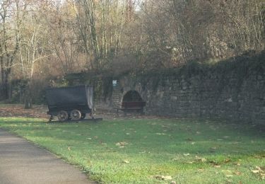
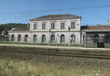
De la ccbp , site aciérie, long Meurthe, terrain foot Maxeville et retour Champigneulles, long du canal puis traversée Moselle puis bord de Moselle
Plaatsbepaling
Land:
France
Regio :
Grand Est
Departement/Provincie :
Meurthe-et-Moselle
Gemeente :
Pompey
Locatie:
Unknown
Vertrek:(Dec)
Vertrek:(UTM)
289464 ; 5406278 (32U) N.
Opmerkingen
Wandeltochten in de omgeving
![Tocht Te voet Champigneulles - Circuit G - Photo](https://media.geolcdn.com/t/375/260/367653e8-319c-4965-be92-65937a99215e.jpeg&format=jpg&maxdim=2)
![Te voet Te voet](https://static1.geolcdn.com/sitytour/trail-icons/100.png)
Circuit G
Te voet
Medium
Champigneulles,
Grand Est,
Meurthe-et-Moselle,
France
![](/images/other/stat-length.png)
18,7 km | 24 km-effort
5h 24min
![](https://static1.geolcdn.com/siteimages/upload/files/16400158638029165_repeat_loop_refresh_sync_direction_icon.png)
Neen
![Tocht Mountainbike Millery - Rando VTT Millery-Autreville Tous unis contre le cancer 2024 - Photo](https://media.geolcdn.com/t/375/260/ext.jpg?maxdim=2&url=https%3A%2F%2Fstatic1.geolcdn.com%2Fsiteimages%2Fupload%2Ffiles%2F1524743154velo.jpg)
![Mountainbike Mountainbike](https://static1.geolcdn.com/sitytour/trail-icons/202.png)
Rando VTT Millery-Autreville Tous unis contre le cancer 2024
Mountainbike
Medium
(1)
Millery,
Grand Est,
Meurthe-et-Moselle,
France
![](/images/other/stat-length.png)
16 km | 21 km-effort
1h 25min
![](https://static1.geolcdn.com/siteimages/upload/files/16400158638029165_repeat_loop_refresh_sync_direction_icon.png)
Ja
![Tocht Fietstoerisme Frouard - 4ème rando vélo Frouard - Lagarde 62 km - Photo](https://media.geolcdn.com/t/375/260/13993c5f-3965-404c-880f-e186b1a79db8.jpg&format=jpg&maxdim=2)
![Fietstoerisme Fietstoerisme](https://static1.geolcdn.com/sitytour/trail-icons/204.png)
4ème rando vélo Frouard - Lagarde 62 km
Fietstoerisme
Zeer moeilijk
Frouard,
Grand Est,
Meurthe-et-Moselle,
France
![](/images/other/stat-length.png)
62 km | 67 km-effort
4h 32min
![](https://static1.geolcdn.com/siteimages/upload/files/16400158638029165_repeat_loop_refresh_sync_direction_icon.png)
Neen
![Tocht Mountainbike Millery - Rando VTT 25km Millery-Autreville Tous unis contre le cancer 2022 - Photo](https://media.geolcdn.com/t/375/260/ext.jpg?maxdim=2&url=https%3A%2F%2Fstatic1.geolcdn.com%2Fsiteimages%2Fupload%2Ffiles%2F1524743154velo.jpg)
![Mountainbike Mountainbike](https://static1.geolcdn.com/sitytour/trail-icons/202.png)
Rando VTT 25km Millery-Autreville Tous unis contre le cancer 2022
Mountainbike
Medium
(1)
Millery,
Grand Est,
Meurthe-et-Moselle,
France
![](/images/other/stat-length.png)
24 km | 30 km-effort
2h 5min
![](https://static1.geolcdn.com/siteimages/upload/files/16400158638029165_repeat_loop_refresh_sync_direction_icon.png)
Ja
![Tocht Te voet Liverdun - Circuit H - Photo](https://media.geolcdn.com/t/375/260/0a326646-0027-4e90-97f9-294cb38ae070.jpeg&format=jpg&maxdim=2)
![Te voet Te voet](https://static1.geolcdn.com/sitytour/trail-icons/100.png)
Circuit H
Te voet
Gemakkelijk
Liverdun,
Grand Est,
Meurthe-et-Moselle,
France
![](/images/other/stat-length.png)
10,2 km | 12,5 km-effort
2h 50min
![](https://static1.geolcdn.com/siteimages/upload/files/16400158638029165_repeat_loop_refresh_sync_direction_icon.png)
Ja
![Tocht Te voet Lay-Saint-Christophe - Circuit L - Photo](https://media.geolcdn.com/t/375/260/8edc069d-a9b9-439a-9f46-3e2f5923a387.jpeg&format=jpg&maxdim=2)
![Te voet Te voet](https://static1.geolcdn.com/sitytour/trail-icons/100.png)
Circuit L
Te voet
Gemakkelijk
Lay-Saint-Christophe,
Grand Est,
Meurthe-et-Moselle,
France
![](/images/other/stat-length.png)
14,7 km | 18,5 km-effort
4h 11min
![](https://static1.geolcdn.com/siteimages/upload/files/16400158638029165_repeat_loop_refresh_sync_direction_icon.png)
Ja
![Tocht Te voet Champigneulles - Circuit du Vallum de la Fourasse - Photo](https://media.geolcdn.com/t/375/260/ff5ef522-89ca-4a55-89a5-b4737ce72d51.jpeg&format=jpg&maxdim=2)
![Te voet Te voet](https://static1.geolcdn.com/sitytour/trail-icons/100.png)
Circuit du Vallum de la Fourasse
Te voet
Gemakkelijk
Champigneulles,
Grand Est,
Meurthe-et-Moselle,
France
![](/images/other/stat-length.png)
3,3 km | 4,9 km-effort
1h 6min
![](https://static1.geolcdn.com/siteimages/upload/files/16400158638029165_repeat_loop_refresh_sync_direction_icon.png)
Ja
![Tocht Te voet Marbache - Circuit de la Vierge de Belleville - Photo](https://media.geolcdn.com/t/375/260/ed731c2b-3434-456a-907f-b6c3a07468bd.jpeg&format=jpg&maxdim=2)
![Te voet Te voet](https://static1.geolcdn.com/sitytour/trail-icons/100.png)
Circuit de la Vierge de Belleville
Te voet
Gemakkelijk
Marbache,
Grand Est,
Meurthe-et-Moselle,
France
![](/images/other/stat-length.png)
6 km | 8,5 km-effort
1h 55min
![](https://static1.geolcdn.com/siteimages/upload/files/16400158638029165_repeat_loop_refresh_sync_direction_icon.png)
Ja
![Tocht Te voet Bouxières-aux-Dames - Circuit moyenne ceinture - Photo](https://media.geolcdn.com/t/375/260/88bdd629-0aa3-4fce-b286-82104b98c415.jpeg&format=jpg&maxdim=2)
![Te voet Te voet](https://static1.geolcdn.com/sitytour/trail-icons/100.png)
Circuit moyenne ceinture
Te voet
Gemakkelijk
Bouxières-aux-Dames,
Grand Est,
Meurthe-et-Moselle,
France
![](/images/other/stat-length.png)
3,8 km | 5,3 km-effort
1h 12min
![](https://static1.geolcdn.com/siteimages/upload/files/16400158638029165_repeat_loop_refresh_sync_direction_icon.png)
Ja