![](/images/other/stat-length.png)
![Tocht Te voet Bagnoles - BOUCLE AU DEPART DE BAGNOLES - Photo](https://media.geolcdn.com/t/1900/400/ext.pjpeg?maxdim=2&url=https%3A%2F%2Fstatic1.geolcdn.com%2Fsiteimages%2Fupload%2Ffiles%2F1545311037marcheuse_200dpi.jpg)
BOUCLE AU DEPART DE BAGNOLES
Combaut11
Gebruiker
![Lengte](/images/other/stat-length.png)
Lengte
10,4 km
![Max. hoogte](https://static1.geolcdn.com/siteimages/upload/files/1508320355ic_sort_altitude_max_24dp.png)
Max. hoogte
212 m
![Positief hoogteverschil](https://static1.geolcdn.com/siteimages/upload/files/1508320355ic_sort_den_pos_24dp.png)
Positief hoogteverschil
191 m
![Km-Effort](/images/other/stat-length.png)
Km-Effort
12,9 km
![Min. hoogte](https://static1.geolcdn.com/siteimages/upload/files/1508320355ic_sort_altitude_min_24dp.png)
Min. hoogte
124 m
![Negatief hoogteverschil](https://static1.geolcdn.com/siteimages/upload/files/1508320355ic_sort_den_neg_24dp.png)
Negatief hoogteverschil
192 m
![Boucle](https://static1.geolcdn.com/siteimages/upload/files/16400158638029165_repeat_loop_refresh_sync_direction_icon.png)
Boucle
Ja
Datum van aanmaak :
2024-02-23 13:53:05.205
Laatste wijziging :
2024-02-23 14:02:40.196
![Te voet](https://static1.geolcdn.com/sitytour/trail-icons/100.png)
2h56
Moeilijkheid : Gemakkelijk
![Scan deze QR-code om de tocht te openen in de SityTrail-applicatie](https://capi.geolives.com/qq0zvz2zws4bq2lad0pu/sitytour/trails/3959398/qr.png?size=200)
Gratisgps-wandelapplicatie
Over ons
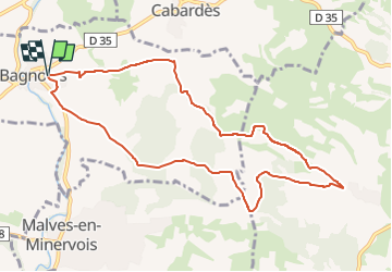
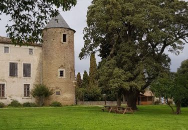
Tocht Te voet van 10,4 km beschikbaar op Occitanië, Aude, Bagnoles. Deze tocht wordt voorgesteld door Combaut11.
Beschrijving
Boucle au départ de bagnoles. Se garer chemin des Soulades.
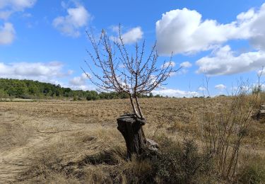
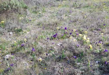
La boucle passe successivement par Parazols, puis direction Le Devez, Gibalaux le Haut, Saint Pierre, Cazals et retour à Bagnoles.
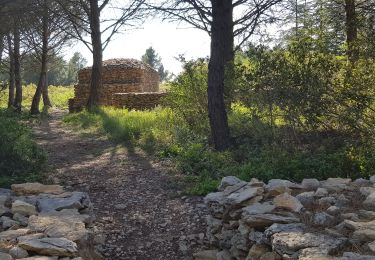
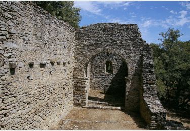
Le circuit emprunte une portion du GR 78.
Plaatsbepaling
Land:
France
Regio :
Occitanië
Departement/Provincie :
Aude
Gemeente :
Bagnoles
Locatie:
Unknown
Vertrek:(Dec)
Vertrek:(UTM)
454411 ; 4791072 (31T) N.
Opmerkingen
Wandeltochten in de omgeving
![Tocht Stappen Villeneuve-Minervois - Un air d'automne - Villeneuve Minervois - Photo](https://media.geolcdn.com/t/375/260/ext.jpg?maxdim=2&url=https%3A%2F%2Fservices.sitytrail.com%2FGeolivesWS%2FDownloadMedia.ashx%3FTrailID%3D107449%26Media%3D12373_6.jpg)
![Stappen Stappen](https://static1.geolcdn.com/sitytour/trail-icons/101.png)
Un air d'automne - Villeneuve Minervois
Stappen
Medium
(1)
Villeneuve-Minervois,
Occitanië,
Aude,
France
![](/images/other/stat-length.png)
18,2 km | 26 km-effort
5h 30min
![](https://static1.geolcdn.com/siteimages/upload/files/16400158638029165_repeat_loop_refresh_sync_direction_icon.png)
Ja
![Tocht Mountainbike Villegly - Cap Nore 2009 60km - Photo](https://media.geolcdn.com/t/375/260/ext.jpg?maxdim=2&url=https%3A%2F%2Fservices.sitytrail.com%2FGeolivesWS%2FDownloadMedia.ashx%3FTrailID%3D103550%26Media%3D5793_6.jpg)
![Mountainbike Mountainbike](https://static1.geolcdn.com/sitytour/trail-icons/202.png)
Cap Nore 2009 60km
Mountainbike
Moeilijk
(1)
Villegly,
Occitanië,
Aude,
France
![](/images/other/stat-length.png)
61 km | 84 km-effort
5h 0min
![](https://static1.geolcdn.com/siteimages/upload/files/16400158638029165_repeat_loop_refresh_sync_direction_icon.png)
Neen
![Tocht Stappen Villegly - Wisigoths - Photo](https://media.geolcdn.com/t/375/260/b23e85ab-30ba-44e7-ba87-562da392561a.jpg&format=jpg&maxdim=2)
![Stappen Stappen](https://static1.geolcdn.com/sitytour/trail-icons/101.png)
![Tocht Te voet Villarzel-Cabardès - Sentier des Wisigoths Villarzel Cabardes - Photo](https://media.geolcdn.com/t/375/260/9be6d263-55a8-4490-a85a-8c17a619cef3.jpg&format=jpg&maxdim=2)
![Te voet Te voet](https://static1.geolcdn.com/sitytour/trail-icons/100.png)
Sentier des Wisigoths Villarzel Cabardes
Te voet
Gemakkelijk
Villarzel-Cabardès,
Occitanië,
Aude,
France
![](/images/other/stat-length.png)
7,4 km | 8,8 km-effort
1h 59min
![](https://static1.geolcdn.com/siteimages/upload/files/16400158638029165_repeat_loop_refresh_sync_direction_icon.png)
Ja
![Tocht Stappen Conques-sur-Orbiel - les capitales à Conques - Photo](https://media.geolcdn.com/t/375/260/0ecfa368-c564-44ac-b31c-bdb0313ae5aa.jpg&format=jpg&maxdim=2)
![Stappen Stappen](https://static1.geolcdn.com/sitytour/trail-icons/101.png)
les capitales à Conques
Stappen
Gemakkelijk
Conques-sur-Orbiel,
Occitanië,
Aude,
France
![](/images/other/stat-length.png)
4,3 km | 5,2 km-effort
1h 36min
![](https://static1.geolcdn.com/siteimages/upload/files/16400158638029165_repeat_loop_refresh_sync_direction_icon.png)
Ja
![Tocht Stappen Villegly - la combe de St Martin à Villegly - Photo](https://media.geolcdn.com/t/375/260/9a0174c9-e7fb-4313-8744-bab2313c03eb.jpg&format=jpg&maxdim=2)
![Stappen Stappen](https://static1.geolcdn.com/sitytour/trail-icons/101.png)
la combe de St Martin à Villegly
Stappen
Gemakkelijk
Villegly,
Occitanië,
Aude,
France
![](/images/other/stat-length.png)
6,2 km | 7,7 km-effort
2h 45min
![](https://static1.geolcdn.com/siteimages/upload/files/16400158638029165_repeat_loop_refresh_sync_direction_icon.png)
Ja
![Tocht Stappen Villeneuve-Minervois - boucle à Villeneuve Minervois - Photo](https://media.geolcdn.com/t/375/260/ae5417d8-8fd6-4524-ac99-505491b32418.jpg&format=jpg&maxdim=2)
![Stappen Stappen](https://static1.geolcdn.com/sitytour/trail-icons/101.png)
boucle à Villeneuve Minervois
Stappen
Gemakkelijk
Villeneuve-Minervois,
Occitanië,
Aude,
France
![](/images/other/stat-length.png)
9,7 km | 13,2 km-effort
3h 2min
![](https://static1.geolcdn.com/siteimages/upload/files/16400158638029165_repeat_loop_refresh_sync_direction_icon.png)
Ja
![Tocht Te voet Villarzel-Cabardès - Sentiers des Wisigoths - Photo](https://media.geolcdn.com/t/375/260/020d7906-1b44-4f82-9bf7-6ef802f93b09.jpeg&format=jpg&maxdim=2)
![Te voet Te voet](https://static1.geolcdn.com/sitytour/trail-icons/100.png)
Sentiers des Wisigoths
Te voet
Gemakkelijk
Villarzel-Cabardès,
Occitanië,
Aude,
France
![](/images/other/stat-length.png)
4,5 km | 5,5 km-effort
1h 15min
![](https://static1.geolcdn.com/siteimages/upload/files/16400158638029165_repeat_loop_refresh_sync_direction_icon.png)
Neen
![Tocht Stappen Villalier - boucle Villalier La Mee les cabanes dans les bois - Photo](https://media.geolcdn.com/t/375/260/972fae87-5c6c-4b20-be31-502366586551.jpg&format=jpg&maxdim=2)
![Stappen Stappen](https://static1.geolcdn.com/sitytour/trail-icons/101.png)
boucle Villalier La Mee les cabanes dans les bois
Stappen
Heel gemakkelijk
Villalier,
Occitanië,
Aude,
France
![](/images/other/stat-length.png)
6,8 km | 8,1 km-effort
1h 58min
![](https://static1.geolcdn.com/siteimages/upload/files/16400158638029165_repeat_loop_refresh_sync_direction_icon.png)
Ja