![](/images/other/stat-length.png)
![Tocht Stappen Saint-Julien - Traversée des gorges de Malavalasse - Photo](https://media.geolcdn.com/t/1900/400/ext.pjpeg?maxdim=2&url=https%3A%2F%2Fstatic1.geolcdn.com%2Fsiteimages%2Fupload%2Ffiles%2F1553511878bg_sport_marche.png)
Traversée des gorges de Malavalasse
Migueldefrance
Gebruiker
![Lengte](/images/other/stat-length.png)
![Max. hoogte](https://static1.geolcdn.com/siteimages/upload/files/1508320355ic_sort_altitude_max_24dp.png)
![Positief hoogteverschil](https://static1.geolcdn.com/siteimages/upload/files/1508320355ic_sort_den_pos_24dp.png)
![Km-Effort](/images/other/stat-length.png)
![Min. hoogte](https://static1.geolcdn.com/siteimages/upload/files/1508320355ic_sort_altitude_min_24dp.png)
![Negatief hoogteverschil](https://static1.geolcdn.com/siteimages/upload/files/1508320355ic_sort_den_neg_24dp.png)
![Boucle](https://static1.geolcdn.com/siteimages/upload/files/16400158638029165_repeat_loop_refresh_sync_direction_icon.png)
![Stappen](https://static1.geolcdn.com/sitytour/trail-icons/101.png)
1h17
Moeilijkheid : Gemakkelijk
![Scan deze QR-code om de tocht te openen in de SityTrail-applicatie](https://capi.geolives.com/qq0zvz2zws4bq2lad0pu/sitytour/trails/3956422/qr.png?size=200)
Gratisgps-wandelapplicatie
Over ons
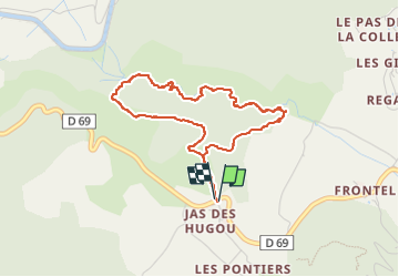
Tocht Stappen van 4,1 km beschikbaar op Provence-Alpes-Côte d'Azur, Var, Saint-Julien. Deze tocht wordt voorgesteld door Migueldefrance.
Beschrijving
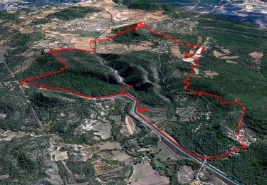
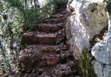
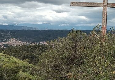
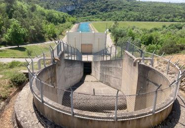
Rando "aventure totale" avec recherche du meilleur itinéraire (ou moins pire), renfougne dans les ronces et crapahut dans les rochers, montées, descentes, le fond de la gorge n'étant pas toujours praticable. Très amusant pour les aventuriers. Le temps indiqué de façon automatique ne tient pas compte des arrêts... Comptez plutot 2h30 à 3h.
Plaatsbepaling
Opmerkingen
Wandeltochten in de omgeving
![Tocht Stappen Saint-Julien - Saint Julien le Montagnier par Aqueduc et Grotte de Malaurie - Photo](https://media.geolcdn.com/t/375/260/3ef2484b-75f1-4519-bd6c-2cfbe3cc63d2.jpg&format=jpg&maxdim=2)
![Stappen Stappen](https://static1.geolcdn.com/sitytour/trail-icons/101.png)
Stappen
![](/images/other/stat-length.png)
![](https://static1.geolcdn.com/siteimages/upload/files/16400158638029165_repeat_loop_refresh_sync_direction_icon.png)
![Tocht Stappen Saint-Julien - 2022-11-11 Balcon de Saint Julien au lac d'Esparon - Photo](https://media.geolcdn.com/t/375/260/62e038c3-e228-4ae0-bf51-fb91477c57ba.jpg&format=jpg&maxdim=2)
![Stappen Stappen](https://static1.geolcdn.com/sitytour/trail-icons/101.png)
Stappen
![](/images/other/stat-length.png)
![](https://static1.geolcdn.com/siteimages/upload/files/16400158638029165_repeat_loop_refresh_sync_direction_icon.png)
![Tocht Stappen Esparron-de-Verdon - VERDON: SENTIER VERS ESPARRON de Verdon. - Photo](https://media.geolcdn.com/t/375/260/a272c2b1-8b59-4b0a-a41f-cf1731d4a7fb.jpg&format=jpg&maxdim=2)
![Stappen Stappen](https://static1.geolcdn.com/sitytour/trail-icons/101.png)
Stappen
![](/images/other/stat-length.png)
![](https://static1.geolcdn.com/siteimages/upload/files/16400158638029165_repeat_loop_refresh_sync_direction_icon.png)
![Tocht Stappen Saint-Julien - St Julien - Grotte de Malavasse - Photo](https://media.geolcdn.com/t/375/260/c80d5ad6-4e61-45a1-a28d-af60e80bae63.jpg&format=jpg&maxdim=2)
![Stappen Stappen](https://static1.geolcdn.com/sitytour/trail-icons/101.png)
Stappen
![](/images/other/stat-length.png)
![](https://static1.geolcdn.com/siteimages/upload/files/16400158638029165_repeat_loop_refresh_sync_direction_icon.png)
![Tocht Stappen Saint-Julien - Le drapeau depuis Les Hugous+ petite incursion dans Malavalas - Photo](https://media.geolcdn.com/t/375/260/160938d6-595e-43a0-98b5-2872a94eaff0.jpg&format=jpg&maxdim=2)
![Stappen Stappen](https://static1.geolcdn.com/sitytour/trail-icons/101.png)
Stappen
![](/images/other/stat-length.png)
![](https://static1.geolcdn.com/siteimages/upload/files/16400158638029165_repeat_loop_refresh_sync_direction_icon.png)
![Tocht Stappen Saint-Julien - 1Départ le long du lac D'Esparon - Photo](https://media.geolcdn.com/t/375/260/106fec4d-8e51-4d1a-8009-d7ac3698da33.jpg&format=jpg&maxdim=2)
![Stappen Stappen](https://static1.geolcdn.com/sitytour/trail-icons/101.png)
Stappen
![](/images/other/stat-length.png)
![](https://static1.geolcdn.com/siteimages/upload/files/16400158638029165_repeat_loop_refresh_sync_direction_icon.png)
![Tocht Stappen Saint-Julien - Boucle du lac (grand format) - Photo](https://media.geolcdn.com/t/375/260/5b9184b9-97bd-4481-b73b-e8b04d6c21b1.jpg&format=jpg&maxdim=2)
![Stappen Stappen](https://static1.geolcdn.com/sitytour/trail-icons/101.png)
Stappen
![](/images/other/stat-length.png)
![](https://static1.geolcdn.com/siteimages/upload/files/16400158638029165_repeat_loop_refresh_sync_direction_icon.png)
![Tocht Stappen Saint-Julien - Les Maurras Les Garduères rduaires - Photo](https://media.geolcdn.com/t/375/260/fa0cec8d-445d-4df0-b0f1-f8a00cb080be.jpg&format=jpg&maxdim=2)
![Stappen Stappen](https://static1.geolcdn.com/sitytour/trail-icons/101.png)
Stappen
![](/images/other/stat-length.png)
![](https://static1.geolcdn.com/siteimages/upload/files/16400158638029165_repeat_loop_refresh_sync_direction_icon.png)
![Tocht Stappen Saint-Julien - 83 Saint Julien le Montagnier - Photo](https://media.geolcdn.com/t/375/260/0ab7c78e-7671-46a1-a48a-bdbfa9a68e8a.jpg&format=jpg&maxdim=2)
![Stappen Stappen](https://static1.geolcdn.com/sitytour/trail-icons/101.png)
Stappen
![](/images/other/stat-length.png)
![](https://static1.geolcdn.com/siteimages/upload/files/16400158638029165_repeat_loop_refresh_sync_direction_icon.png)