![](/images/other/stat-length.png)
![Tocht Stappen Martigues - Cap Couronne - Photo](https://media.geolcdn.com/t/1900/400/f24bbda7-bec8-4767-80d7-37c4c3ad00bd.jpg&format=pjpeg&maxdim=2)
Cap Couronne
TOULAUDIN
Gebruiker
![Lengte](/images/other/stat-length.png)
Lengte
10,9 km
![Max. hoogte](https://static1.geolcdn.com/siteimages/upload/files/1508320355ic_sort_altitude_max_24dp.png)
Max. hoogte
20 m
![Positief hoogteverschil](https://static1.geolcdn.com/siteimages/upload/files/1508320355ic_sort_den_pos_24dp.png)
Positief hoogteverschil
105 m
![Km-Effort](/images/other/stat-length.png)
Km-Effort
12,3 km
![Min. hoogte](https://static1.geolcdn.com/siteimages/upload/files/1508320355ic_sort_altitude_min_24dp.png)
Min. hoogte
0 m
![Negatief hoogteverschil](https://static1.geolcdn.com/siteimages/upload/files/1508320355ic_sort_den_neg_24dp.png)
Negatief hoogteverschil
106 m
![Boucle](https://static1.geolcdn.com/siteimages/upload/files/16400158638029165_repeat_loop_refresh_sync_direction_icon.png)
Boucle
Ja
Datum van aanmaak :
2024-02-05 10:23:29.7
Laatste wijziging :
2024-02-13 17:40:48.55
![Stappen](https://static1.geolcdn.com/sitytour/trail-icons/101.png)
3h58
Moeilijkheid : Gemakkelijk
![Scan deze QR-code om de tocht te openen in de SityTrail-applicatie](https://capi.geolives.com/qq0zvz2zws4bq2lad0pu/sitytour/trails/3940051/qr.png?size=200)
Gratisgps-wandelapplicatie
Over ons
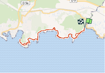
Tocht Stappen van 10,9 km beschikbaar op Provence-Alpes-Côte d'Azur, Bouches-du-Rhône, Martigues. Deze tocht wordt voorgesteld door TOULAUDIN.
Beschrijving
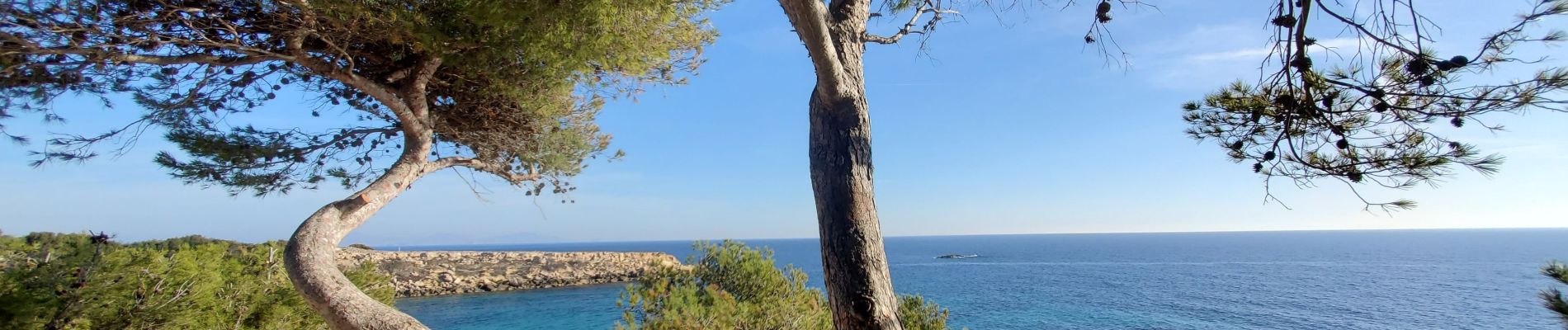
A/R pas de difficultés, j'ai évités un départ de Sausset les pins car
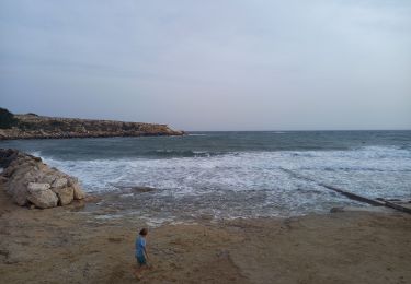
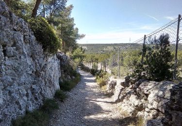
parcours piéton le long de la route
Plaatsbepaling
Land:
France
Regio :
Provence-Alpes-Côte d'Azur
Departement/Provincie :
Bouches-du-Rhône
Gemeente :
Martigues
Locatie:
Unknown
Vertrek:(Dec)
Vertrek:(UTM)
669262 ; 4799938 (31T) N.
Opmerkingen
Wandeltochten in de omgeving
![Stappen Stappen](https://static1.geolcdn.com/sitytour/trail-icons/101.png)
PF-La Côte bleue - Cap Couronne
Stappen
Heel gemakkelijk
(2)
Martigues,
Provence-Alpes-Côte d'Azur,
Bouches-du-Rhône,
France
![](/images/other/stat-length.png)
21 km | 24 km-effort
5h 18min
![](https://static1.geolcdn.com/siteimages/upload/files/16400158638029165_repeat_loop_refresh_sync_direction_icon.png)
Ja
![Tocht Stappen Martigues - Cap couronne - Photo](https://media.geolcdn.com/t/375/260/a311f26f-67e9-4722-b5dc-a3c3bf8cdd1f.jpg&format=jpg&maxdim=2)
![Stappen Stappen](https://static1.geolcdn.com/sitytour/trail-icons/101.png)
Cap couronne
Stappen
Medium
Martigues,
Provence-Alpes-Côte d'Azur,
Bouches-du-Rhône,
France
![](/images/other/stat-length.png)
21 km | 25 km-effort
5h 17min
![](https://static1.geolcdn.com/siteimages/upload/files/16400158638029165_repeat_loop_refresh_sync_direction_icon.png)
Ja
![Tocht Te voet Martigues - Les carrières de pierre de La Couronne - Photo](https://media.geolcdn.com/t/375/260/26fea46b-0136-4e03-82e5-aa4d3d222ff5.jpeg&format=jpg&maxdim=2)
![Te voet Te voet](https://static1.geolcdn.com/sitytour/trail-icons/100.png)
Les carrières de pierre de La Couronne
Te voet
Gemakkelijk
Martigues,
Provence-Alpes-Côte d'Azur,
Bouches-du-Rhône,
France
![](/images/other/stat-length.png)
3,1 km | 3,4 km-effort
45min
![](https://static1.geolcdn.com/siteimages/upload/files/16400158638029165_repeat_loop_refresh_sync_direction_icon.png)
Neen
![Tocht Te voet Martigues - Boucle de Boumandariel - Photo](https://media.geolcdn.com/t/375/260/952ba8e0-5d66-42a5-803d-b742aff43050.jpeg&format=jpg&maxdim=2)
![Te voet Te voet](https://static1.geolcdn.com/sitytour/trail-icons/100.png)
Boucle de Boumandariel
Te voet
Gemakkelijk
Martigues,
Provence-Alpes-Côte d'Azur,
Bouches-du-Rhône,
France
![](/images/other/stat-length.png)
5,8 km | 6,6 km-effort
1h 30min
![](https://static1.geolcdn.com/siteimages/upload/files/16400158638029165_repeat_loop_refresh_sync_direction_icon.png)
Ja
![Tocht Te voet Martigues - Sentier botanique de la plaine de Carro - Photo](https://media.geolcdn.com/t/375/260/6e507b0b-ffdb-4c7c-b8fe-ce4599d1b5df.jpeg&format=jpg&maxdim=2)
![Te voet Te voet](https://static1.geolcdn.com/sitytour/trail-icons/100.png)
Sentier botanique de la plaine de Carro
Te voet
Gemakkelijk
Martigues,
Provence-Alpes-Côte d'Azur,
Bouches-du-Rhône,
France
![](/images/other/stat-length.png)
3,9 km | 4,3 km-effort
58min
![](https://static1.geolcdn.com/siteimages/upload/files/16400158638029165_repeat_loop_refresh_sync_direction_icon.png)
Ja
![Tocht Te voet Martigues - Le Cap Couronne - Photo](https://media.geolcdn.com/t/375/260/2e60c5c0-e67b-4759-bf81-6d72ec0d7ebf.jpeg&format=jpg&maxdim=2)
![Te voet Te voet](https://static1.geolcdn.com/sitytour/trail-icons/100.png)
Le Cap Couronne
Te voet
Medium
Martigues,
Provence-Alpes-Côte d'Azur,
Bouches-du-Rhône,
France
![](/images/other/stat-length.png)
20 km | 24 km-effort
5h 22min
![](https://static1.geolcdn.com/siteimages/upload/files/16400158638029165_repeat_loop_refresh_sync_direction_icon.png)
Neen
![Tocht Te voet Sausset-les-Pins - Mer et Pinéde Valapoux - Photo](https://media.geolcdn.com/t/375/260/ec105952-3cc0-4c7a-8d8b-51e1ce146bb7.jpeg&format=jpg&maxdim=2)
![Te voet Te voet](https://static1.geolcdn.com/sitytour/trail-icons/100.png)
Mer et Pinéde Valapoux
Te voet
Gemakkelijk
Sausset-les-Pins,
Provence-Alpes-Côte d'Azur,
Bouches-du-Rhône,
France
![](/images/other/stat-length.png)
6,6 km | 7,9 km-effort
1h 47min
![](https://static1.geolcdn.com/siteimages/upload/files/16400158638029165_repeat_loop_refresh_sync_direction_icon.png)
Ja
![Tocht Te voet Sausset-les-Pins - Grand Vallat - Littoral - Photo](https://media.geolcdn.com/t/375/260/1e3c7066-4ba9-4783-af2a-1feb7908d7d5.jpeg&format=jpg&maxdim=2)
![Te voet Te voet](https://static1.geolcdn.com/sitytour/trail-icons/100.png)
Grand Vallat - Littoral
Te voet
Gemakkelijk
Sausset-les-Pins,
Provence-Alpes-Côte d'Azur,
Bouches-du-Rhône,
France
![](/images/other/stat-length.png)
4,9 km | 5,9 km-effort
1h 20min
![](https://static1.geolcdn.com/siteimages/upload/files/16400158638029165_repeat_loop_refresh_sync_direction_icon.png)
Ja
![Tocht Te voet Martigues - Mer et colline Valestéloué - Photo](https://media.geolcdn.com/t/375/260/21e84c92-a2fb-4448-a2ca-dfd7aed22fbc.jpeg&format=jpg&maxdim=2)
![Te voet Te voet](https://static1.geolcdn.com/sitytour/trail-icons/100.png)
Mer et colline Valestéloué
Te voet
Gemakkelijk
Martigues,
Provence-Alpes-Côte d'Azur,
Bouches-du-Rhône,
France
![](/images/other/stat-length.png)
14,5 km | 17,8 km-effort
4h 2min
![](https://static1.geolcdn.com/siteimages/upload/files/16400158638029165_repeat_loop_refresh_sync_direction_icon.png)
Ja