![](/images/other/stat-length.png)
![Tocht Stappen Cabrerolles - Cabrerolles - Photo](https://media.geolcdn.com/t/1900/400/f7148cd6-e1d8-4e1b-b32e-00e6281cecd4.jpg&format=pjpeg&maxdim=2)
Cabrerolles
Raymond DAVID
Gebruiker
![Lengte](/images/other/stat-length.png)
![Max. hoogte](https://static1.geolcdn.com/siteimages/upload/files/1508320355ic_sort_altitude_max_24dp.png)
![Positief hoogteverschil](https://static1.geolcdn.com/siteimages/upload/files/1508320355ic_sort_den_pos_24dp.png)
![Km-Effort](/images/other/stat-length.png)
![Min. hoogte](https://static1.geolcdn.com/siteimages/upload/files/1508320355ic_sort_altitude_min_24dp.png)
![Negatief hoogteverschil](https://static1.geolcdn.com/siteimages/upload/files/1508320355ic_sort_den_neg_24dp.png)
![Boucle](https://static1.geolcdn.com/siteimages/upload/files/16400158638029165_repeat_loop_refresh_sync_direction_icon.png)
![Stappen](https://static1.geolcdn.com/sitytour/trail-icons/101.png)
4h30
Moeilijkheid : Medium
![Mountainbike](https://static1.geolcdn.com/sitytour/trail-icons/202.png)
3h00
Moeilijkheid : Gemakkelijk
![Scan deze QR-code om de tocht te openen in de SityTrail-applicatie](https://capi.geolives.com/qq0zvz2zws4bq2lad0pu/sitytour/trails/3926991/qr.png?size=200)
Gratisgps-wandelapplicatie
Over ons
Tocht Stappen van 14 km beschikbaar op Occitanië, Hérault, Cabrerolles. Deze tocht wordt voorgesteld door Raymond DAVID .
Beschrijving
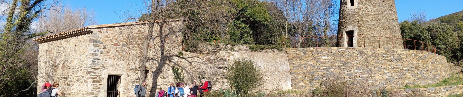
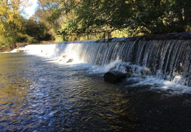
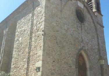
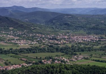
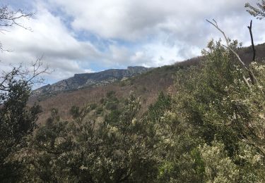
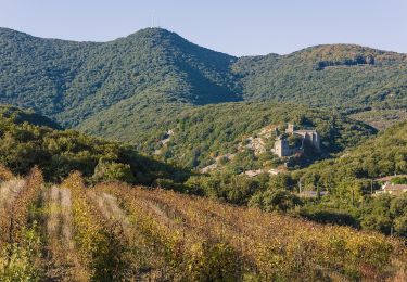
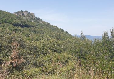
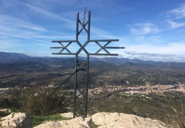
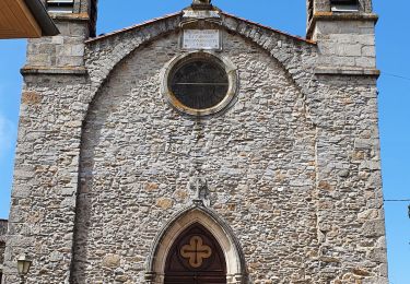
Parking devant le cimetière. Belle randonnée sur de grands chemins. Commencer par la visite du village et du château (vues), puis aller au cratère du météore. Ensuite descendre jusqu'aux moulins de Lentheric. Sur le retour, belles vues à 360 degrés. Difficulté à peine moyenne.
Plaatsbepaling
Opmerkingen
Wandeltochten in de omgeving
![Tocht Stappen Hérépian - herepian pic de Tantajo - Photo](https://media.geolcdn.com/t/375/260/ext.jpg?maxdim=2&url=https%3A%2F%2Fservices.sitytrail.com%2FGeolivesWS%2FDownloadMedia.ashx%3FTrailID%3D656804%26Media%3D20161106140841.jpg)
![Stappen Stappen](https://static1.geolcdn.com/sitytour/trail-icons/101.png)
Stappen
![](/images/other/stat-length.png)
![](https://static1.geolcdn.com/siteimages/upload/files/16400158638029165_repeat_loop_refresh_sync_direction_icon.png)
![Tocht Stappen Les Aires - Saint Michel la coquillade - Photo](https://media.geolcdn.com/t/375/260/ext.jpg?maxdim=2&url=https%3A%2F%2Fservices.sitytrail.com%2FGeolivesWS%2FDownloadMedia.ashx%3FTrailID%3D419022%26Media%3Dfix__20150406153326.jpg)
![Stappen Stappen](https://static1.geolcdn.com/sitytour/trail-icons/101.png)
Stappen
![](/images/other/stat-length.png)
![](https://static1.geolcdn.com/siteimages/upload/files/16400158638029165_repeat_loop_refresh_sync_direction_icon.png)
![Tocht Te voet Les Aires - Pic de la Coquillade - Photo](https://media.geolcdn.com/t/375/260/a1b049b6-4309-4e8c-86c9-1d2c07783337.jpeg&format=jpg&maxdim=2)
![Te voet Te voet](https://static1.geolcdn.com/sitytour/trail-icons/100.png)
Te voet
![](/images/other/stat-length.png)
![](https://static1.geolcdn.com/siteimages/upload/files/16400158638029165_repeat_loop_refresh_sync_direction_icon.png)
![Tocht Mountainbike Cabrerolles - Cabrerolles-Roquebrun-Cabrerolles - Photo](https://media.geolcdn.com/t/375/260/ext.jpg?maxdim=2&url=https%3A%2F%2Fstatic1.geolcdn.com%2Fsiteimages%2Fupload%2Ffiles%2F1524743154velo.jpg)
![Mountainbike Mountainbike](https://static1.geolcdn.com/sitytour/trail-icons/202.png)
Mountainbike
![](/images/other/stat-length.png)
![](https://static1.geolcdn.com/siteimages/upload/files/16400158638029165_repeat_loop_refresh_sync_direction_icon.png)
![Tocht Stappen Le Poujol-sur-Orb - Rando Seviracttt - Photo](https://media.geolcdn.com/t/375/260/abbb6ad5-7718-434b-be19-2e67e5d9637f.jpg&format=jpg&maxdim=2)
![Stappen Stappen](https://static1.geolcdn.com/sitytour/trail-icons/101.png)
Stappen
![](/images/other/stat-length.png)
![](https://static1.geolcdn.com/siteimages/upload/files/16400158638029165_repeat_loop_refresh_sync_direction_icon.png)
![Tocht Te voet Cabrerolles - Le trou du météore à Cabrerolles - Photo](https://media.geolcdn.com/t/375/260/bfc0afe0-7af6-4650-a40f-97c6d7a43ce8.jpeg&format=jpg&maxdim=2)
![Te voet Te voet](https://static1.geolcdn.com/sitytour/trail-icons/100.png)
Te voet
![](/images/other/stat-length.png)
![](https://static1.geolcdn.com/siteimages/upload/files/16400158638029165_repeat_loop_refresh_sync_direction_icon.png)
![Tocht Stappen Les Aires - les aires, chapelle Saint Michel - Photo](https://media.geolcdn.com/t/375/260/5794cff5-7317-4fba-a64f-d491ed24084c.jpg&format=jpg&maxdim=2)
![Stappen Stappen](https://static1.geolcdn.com/sitytour/trail-icons/101.png)
Stappen
![](/images/other/stat-length.png)
![](https://static1.geolcdn.com/siteimages/upload/files/16400158638029165_repeat_loop_refresh_sync_direction_icon.png)
![Tocht Stappen Faugères - La Caumette- Pic du Tantajo - Photo](https://media.geolcdn.com/t/375/260/a3bc5e44-6b9f-4ff4-a63f-d3f7e92231db.jpg&format=jpg&maxdim=2)
![Stappen Stappen](https://static1.geolcdn.com/sitytour/trail-icons/101.png)
Stappen
![](/images/other/stat-length.png)
![](https://static1.geolcdn.com/siteimages/upload/files/16400158638029165_repeat_loop_refresh_sync_direction_icon.png)
![Tocht Stappen Les Aires - la coquillage et saint michel - Photo](https://media.geolcdn.com/t/375/260/2c99762b-b4fb-4a37-b9fb-706d8d94b4c4.jpg&format=jpg&maxdim=2)
![Stappen Stappen](https://static1.geolcdn.com/sitytour/trail-icons/101.png)
Stappen
![](/images/other/stat-length.png)
![](https://static1.geolcdn.com/siteimages/upload/files/16400158638029165_repeat_loop_refresh_sync_direction_icon.png)