![](/images/other/stat-length.png)
![Tocht Stappen Cabrespine - reco Cabrespine - Pic de Nore - refuge Del Tap - Photo](https://media.geolcdn.com/t/1900/400/ext.pjpeg?maxdim=2&url=https%3A%2F%2Fmedia.geolcdn.com%2Ff%2F6e7dc888-ed1a-44f1-99cf-a7b612a49389.jpg)
reco Cabrespine - Pic de Nore - refuge Del Tap
jacques delaporte
Gebruiker
![Lengte](/images/other/stat-length.png)
Lengte
23 km
![Max. hoogte](https://static1.geolcdn.com/siteimages/upload/files/1508320355ic_sort_altitude_max_24dp.png)
Max. hoogte
1214 m
![Positief hoogteverschil](https://static1.geolcdn.com/siteimages/upload/files/1508320355ic_sort_den_pos_24dp.png)
Positief hoogteverschil
1296 m
![Km-Effort](/images/other/stat-length.png)
Km-Effort
38 km
![Min. hoogte](https://static1.geolcdn.com/siteimages/upload/files/1508320355ic_sort_altitude_min_24dp.png)
Min. hoogte
307 m
![Negatief hoogteverschil](https://static1.geolcdn.com/siteimages/upload/files/1508320355ic_sort_den_neg_24dp.png)
Negatief hoogteverschil
447 m
![Boucle](https://static1.geolcdn.com/siteimages/upload/files/16400158638029165_repeat_loop_refresh_sync_direction_icon.png)
Boucle
Neen
Datum van aanmaak :
2024-01-20 06:49:29.289
Laatste wijziging :
2024-01-22 19:37:16.188
![Stappen](https://static1.geolcdn.com/sitytour/trail-icons/101.png)
7h45
Moeilijkheid : Zeer moeilijk
![Scan deze QR-code om de tocht te openen in de SityTrail-applicatie](https://capi.geolives.com/qq0zvz2zws4bq2lad0pu/sitytour/trails/3921985/qr.png?size=200)
Gratisgps-wandelapplicatie
Over ons
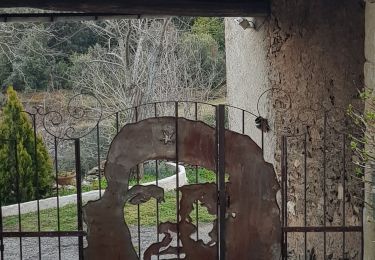
Tocht Stappen van 23 km beschikbaar op Occitanië, Aude, Cabrespine. Deze tocht wordt voorgesteld door jacques delaporte.
Beschrijving
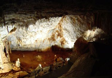
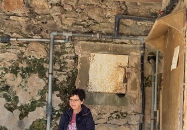
Belle randonnée et belle reconnaissance, toujours un bonheur de gravir le Pic de Nore, ça monte et ça monte toujours,environ 847 m de dénivelé( -) c'est normal..
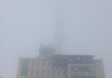
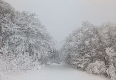
Je regrette de ne pas avoir rencontré la neige mais le temps était froid et ensoleillé sans brume...
Plaatsbepaling
Land:
France
Regio :
Occitanië
Departement/Provincie :
Aude
Gemeente :
Cabrespine
Locatie:
Unknown
Vertrek:(Dec)
Vertrek:(UTM)
456312 ; 4801184 (31T) N.
Opmerkingen
Wandeltochten in de omgeving
![Tocht Stappen Castans - Boucle des ruisseaux - Castans - Photo](https://media.geolcdn.com/t/375/260/ext.jpg?maxdim=2&url=https%3A%2F%2Fservices.sitytrail.com%2FGeolivesWS%2FDownloadMedia.ashx%3FTrailID%3D107218%26Media%3D12083_6.jpg)
![Stappen Stappen](https://static1.geolcdn.com/sitytour/trail-icons/101.png)
Boucle des ruisseaux - Castans
Stappen
Medium
(5)
Castans,
Occitanië,
Aude,
France
![](/images/other/stat-length.png)
6,4 km | 10 km-effort
4h 0min
![](https://static1.geolcdn.com/siteimages/upload/files/16400158638029165_repeat_loop_refresh_sync_direction_icon.png)
Ja
![Tocht Te voet Cabrespine - Les Villages Perchés - Photo](https://media.geolcdn.com/t/375/260/ext.jpg?maxdim=2&url=https%3A%2F%2Fmedia.geolcdn.com%2Ff%2F4379f8e7-e0a2-4ee4-810f-0aa42c1f51f8.jpeg)
![Te voet Te voet](https://static1.geolcdn.com/sitytour/trail-icons/100.png)
Les Villages Perchés
Te voet
Gemakkelijk
Cabrespine,
Occitanië,
Aude,
France
![](/images/other/stat-length.png)
8,3 km | 14,7 km-effort
3h 21min
![](https://static1.geolcdn.com/siteimages/upload/files/16400158638029165_repeat_loop_refresh_sync_direction_icon.png)
Neen
![Tocht Te voet Cabrespine - Boucle du Gouffre de Cabrespine - Photo](https://media.geolcdn.com/t/375/260/ext.jpg?maxdim=2&url=https%3A%2F%2Fmedia.geolcdn.com%2Ff%2Fb4f79f08-71e0-4997-b690-a17cfd5f244e.jpeg)
![Te voet Te voet](https://static1.geolcdn.com/sitytour/trail-icons/100.png)
Boucle du Gouffre de Cabrespine
Te voet
Gemakkelijk
Cabrespine,
Occitanië,
Aude,
France
![](/images/other/stat-length.png)
4,9 km | 8,7 km-effort
1h 59min
![](https://static1.geolcdn.com/siteimages/upload/files/16400158638029165_repeat_loop_refresh_sync_direction_icon.png)
Neen
![Tocht Stappen Villeneuve-Minervois - pujol de bosc castanviel - Photo](https://media.geolcdn.com/t/375/260/ext.jpg?maxdim=2&url=https%3A%2F%2Fmedia.geolcdn.com%2Ff%2F0e58840e-6e19-4149-b133-b9ac43c459d6.jpg)
![Stappen Stappen](https://static1.geolcdn.com/sitytour/trail-icons/101.png)
pujol de bosc castanviel
Stappen
Gemakkelijk
Villeneuve-Minervois,
Occitanië,
Aude,
France
![](/images/other/stat-length.png)
15,9 km | 23 km-effort
5h 20min
![](https://static1.geolcdn.com/siteimages/upload/files/16400158638029165_repeat_loop_refresh_sync_direction_icon.png)
Ja
![Tocht Stappen Sallèles-Cabardès - Sallèles Cabardès - Pradellles Cabardès - Pic du Nore- - Photo](https://media.geolcdn.com/t/375/260/ext.jpg?maxdim=2&url=https%3A%2F%2Fmedia.geolcdn.com%2Ff%2F90caa0b8-22c4-41a8-a0b4-9f5599ac34e4.jpg)
![Stappen Stappen](https://static1.geolcdn.com/sitytour/trail-icons/101.png)
Sallèles Cabardès - Pradellles Cabardès - Pic du Nore-
Stappen
Zeer moeilijk
Sallèles-Cabardès,
Occitanië,
Aude,
France
![](/images/other/stat-length.png)
65 km | 0 m-effort
23h 36min
![](https://static1.geolcdn.com/siteimages/upload/files/16400158638029165_repeat_loop_refresh_sync_direction_icon.png)
Ja
![Tocht Stappen Sallèles-Cabardès - Reco Le Pic de Nore - Photo](https://media.geolcdn.com/t/375/260/ext.jpg?maxdim=2&url=https%3A%2F%2Fmedia.geolcdn.com%2Ff%2F81a42295-0bf8-4918-a48c-4464e99ea34e.jpg)
![Stappen Stappen](https://static1.geolcdn.com/sitytour/trail-icons/101.png)
Reco Le Pic de Nore
Stappen
Zeer moeilijk
Sallèles-Cabardès,
Occitanië,
Aude,
France
![](/images/other/stat-length.png)
54 km | 79 km-effort
21h 27min
![](https://static1.geolcdn.com/siteimages/upload/files/16400158638029165_repeat_loop_refresh_sync_direction_icon.png)
Ja
![Tocht Stappen Limousis - Limousis - Photo](https://media.geolcdn.com/t/375/260/ext.jpg?maxdim=2&url=https%3A%2F%2Fmedia.geolcdn.com%2Ff%2Fc9382851-66d8-4f11-8490-1b66e63d0ad4.jpg)
![Stappen Stappen](https://static1.geolcdn.com/sitytour/trail-icons/101.png)
![Tocht Stappen Limousis - Mont Simel - Photo](https://media.geolcdn.com/t/375/260/ext.jpg?maxdim=2&url=https%3A%2F%2Fmedia.geolcdn.com%2Ff%2F38332c18-c5e2-4493-b4a7-4fa8f48f76d3.jpg)
![Stappen Stappen](https://static1.geolcdn.com/sitytour/trail-icons/101.png)
![Tocht Te voet Pradelles-Cabardès - Pradelles,roc de l'aigle,cabrespine,pradelles - Photo](https://media.geolcdn.com/t/375/260/ext.jpg?maxdim=2&url=https%3A%2F%2Fmedia.geolcdn.com%2Ff%2F82fe34a8-bde4-49e0-8e94-332d7cbba6cc.jpg)
![Te voet Te voet](https://static1.geolcdn.com/sitytour/trail-icons/100.png)
Pradelles,roc de l'aigle,cabrespine,pradelles
Te voet
Moeilijk
Pradelles-Cabardès,
Occitanië,
Aude,
France
![](/images/other/stat-length.png)
15,3 km | 24 km-effort
5h 50min
![](https://static1.geolcdn.com/siteimages/upload/files/16400158638029165_repeat_loop_refresh_sync_direction_icon.png)
Ja