![](/images/other/stat-length.png)
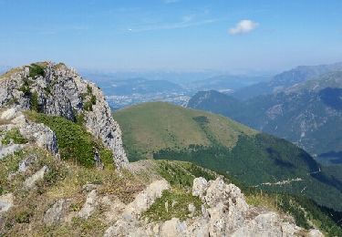
![Tocht Stappen Sainte-Luce - Côte Rouge - Photo](https://media.geolcdn.com/t/1900/400/de862aa8-3a89-4016-889b-2ec83352f8c0.jpg&format=pjpeg&maxdim=2)
Côte Rouge
GuyVachet
Gebruiker
![Lengte](/images/other/stat-length.png)
![Max. hoogte](https://static1.geolcdn.com/siteimages/upload/files/1508320355ic_sort_altitude_max_24dp.png)
![Positief hoogteverschil](https://static1.geolcdn.com/siteimages/upload/files/1508320355ic_sort_den_pos_24dp.png)
![Km-Effort](/images/other/stat-length.png)
![Min. hoogte](https://static1.geolcdn.com/siteimages/upload/files/1508320355ic_sort_altitude_min_24dp.png)
![Negatief hoogteverschil](https://static1.geolcdn.com/siteimages/upload/files/1508320355ic_sort_den_neg_24dp.png)
![Boucle](https://static1.geolcdn.com/siteimages/upload/files/16400158638029165_repeat_loop_refresh_sync_direction_icon.png)
![Stappen](https://static1.geolcdn.com/sitytour/trail-icons/101.png)
6h59
Moeilijkheid : Zeer moeilijk
![Scan deze QR-code om de tocht te openen in de SityTrail-applicatie](https://capi.geolives.com/qq0zvz2zws4bq2lad0pu/sitytour/trails/3915473/qr.png?size=200)
Gratisgps-wandelapplicatie
Over ons
Tocht Stappen van 10,7 km beschikbaar op Auvergne-Rhône-Alpes, Isère, Sainte-Luce. Deze tocht wordt voorgesteld door GuyVachet.
Beschrijving
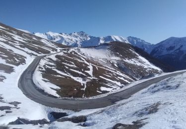
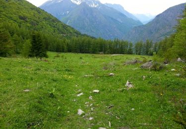
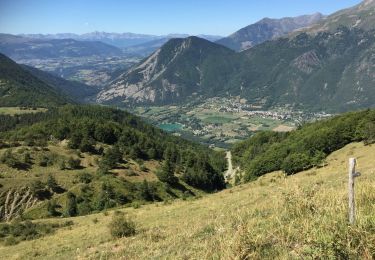
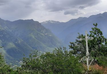
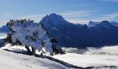
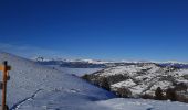
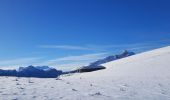
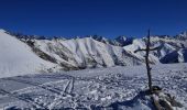
Très belle rando dans un environnement peu fréquenté avec constamment des superbes vues. Le parcours très régulier commence face au Col de L'Holme et se transforme en large sentier sous les arbres. Puis rapidement la vue s'ouvre complètement lorsqu'on arrive à Haut Col avec d'un côté, toute la chaine du Vercors et de l'autre, le Dévoluy avec l'Obiou et le Pic de Bure. Après le contournement du Mont de Rousse avec le Lac du Sautet en contre-bas, Côte Rouge se présente devant le Col Nodry. Au sommet de cette jumelle de Côte Belle, la vue panoramique est complétée par les Écrins avec notamment l'Olan en arrière plan. Retour par la cabane au-dessus du Col de Lière puis le Col Nodry (in opposition to Dry January?) et enfin l'itinéraire reprend celui de l'aller.
Plaatsbepaling
Opmerkingen
Wandeltochten in de omgeving
![Tocht Stappen Entraigues - gargas en partant du villard - Photo](https://media.geolcdn.com/t/375/260/ext.jpg?maxdim=2&url=https%3A%2F%2Fservices.sitytrail.com%2FGeolivesWS%2FDownloadMedia.ashx%3FTrailID%3D804668%26Media%3Dfix__20170807111554.jpg)
![Stappen Stappen](https://static1.geolcdn.com/sitytour/trail-icons/101.png)
Stappen
![](/images/other/stat-length.png)
![](https://static1.geolcdn.com/siteimages/upload/files/16400158638029165_repeat_loop_refresh_sync_direction_icon.png)
![Tocht Stappen Saint-Michel-en-Beaumont - 2022-07-20_17h09m05_ND Salette - Photo](https://media.geolcdn.com/t/375/260/ext.jpg?maxdim=2&url=https%3A%2F%2Fstatic1.geolcdn.com%2Fsiteimages%2Fupload%2Ffiles%2F1553511878bg_sport_marche.png)
![Stappen Stappen](https://static1.geolcdn.com/sitytour/trail-icons/101.png)
Stappen
![](/images/other/stat-length.png)
![](https://static1.geolcdn.com/siteimages/upload/files/16400158638029165_repeat_loop_refresh_sync_direction_icon.png)
![Tocht Ski randonnée La Salette-Fallavaux - côté belle et Gargas - Photo](https://media.geolcdn.com/t/375/260/dc2d20ac-386f-4432-b67f-65443d05e523.jpg&format=jpg&maxdim=2)
![Ski randonnée Ski randonnée](https://static1.geolcdn.com/sitytour/trail-icons/503.png)
Ski randonnée
![](/images/other/stat-length.png)
![](https://static1.geolcdn.com/siteimages/upload/files/16400158638029165_repeat_loop_refresh_sync_direction_icon.png)
![Tocht Stappen Saint-Michel-en-Beaumont - Valbonnais Cols de Parquetout-d'Hurtieres - Photo](https://media.geolcdn.com/t/375/260/ext.jpg?maxdim=2&url=https%3A%2F%2Fservices.sitytrail.com%2FGeolivesWS%2FDownloadMedia.ashx%3FTrailID%3D309864%26Media%3Dfix__20140606152454.jpg)
![Stappen Stappen](https://static1.geolcdn.com/sitytour/trail-icons/101.png)
Stappen
![](/images/other/stat-length.png)
![](https://static1.geolcdn.com/siteimages/upload/files/16400158638029165_repeat_loop_refresh_sync_direction_icon.png)
![Tocht Stappen Saint-Laurent-en-Beaumont - Valbonnais Canal Beaumont StLaurent - Photo](https://media.geolcdn.com/t/375/260/c4704b83-2e24-4742-b66e-bcb05b8bcf7e.jpg&format=jpg&maxdim=2)
![Stappen Stappen](https://static1.geolcdn.com/sitytour/trail-icons/101.png)
Stappen
![](/images/other/stat-length.png)
![](https://static1.geolcdn.com/siteimages/upload/files/16400158638029165_repeat_loop_refresh_sync_direction_icon.png)
![Tocht Stappen Valbonnais - Valbonnais Canal Beaumont - Photo](https://media.geolcdn.com/t/375/260/77eaf8a7-64c4-4d56-9f49-2bfbac09109f.jpg&format=jpg&maxdim=2)
![Stappen Stappen](https://static1.geolcdn.com/sitytour/trail-icons/101.png)
Stappen
![](/images/other/stat-length.png)
![](https://static1.geolcdn.com/siteimages/upload/files/16400158638029165_repeat_loop_refresh_sync_direction_icon.png)
![Tocht Stappen Saint-Michel-en-Beaumont - PARQUETOUT-Col d'HURETIERE-Col du LIERRE -22-08-2017 - Photo](https://media.geolcdn.com/t/375/260/ext.jpg?maxdim=2&url=https%3A%2F%2Fservices.sitytrail.com%2FGeolivesWS%2FDownloadMedia.ashx%3FTrailID%3D822392%26Media%3D20170822140629.jpg)
![Stappen Stappen](https://static1.geolcdn.com/sitytour/trail-icons/101.png)
Stappen
![](/images/other/stat-length.png)
![](https://static1.geolcdn.com/siteimages/upload/files/16400158638029165_repeat_loop_refresh_sync_direction_icon.png)
![Tocht Stappen Saint-Laurent-en-Beaumont - Croix de la Roche et Signal St-Michel - Photo](https://media.geolcdn.com/t/375/260/52236408-4d5b-4a9f-bbaa-7fca94a30aee.jpg&format=jpg&maxdim=2)
![Stappen Stappen](https://static1.geolcdn.com/sitytour/trail-icons/101.png)
Stappen
![](/images/other/stat-length.png)
![](https://static1.geolcdn.com/siteimages/upload/files/16400158638029165_repeat_loop_refresh_sync_direction_icon.png)
![Tocht Stappen Valbonnais - le canal du Beaumont ,les verneys - Photo](https://media.geolcdn.com/t/375/260/2798c172-0fea-462e-b7e1-5b2ec3854f74.jpg&format=jpg&maxdim=2)
![Stappen Stappen](https://static1.geolcdn.com/sitytour/trail-icons/101.png)
Stappen
![](/images/other/stat-length.png)
![](https://static1.geolcdn.com/siteimages/upload/files/16400158638029165_repeat_loop_refresh_sync_direction_icon.png)