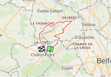
![](/images/other/stat-length.png)
![Tocht Stappen Châlonvillars - Châlonvillars - Fort du Salbert - Evette-Salbert - Photo](https://media.geolcdn.com/t/1900/400/30a56d40-1ac0-4227-a497-f489c67ce1fe.jpg&format=pjpeg&maxdim=2)
Châlonvillars - Fort du Salbert - Evette-Salbert
Bart2015
Gebruiker
![Lengte](/images/other/stat-length.png)
![Max. hoogte](https://static1.geolcdn.com/siteimages/upload/files/1508320355ic_sort_altitude_max_24dp.png)
![Positief hoogteverschil](https://static1.geolcdn.com/siteimages/upload/files/1508320355ic_sort_den_pos_24dp.png)
![Km-Effort](/images/other/stat-length.png)
![Min. hoogte](https://static1.geolcdn.com/siteimages/upload/files/1508320355ic_sort_altitude_min_24dp.png)
![Negatief hoogteverschil](https://static1.geolcdn.com/siteimages/upload/files/1508320355ic_sort_den_neg_24dp.png)
![Boucle](https://static1.geolcdn.com/siteimages/upload/files/16400158638029165_repeat_loop_refresh_sync_direction_icon.png)
![Stappen](https://static1.geolcdn.com/sitytour/trail-icons/101.png)
3h36
Moeilijkheid : Moeilijk
![Scan deze QR-code om de tocht te openen in de SityTrail-applicatie](https://capi.geolives.com/qq0zvz2zws4bq2lad0pu/sitytour/trails/3911015/qr.png?size=200)
Gratisgps-wandelapplicatie
Over ons
Tocht Stappen van 11 km beschikbaar op Bourgondië-Franche-Comté, Haute-Saône, Châlonvillars. Deze tocht wordt voorgesteld door Bart2015.
Beschrijving
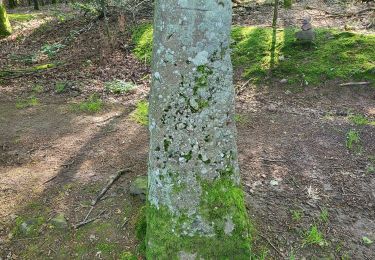
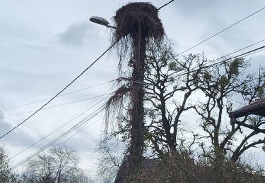
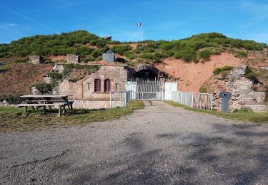
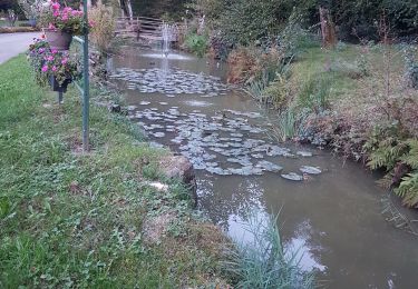
Petite randonnée sympa pour monter au Fort du Salbert et sa magnifique vue sur Belfort et ses environs. Retour par Evette-Salbert et sa vue sur les étangs du Malsaucy, la Planche des Belles Filles et le Ballon d'Alsace.
Bonne rando ...
Plaatsbepaling
Opmerkingen
Wandeltochten in de omgeving
![Tocht Stappen Sermamagny - Veronne PC - Photo](https://media.geolcdn.com/t/375/260/ext.jpg?maxdim=2&url=https%3A%2F%2Fstatic1.geolcdn.com%2Fsiteimages%2Fupload%2Ffiles%2F1553511878bg_sport_marche.png)
![Stappen Stappen](https://static1.geolcdn.com/sitytour/trail-icons/101.png)
Stappen
![](/images/other/stat-length.png)
![](https://static1.geolcdn.com/siteimages/upload/files/16400158638029165_repeat_loop_refresh_sync_direction_icon.png)
![Tocht Elektrische fiets Essert - VTT - Essert - Salbert - Vétrigne - Miotte - Citadelle Belfort - Essert - Photo](https://media.geolcdn.com/t/375/260/9ea3754c-f673-4e19-890f-f64e417a9f4d.jpg&format=jpg&maxdim=2)
![Elektrische fiets Elektrische fiets](https://static1.geolcdn.com/sitytour/trail-icons/205.png)
Elektrische fiets
![](/images/other/stat-length.png)
![](https://static1.geolcdn.com/siteimages/upload/files/16400158638029165_repeat_loop_refresh_sync_direction_icon.png)
![Tocht Motorfiets Évette-Salbert - Moto - Evette - Grand Ballon - Honneck - Lacs de Longemer puis de Gérardmer - chapelle des Vés - Ballon d'Alsace - Photo](https://media.geolcdn.com/t/375/260/7fdb8878-2da7-4fc1-b838-8926082e0304.jpg&format=jpg&maxdim=2)
![Motorfiets Motorfiets](https://static1.geolcdn.com/sitytour/trail-icons/402.png)
Motorfiets
![](/images/other/stat-length.png)
![](https://static1.geolcdn.com/siteimages/upload/files/16400158638029165_repeat_loop_refresh_sync_direction_icon.png)
![Tocht Elektrische fiets Châlonvillars - VTT - Châlonvillars - Etobon - Ronchamp - Plancher-Bas - Malsaucy - Photo](https://media.geolcdn.com/t/375/260/0af5e710-b661-426e-a32c-4cb272df7c44.jpg&format=jpg&maxdim=2)
![Elektrische fiets Elektrische fiets](https://static1.geolcdn.com/sitytour/trail-icons/205.png)
Elektrische fiets
![](/images/other/stat-length.png)
![](https://static1.geolcdn.com/siteimages/upload/files/16400158638029165_repeat_loop_refresh_sync_direction_icon.png)
![Tocht Stappen Mandrevillars - Echenans et son fort - Photo](https://media.geolcdn.com/t/375/260/f507e7d6-76e6-4d94-8c38-4bcdb3990215.jpg&format=jpg&maxdim=2)
![Stappen Stappen](https://static1.geolcdn.com/sitytour/trail-icons/101.png)
Stappen
![](/images/other/stat-length.png)
![](https://static1.geolcdn.com/siteimages/upload/files/16400158638029165_repeat_loop_refresh_sync_direction_icon.png)
![Tocht Mountainbike Châlonvillars - Châlonvillars - Fort Giromagny en passant au milieu des étangs - Photo](https://media.geolcdn.com/t/375/260/4cf742f1-48e3-4bef-b8af-82a52a583623.jpg&format=jpg&maxdim=2)
![Mountainbike Mountainbike](https://static1.geolcdn.com/sitytour/trail-icons/202.png)
Mountainbike
![](/images/other/stat-length.png)
![](https://static1.geolcdn.com/siteimages/upload/files/16400158638029165_repeat_loop_refresh_sync_direction_icon.png)
![Tocht Mountainbike Châlonvillars - Châlonvillars - Menhir - Mandrevillars - Fort Essert et du Salbert - Photo](https://media.geolcdn.com/t/375/260/0d0bf6fd-2dc2-4259-800b-34db6b624b81.jpg&format=jpg&maxdim=2)
![Mountainbike Mountainbike](https://static1.geolcdn.com/sitytour/trail-icons/202.png)
Mountainbike
![](/images/other/stat-length.png)
![](https://static1.geolcdn.com/siteimages/upload/files/16400158638029165_repeat_loop_refresh_sync_direction_icon.png)
![Tocht Stappen Châlonvillars - Châlonvillars - le mehnir - Mandrevillars - Photo](https://media.geolcdn.com/t/375/260/b30d40ec-93d6-4f7b-887c-caef10825b9c.jpg&format=jpg&maxdim=2)
![Stappen Stappen](https://static1.geolcdn.com/sitytour/trail-icons/101.png)
Stappen
![](/images/other/stat-length.png)
![](https://static1.geolcdn.com/siteimages/upload/files/16400158638029165_repeat_loop_refresh_sync_direction_icon.png)
![Tocht Stappen Châlonvillars - Châlonvillars - Mandrevillars - Photo](https://media.geolcdn.com/t/375/260/e4fd3b0e-8b31-475e-ba79-3ca96152b87a.jpg&format=jpg&maxdim=2)
![Stappen Stappen](https://static1.geolcdn.com/sitytour/trail-icons/101.png)
Stappen
![](/images/other/stat-length.png)
![](https://static1.geolcdn.com/siteimages/upload/files/16400158638029165_repeat_loop_refresh_sync_direction_icon.png)