![](/images/other/stat-length.png)
![Tocht Bénivay-Ollon - 2024-01-07_22h57m03_tmpWriteApidae_353823_fr - Photo](https://media.geolcdn.com/t/1900/400/ext.pjpeg?maxdim=2&url=https%3A%2F%2Fsecurestorage.geolives.com%2Fsitytour%2Ftrail-bg%2Fdefault.jpg)
2024-01-07_22h57m03_tmpWriteApidae_353823_fr
losjo
Gebruiker
![Lengte](/images/other/stat-length.png)
Lengte
17 km
![Max. hoogte](https://static1.geolcdn.com/siteimages/upload/files/1508320355ic_sort_altitude_max_24dp.png)
Max. hoogte
904 m
![Positief hoogteverschil](https://static1.geolcdn.com/siteimages/upload/files/1508320355ic_sort_den_pos_24dp.png)
Positief hoogteverschil
663 m
![Km-Effort](/images/other/stat-length.png)
Km-Effort
26 km
![Min. hoogte](https://static1.geolcdn.com/siteimages/upload/files/1508320355ic_sort_altitude_min_24dp.png)
Min. hoogte
487 m
![Negatief hoogteverschil](https://static1.geolcdn.com/siteimages/upload/files/1508320355ic_sort_den_neg_24dp.png)
Negatief hoogteverschil
661 m
![Boucle](https://static1.geolcdn.com/siteimages/upload/files/16400158638029165_repeat_loop_refresh_sync_direction_icon.png)
Boucle
Ja
Datum van aanmaak :
2024-01-07 21:57:03.742
Laatste wijziging :
2024-01-07 21:57:05.754
![Scan deze QR-code om de tocht te openen in de SityTrail-applicatie](https://capi.geolives.com/qq0zvz2zws4bq2lad0pu/sitytour/trails/3910591/qr.png?size=200)
Gratisgps-wandelapplicatie
Over ons
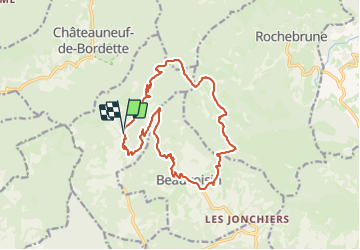
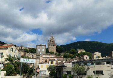
Tocht van 17 km beschikbaar op Auvergne-Rhône-Alpes, Drôme, Bénivay-Ollon. Deze tocht wordt voorgesteld door losjo.
Beschrijving
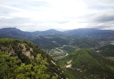
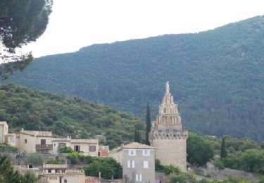
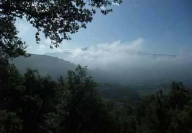
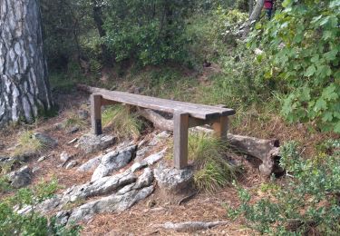
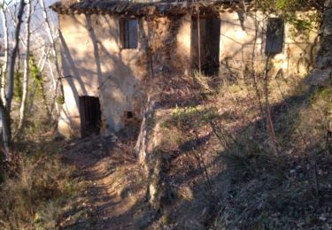
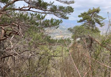
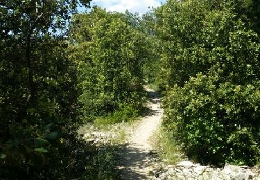
Longue randonnée dont chaque col franchi offre des vues variées, permettant de découvrir la vallée de l'Eygue-Marse, le nord des Baronnies, les hameaux de Beauovisin, ainsi qu'un point de vue sur le Mont Ventoux.
Plaatsbepaling
Land:
France
Regio :
Auvergne-Rhône-Alpes
Departement/Provincie :
Drôme
Gemeente :
Bénivay-Ollon
Locatie:
Unknown
Vertrek:(Dec)
Vertrek:(UTM)
674513 ; 4909001 (31T) N.
Opmerkingen
Wandeltochten in de omgeving
![Tocht Stappen Nyons - L'Essaillon - Photo](https://media.geolcdn.com/t/375/260/beb3de1a-3f08-4a05-b207-e485690ee2d6.jpg&format=jpg&maxdim=2)
![Stappen Stappen](https://static1.geolcdn.com/sitytour/trail-icons/101.png)
L'Essaillon
Stappen
Moeilijk
(1)
Nyons,
Auvergne-Rhône-Alpes,
Drôme,
France
![](/images/other/stat-length.png)
17,2 km | 29 km-effort
5h 22min
![](https://static1.geolcdn.com/siteimages/upload/files/16400158638029165_repeat_loop_refresh_sync_direction_icon.png)
Ja
![Tocht Stappen Nyons - NYONS (sentier des Oliviers) - Photo](https://media.geolcdn.com/t/375/260/ext.jpg?maxdim=2&url=https%3A%2F%2Fservices.sitytrail.com%2FGeolivesWS%2FDownloadMedia.ashx%3FTrailID%3D970837%26Media%3Dfix__20180521115311.jpg)
![Stappen Stappen](https://static1.geolcdn.com/sitytour/trail-icons/101.png)
NYONS (sentier des Oliviers)
Stappen
Gemakkelijk
(1)
Nyons,
Auvergne-Rhône-Alpes,
Drôme,
France
![](/images/other/stat-length.png)
7 km | 10,6 km-effort
2h 13min
![](https://static1.geolcdn.com/siteimages/upload/files/16400158638029165_repeat_loop_refresh_sync_direction_icon.png)
Ja
![Tocht Stappen Bénivay-Ollon - Balade en Baronnies - Propiac - Photo](https://media.geolcdn.com/t/375/260/ext.jpg?maxdim=2&url=https%3A%2F%2Fservices.sitytrail.com%2FGeolivesWS%2FDownloadMedia.ashx%3FTrailID%3D103777%26Media%3D6544_2.jpg)
![Stappen Stappen](https://static1.geolcdn.com/sitytour/trail-icons/101.png)
Balade en Baronnies - Propiac
Stappen
Medium
(2)
Bénivay-Ollon,
Auvergne-Rhône-Alpes,
Drôme,
France
![](/images/other/stat-length.png)
9,8 km | 15,4 km-effort
3h 0min
![](https://static1.geolcdn.com/siteimages/upload/files/16400158638029165_repeat_loop_refresh_sync_direction_icon.png)
Ja
![Tocht Stappen Nyons - 26 l essaillon Nyons Zel - Photo](https://media.geolcdn.com/t/375/260/0c38f6e5-0ff4-44f9-9732-643c719783ac.jpg&format=jpg&maxdim=2)
![Stappen Stappen](https://static1.geolcdn.com/sitytour/trail-icons/101.png)
26 l essaillon Nyons Zel
Stappen
Medium
Nyons,
Auvergne-Rhône-Alpes,
Drôme,
France
![](/images/other/stat-length.png)
13,3 km | 25 km-effort
6h 45min
![](https://static1.geolcdn.com/siteimages/upload/files/16400158638029165_repeat_loop_refresh_sync_direction_icon.png)
Ja
![Tocht Stappen Nyons - 26 de Nyons essaillon - Photo](https://media.geolcdn.com/t/375/260/7e1bb091-21b9-4642-a461-e7f5cda8e03d.jpg&format=jpg&maxdim=2)
![Stappen Stappen](https://static1.geolcdn.com/sitytour/trail-icons/101.png)
26 de Nyons essaillon
Stappen
Medium
Nyons,
Auvergne-Rhône-Alpes,
Drôme,
France
![](/images/other/stat-length.png)
13 km | 24 km-effort
5h 46min
![](https://static1.geolcdn.com/siteimages/upload/files/16400158638029165_repeat_loop_refresh_sync_direction_icon.png)
Ja
![Tocht Stappen Propiac - Propiac(26) - Photo](https://media.geolcdn.com/t/375/260/ext.jpg?maxdim=2&url=https%3A%2F%2Fstatic1.geolcdn.com%2Fsiteimages%2Fupload%2Ffiles%2F1553511878bg_sport_marche.png)
![Stappen Stappen](https://static1.geolcdn.com/sitytour/trail-icons/101.png)
Propiac(26)
Stappen
Medium
(1)
Propiac,
Auvergne-Rhône-Alpes,
Drôme,
France
![](/images/other/stat-length.png)
14,9 km | 22 km-effort
4h 48min
![](https://static1.geolcdn.com/siteimages/upload/files/16400158638029165_repeat_loop_refresh_sync_direction_icon.png)
Ja
![Tocht Stappen Piégon - Piegon les géants moins dur - Photo](https://media.geolcdn.com/t/375/260/d32a1bd2-8353-472c-b62f-28b31d928b46.jpg&format=jpg&maxdim=2)
![Stappen Stappen](https://static1.geolcdn.com/sitytour/trail-icons/101.png)
Piegon les géants moins dur
Stappen
Gemakkelijk
Piégon,
Auvergne-Rhône-Alpes,
Drôme,
France
![](/images/other/stat-length.png)
12,1 km | 18,5 km-effort
6h 6min
![](https://static1.geolcdn.com/siteimages/upload/files/16400158638029165_repeat_loop_refresh_sync_direction_icon.png)
Ja
![Tocht Stappen Nyons - NYONS (Montagne d'Essaillon) - Photo](https://media.geolcdn.com/t/375/260/ext.jpg?maxdim=2&url=https%3A%2F%2Fservices.sitytrail.com%2FGeolivesWS%2FDownloadMedia.ashx%3FTrailID%3D968877%26Media%3Dfix__20180518150201.jpg)
![Stappen Stappen](https://static1.geolcdn.com/sitytour/trail-icons/101.png)
NYONS (Montagne d'Essaillon)
Stappen
Medium
Nyons,
Auvergne-Rhône-Alpes,
Drôme,
France
![](/images/other/stat-length.png)
10,5 km | 18,5 km-effort
3h 56min
![](https://static1.geolcdn.com/siteimages/upload/files/16400158638029165_repeat_loop_refresh_sync_direction_icon.png)
Ja
![Tocht Stappen Nyons - NYONS (Devès) - Photo](https://media.geolcdn.com/t/375/260/ext.jpg?maxdim=2&url=https%3A%2F%2Fservices.sitytrail.com%2FGeolivesWS%2FDownloadMedia.ashx%3FTrailID%3D966744%26Media%3Dfix__20180515164009.jpg)
![Stappen Stappen](https://static1.geolcdn.com/sitytour/trail-icons/101.png)
NYONS (Devès)
Stappen
Gemakkelijk
Nyons,
Auvergne-Rhône-Alpes,
Drôme,
France
![](/images/other/stat-length.png)
7,8 km | 11,3 km-effort
2h 28min
![](https://static1.geolcdn.com/siteimages/upload/files/16400158638029165_repeat_loop_refresh_sync_direction_icon.png)
Ja