15,3 km | 23 km-effort
gorges de la Dourbies
thomas.o.vert
Gebruiker
Lengte
32 km
Max. hoogte
969 m
Positief hoogteverschil
1215 m
Km-Effort
47 km
Min. hoogte
510 m
Negatief hoogteverschil
846 m
Boucle
Neen
Datum van aanmaak :
2023-12-31 09:41:59.903
Laatste wijziging :
2023-12-31 17:27:14.59
7h42
Moeilijkheid : Medium
Gratisgps-wandelapplicatie
Over ons
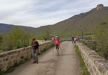
Tocht Stappen van 32 km beschikbaar op Occitanië, Aveyron, Saint-Jean-du-Bruel. Deze tocht wordt voorgesteld door thomas.o.vert.
Plaatsbepaling
Land:
France
Regio :
Occitanië
Departement/Provincie :
Aveyron
Gemeente :
Saint-Jean-du-Bruel
Locatie:
Unknown
Vertrek:(Dec)
Vertrek:(UTM)
528813 ; 4874673 (31T) N.
Opmerkingen
Wandeltochten in de omgeving
Le roc nantais
Stappen
Medium
Saint-Jean-du-Bruel,
Occitanië,
Aveyron,
France
22 km | 32 km-effort
7h 7min
Ja
ST JEAN DE BRUEL CAUSSES BEGON
Stappen
Medium
Saint-Jean-du-Bruel,
Occitanië,
Aveyron,
France
13,9 km | 20 km-effort
4h 32min
Ja
ST JEAN DE BRUEL CHATEAU D ALGUE
Stappen
Medium
Saint-Jean-du-Bruel,
Occitanië,
Aveyron,
France
10,3 km | 15,1 km-effort
3h 28min
Ja
Cantobre 31-08-21
Stappen
Medium
Nant,
Occitanië,
Aveyron,
France
15,5 km | 23 km-effort
4h 14min
Ja
Trail hopitalier 2016
Lopen
Heel gemakkelijk
(2)
Nant,
Occitanië,
Aveyron,
France
29 km | 45 km-effort
Onbekend
Ja
la vallée de la Dourbie
Stappen
Moeilijk
(3)
Saint-Jean-du-Bruel,
Occitanië,
Aveyron,
France
19,1 km | 28 km-effort
5h 48min
Ja
roc nantais
Stappen
Moeilijk
(3)
Nant,
Occitanië,
Aveyron,
France
12,4 km | 19,1 km-effort
4h 2min
Ja