![](/images/other/stat-length.png)
![Tocht Stappen Lunay - Château de la Mézière - Asnières - Photo](https://media.geolcdn.com/t/1900/400/7020eb26-114b-4b8b-93d9-05c4bb72eb01.jpg&format=pjpeg&maxdim=2)
Château de la Mézière - Asnières
guydu41
Gebruiker
![Lengte](/images/other/stat-length.png)
![Max. hoogte](https://static1.geolcdn.com/siteimages/upload/files/1508320355ic_sort_altitude_max_24dp.png)
![Positief hoogteverschil](https://static1.geolcdn.com/siteimages/upload/files/1508320355ic_sort_den_pos_24dp.png)
![Km-Effort](/images/other/stat-length.png)
![Min. hoogte](https://static1.geolcdn.com/siteimages/upload/files/1508320355ic_sort_altitude_min_24dp.png)
![Negatief hoogteverschil](https://static1.geolcdn.com/siteimages/upload/files/1508320355ic_sort_den_neg_24dp.png)
![Boucle](https://static1.geolcdn.com/siteimages/upload/files/16400158638029165_repeat_loop_refresh_sync_direction_icon.png)
![Stappen](https://static1.geolcdn.com/sitytour/trail-icons/101.png)
1h56
Moeilijkheid : Medium
![Scan deze QR-code om de tocht te openen in de SityTrail-applicatie](https://capi.geolives.com/qq0zvz2zws4bq2lad0pu/sitytour/trails/3869187/qr.png?size=200)
Gratisgps-wandelapplicatie
Over ons
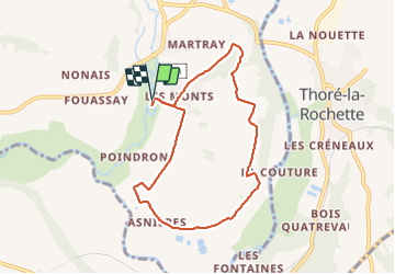
Tocht Stappen van 7,4 km beschikbaar op Centre-Val de Loire, Loir-et-Cher, Lunay. Deze tocht wordt voorgesteld door guydu41.
Beschrijving
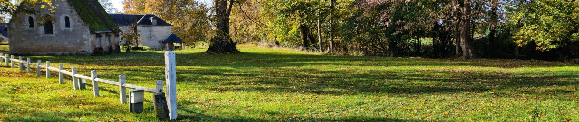
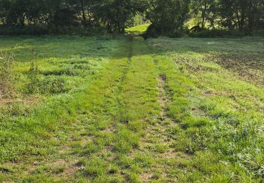
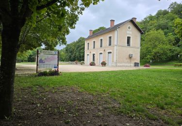
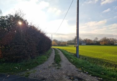
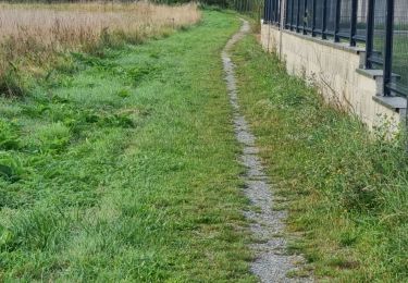
Joli petit circuit depuis l'aire de stationnement du Château de la Mézière (gîte d'Isabelle) sur des chemins à travers champs et un beau sentier tortueux descendant le coteau vers la vallée du Loir.
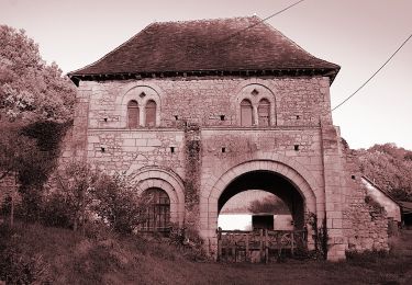
Découverte de nombreuses caves et habitations troglodytes dans le village d'Asnières.
Plaatsbepaling
Opmerkingen
Wandeltochten in de omgeving
![Tocht Te voet Villiers-sur-Loir - Circuit des Côteaux - Photo](https://media.geolcdn.com/t/375/260/25cb373c-e85b-47b3-b4c8-0c4c4213b15c.jpeg&format=jpg&maxdim=2)
![Te voet Te voet](https://static1.geolcdn.com/sitytour/trail-icons/100.png)
Te voet
![](/images/other/stat-length.png)
![](https://static1.geolcdn.com/siteimages/upload/files/16400158638029165_repeat_loop_refresh_sync_direction_icon.png)
![Tocht Stappen Villavard - Villavard - Bois et champs - Photo](https://media.geolcdn.com/t/375/260/4d475905-90ac-4961-b085-7edf726aaef9.jpg&format=jpg&maxdim=2)
![Stappen Stappen](https://static1.geolcdn.com/sitytour/trail-icons/101.png)
Stappen
![](/images/other/stat-length.png)
![](https://static1.geolcdn.com/siteimages/upload/files/16400158638029165_repeat_loop_refresh_sync_direction_icon.png)
![Tocht Stappen Thoré-la-Rochette - Thoré-la-Rochette - Vallée et Coteaux du Loir - Photo](https://media.geolcdn.com/t/375/260/3f4c80d2-3437-4e69-84de-30a02f464543.jpg&format=jpg&maxdim=2)
![Stappen Stappen](https://static1.geolcdn.com/sitytour/trail-icons/101.png)
Stappen
![](/images/other/stat-length.png)
![](https://static1.geolcdn.com/siteimages/upload/files/16400158638029165_repeat_loop_refresh_sync_direction_icon.png)
![Tocht Stappen Marcilly-en-Beauce - Varennes - Photo](https://media.geolcdn.com/t/375/260/e5fe1065-d10c-4b43-96c8-69a926a5b2c1.jpg&format=jpg&maxdim=2)
![Stappen Stappen](https://static1.geolcdn.com/sitytour/trail-icons/101.png)
Stappen
![](/images/other/stat-length.png)
![](https://static1.geolcdn.com/siteimages/upload/files/16400158638029165_repeat_loop_refresh_sync_direction_icon.png)
![Tocht Stappen Mazangé - Bonaventure - Moulin de la Loupe - Photo](https://media.geolcdn.com/t/375/260/759d7924-4ccb-43c3-8104-ebc2f5335c97.jpg&format=jpg&maxdim=2)
![Stappen Stappen](https://static1.geolcdn.com/sitytour/trail-icons/101.png)
Stappen
![](/images/other/stat-length.png)
![](https://static1.geolcdn.com/siteimages/upload/files/16400158638029165_repeat_loop_refresh_sync_direction_icon.png)
![Tocht Stappen Saint-Rimay - Saint-Rimay - Photo](https://media.geolcdn.com/t/375/260/4102077f-f972-4a74-9982-90e370a0028d.jpg&format=jpg&maxdim=2)
![Stappen Stappen](https://static1.geolcdn.com/sitytour/trail-icons/101.png)
Stappen
![](/images/other/stat-length.png)
![](https://static1.geolcdn.com/siteimages/upload/files/16400158638029165_repeat_loop_refresh_sync_direction_icon.png)
![Tocht Stappen Houssay - Houssay - Photo](https://media.geolcdn.com/t/375/260/3bd1239e-bd99-41e7-b552-6fe8c8fd81df.jpg&format=jpg&maxdim=2)
![Stappen Stappen](https://static1.geolcdn.com/sitytour/trail-icons/101.png)
Stappen
![](/images/other/stat-length.png)
![](https://static1.geolcdn.com/siteimages/upload/files/16400158638029165_repeat_loop_refresh_sync_direction_icon.png)
![Tocht Stappen Les Roches-l'Évêque - Les Roches-l'Evêque - Photo](https://media.geolcdn.com/t/375/260/dca20853-d794-4c8a-9c81-2319f41b2890.jpg&format=jpg&maxdim=2)
![Stappen Stappen](https://static1.geolcdn.com/sitytour/trail-icons/101.png)
Stappen
![](/images/other/stat-length.png)
![](https://static1.geolcdn.com/siteimages/upload/files/16400158638029165_repeat_loop_refresh_sync_direction_icon.png)
![Tocht Stappen Lunay - Lunay - Parc, étang, champs, bois - Photo](https://media.geolcdn.com/t/375/260/e902342d-dd1f-4c6b-84f8-13dbcb4d6bff.jpg&format=jpg&maxdim=2)
![Stappen Stappen](https://static1.geolcdn.com/sitytour/trail-icons/101.png)
Stappen
![](/images/other/stat-length.png)
![](https://static1.geolcdn.com/siteimages/upload/files/16400158638029165_repeat_loop_refresh_sync_direction_icon.png)