![](/images/other/stat-length.png)
![Tocht Stappen Martigues - 2023-10-24_19h28m45_Cirkwi-Rando_en_train_-_Traversée_de_la_Côte_Bleue - Photo](https://media.geolcdn.com/t/1900/400/ext.pjpeg?maxdim=2&url=https%3A%2F%2Fstatic1.geolcdn.com%2Fsiteimages%2Fupload%2Ffiles%2F1553511878bg_sport_marche.png)
2023-10-24_19h28m45_Cirkwi-Rando_en_train_-_Traversée_de_la_Côte_Bleue
Maryma
Gebruiker
![Lengte](/images/other/stat-length.png)
![Max. hoogte](https://static1.geolcdn.com/siteimages/upload/files/1508320355ic_sort_altitude_max_24dp.png)
![Positief hoogteverschil](https://static1.geolcdn.com/siteimages/upload/files/1508320355ic_sort_den_pos_24dp.png)
![Km-Effort](/images/other/stat-length.png)
![Min. hoogte](https://static1.geolcdn.com/siteimages/upload/files/1508320355ic_sort_altitude_min_24dp.png)
![Negatief hoogteverschil](https://static1.geolcdn.com/siteimages/upload/files/1508320355ic_sort_den_neg_24dp.png)
![Boucle](https://static1.geolcdn.com/siteimages/upload/files/16400158638029165_repeat_loop_refresh_sync_direction_icon.png)
![Stappen](https://static1.geolcdn.com/sitytour/trail-icons/101.png)
15h15
Moeilijkheid : Zeer moeilijk
![Scan deze QR-code om de tocht te openen in de SityTrail-applicatie](https://capi.geolives.com/qq0zvz2zws4bq2lad0pu/sitytour/trails/3849629/qr.png?size=200)
Gratisgps-wandelapplicatie
Over ons
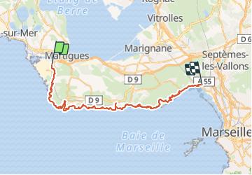
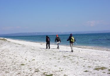
Tocht Stappen van 53 km beschikbaar op Provence-Alpes-Côte d'Azur, Bouches-du-Rhône, Martigues. Deze tocht wordt voorgesteld door Maryma.
Beschrijving
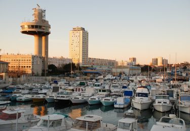
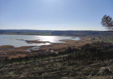
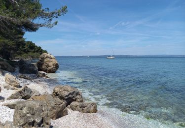
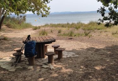
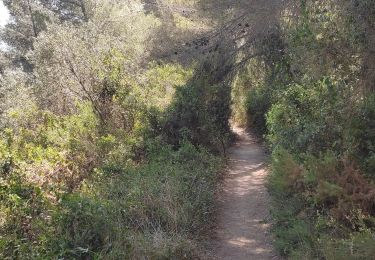
Une traversée idyllique de la Côte Bleue entre plages, criques, calanques et villages de pêcheurs avec des vues imprenables sur la rade de Marseille. Itinéraire nécessitant plusieurs jours de marche mais très accessible grâce à la ligne TER Marseille-Miramas par la Côte Bleue
Plaatsbepaling
Opmerkingen
Wandeltochten in de omgeving
![Tocht Te voet Port-de-Bouc - La Presqu’ile - Le sentier du littoral - Photo](https://media.geolcdn.com/t/375/260/7fd51f05-a6e7-42de-ab91-8a11cdb4314b.jpeg&format=jpg&maxdim=2)
![Te voet Te voet](https://static1.geolcdn.com/sitytour/trail-icons/100.png)
Te voet
![](/images/other/stat-length.png)
![](https://static1.geolcdn.com/siteimages/upload/files/16400158638029165_repeat_loop_refresh_sync_direction_icon.png)
![Tocht Te voet Port-de-Bouc - Forêt de Castillon Etangs de Pourra et d’Engrenier - Photo](https://media.geolcdn.com/t/375/260/b4485374-af03-4dfc-85d7-4833d4297133.jpeg&format=jpg&maxdim=2)
![Te voet Te voet](https://static1.geolcdn.com/sitytour/trail-icons/100.png)
Te voet
![](/images/other/stat-length.png)
![](https://static1.geolcdn.com/siteimages/upload/files/16400158638029165_repeat_loop_refresh_sync_direction_icon.png)
![Tocht Stappen Martigues - Parc de Figuerolles 26.5.24 - Photo](https://media.geolcdn.com/t/375/260/cfe36c57-0ab2-4f94-9dae-8a49ceb2c9ba.jpg&format=jpg&maxdim=2)
![Stappen Stappen](https://static1.geolcdn.com/sitytour/trail-icons/101.png)
Stappen
![](/images/other/stat-length.png)
![](https://static1.geolcdn.com/siteimages/upload/files/16400158638029165_repeat_loop_refresh_sync_direction_icon.png)
![Tocht Stappen Martigues - Figuerrolles - Photo](https://media.geolcdn.com/t/375/260/4a5f1588-9bfa-4aa2-87f0-3f537570d4aa.jpg&format=jpg&maxdim=2)
![Stappen Stappen](https://static1.geolcdn.com/sitytour/trail-icons/101.png)
Stappen
![](/images/other/stat-length.png)
![](https://static1.geolcdn.com/siteimages/upload/files/16400158638029165_repeat_loop_refresh_sync_direction_icon.png)
![Tocht Stappen Martigues - Promenade sur la rive de l'étang de Berre - Photo](https://media.geolcdn.com/t/375/260/7e13284d-163b-4a11-a7aa-ccfaecaf0dbc.jpg&format=jpg&maxdim=2)
![Stappen Stappen](https://static1.geolcdn.com/sitytour/trail-icons/101.png)
Stappen
![](/images/other/stat-length.png)
![](https://static1.geolcdn.com/siteimages/upload/files/16400158638029165_repeat_loop_refresh_sync_direction_icon.png)
![Tocht Stappen Martigues - le parc de Figuerolles - Photo](https://media.geolcdn.com/t/375/260/5cd4b284-43d0-4749-a83d-d42e7a468467.jpg&format=jpg&maxdim=2)
![Stappen Stappen](https://static1.geolcdn.com/sitytour/trail-icons/101.png)
Stappen
![](/images/other/stat-length.png)
![](https://static1.geolcdn.com/siteimages/upload/files/16400158638029165_repeat_loop_refresh_sync_direction_icon.png)
![Tocht Te voet Martigues - Boucle de Figuerolles - Photo](https://media.geolcdn.com/t/375/260/95277df0-03ce-438e-8003-6258ba4d95b2.jpeg&format=jpg&maxdim=2)
![Te voet Te voet](https://static1.geolcdn.com/sitytour/trail-icons/100.png)
Te voet
![](/images/other/stat-length.png)
![](https://static1.geolcdn.com/siteimages/upload/files/16400158638029165_repeat_loop_refresh_sync_direction_icon.png)
![Tocht Te voet Martigues - Vestiges Militaires - Photo](https://media.geolcdn.com/t/375/260/6e507b0b-ffdb-4c7c-b8fe-ce4599d1b5df.jpeg&format=jpg&maxdim=2)
![Te voet Te voet](https://static1.geolcdn.com/sitytour/trail-icons/100.png)
Te voet
![](/images/other/stat-length.png)
![](https://static1.geolcdn.com/siteimages/upload/files/16400158638029165_repeat_loop_refresh_sync_direction_icon.png)
![Stappen Stappen](https://static1.geolcdn.com/sitytour/trail-icons/101.png)
Stappen
![](/images/other/stat-length.png)
![](https://static1.geolcdn.com/siteimages/upload/files/16400158638029165_repeat_loop_refresh_sync_direction_icon.png)