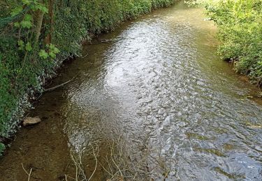
Tocht Stappen Maintenon - Le long du Canal Louis XIV à Maintenon - Photo

Le long du Canal Louis XIV à Maintenon

partout a pied et en moto

© OpenStreetMap contributors
Lengte
Lengte
16,5 km
Max. hoogte
Max. hoogte
144 m
Positief hoogteverschil
195 m
Km-Effort
Km-Effort  
19,1 km
Min. hoogte
Min. hoogte
95 m
Negatief hoogteverschil
194 m
Boucle
Boucle
Ja
Datum van aanmaak :
2023-09-30 17:26:45.922
Laatste wijziging :
2023-09-30 17:28:24.661

(0 Bericht)

Stappen
Stappen
4h19
Moeilijkheid : Zeer moeilijk

Scan deze QR-code om de tocht te openen in de SityTrail-applicatie

Gratisgps-wandelapplicatie

Logo SityTrail SityTrail

IGN / Geografische instituten

SityTrail uit de App Store downloaden SityTrail uit Google Play downloaden

Logo SityTrail SityTrail World

De wereld gaat voor u open

SityTrail uit de App Store downloaden SityTrail uit Google Play downloaden SityTrail op Huawei AppGallery downloaden

Over ons

Tocht Stappen van 16,5 km beschikbaar op Centre-Val de Loire, Eure-et-Loir, Maintenon. Deze tocht wordt voorgesteld door les randos d'Olivier.

Hoogteprofiel

POI's

POI Maintenon - Place Aristide Briand. Longer le Canal Louis XIV - Photo
olivieraron
POI Pierres - Route D116a - Photo
olivieraron
PIERRES 
POI Pierres - La Mare Vignot - Photo
olivieraron
POI Villiers-le-Morhier - Bifurcation - Photo
olivieraron
VILLIERS-LE-MORHIER 
POI Villiers-le-Morhier - Pommiers - Photo
olivieraron
VILLIERS-LE-MORHIER 
POI Villiers-le-Morhier - Clos-Verdelet - Photo
olivieraron
VILLIERS-LE-MORHIER 
POI Villiers-le-Morhier - GR® 655 - Photo
olivieraron
VILLIERS-LE-MORHIER 
POI Villiers-le-Morhier -  GR® 655 - Photo
olivieraron
VILLIERS-LE-MORHIER 
POI Villiers-le-Morhier - Bifurcation - Photo
olivieraron
VILLIERS-LE-MORHIER 
POI Villiers-le-Morhier - Malmaison - Photo
olivieraron
VILLIERS-LE-MORHIER 
POI Villiers-le-Morhier - Château d’eau - Photo
olivieraron
VILLIERS-LE-MORHIER 
POI Nogent-le-Roi - Route D983 - Photo
olivieraron
NOGENT-LE-ROI 
POI Pierres - Hameau. GRP - Photo
olivieraron
PIERRES 
POI Pierres - Sentier forestier - Photo
olivieraron
POI Pierres - Sente de Saint Piat - Photo
olivieraron
POI Pierres - Sentier GRP - Photo
olivieraron
PIERRES 
POI Maintenon - Route D109 - Photo
olivieraron
MAINTENON 
POI Maintenon - Place Aristide Briand - Photo
olivieraron

Plaatsbepaling

Land:
France
Regio :
Centre-Val de Loire
Departement/Provincie :
Eure-et-Loir
Gemeente :
Maintenon
Locatie:
Unknown
Vertrek:(UTM)
395133 ; 5382844 (31U) N.

Wandeltochten in de omgeving

Tocht Mountainbike Maintenon - Bois et vallées - Maintenon - Photo
Mountainbike
tracegps

Mountainbike

Gemakkelijk
(1)
Maintenon, Centre-Val de Loire, Eure-et-Loir, France
12,7 km | 14,7 km-effort
1h 0min
Ja
Tocht Stappen Maintenon - maintenon - Photo
Stappen
topophil

Stappen

Heel gemakkelijk
(1)
Maintenon, Centre-Val de Loire, Eure-et-Loir, France
14 km | 16,3 km-effort
3h 5min
Ja
Tocht Stappen Maintenon - Bois et vallées - Maintenon - Photo
Stappen
tracegps

Stappen

Moeilijk
(3)
Maintenon, Centre-Val de Loire, Eure-et-Loir, France
12,7 km | 14,7 km-effort
3h 10min
Ja
Tocht Stappen Maintenon - Maintenon APL - Photo
Stappen
jctbis

Stappen

Medium
Maintenon, Centre-Val de Loire, Eure-et-Loir, France
11,5 km | 12,8 km-effort
2h 38min
Ja
Tocht Mountainbike Hanches - hanches Droue sur Drouette st Hilarion - Photo
Mountainbike
topophil

Mountainbike

Moeilijk
Hanches, Centre-Val de Loire, Eure-et-Loir, France
31 km | 36 km-effort
3h 12min
Ja
Tocht Stappen Maintenon - Maintenon Reco du 04 08 2022 - Photo
Stappen
christianbossavy

Stappen

Heel gemakkelijk
Maintenon, Centre-Val de Loire, Eure-et-Loir, France
8,1 km | 8,7 km-effort
2h 2min
Ja
Tocht Stappen Maintenon - Maintenon Reco du 04 08 2022 - Photo
Stappen
christianbossavy

Stappen

Heel gemakkelijk
Maintenon, Centre-Val de Loire, Eure-et-Loir, France
8,1 km | 8,7 km-effort
2h 2min
Ja
Tocht Stappen Maintenon - Maintenon Reco du 04 08 2022 - Photo
Stappen
christianbossavy

Stappen

Heel gemakkelijk
Maintenon, Centre-Val de Loire, Eure-et-Loir, France
8,1 km | 8,7 km-effort
2h 2min
Ja
Tocht Stappen Maintenon - Entre le Canal Louis XIV et la Vallée de l'Eure - Photo
Stappen

Stappen

Zeer moeilijk
Maintenon, Centre-Val de Loire, Eure-et-Loir, France
17,1 km | 19,6 km-effort
4h 27min
Ja


Sluiten
Mijn abonnementen