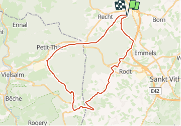
![](/images/other/stat-length.png)
![Tocht Wegfiets Sankt Vith - Recht vers Commanster - Photo](https://media.geolcdn.com/t/1900/400/ext.pjpeg?maxdim=2&url=https%3A%2F%2Fstatic1.geolcdn.com%2Fsiteimages%2Fupload%2Ffiles%2F1524743154velo.jpg)
Recht vers Commanster
Giltayjean
Gebruiker
![Lengte](/images/other/stat-length.png)
![Max. hoogte](https://static1.geolcdn.com/siteimages/upload/files/1508320355ic_sort_altitude_max_24dp.png)
![Positief hoogteverschil](https://static1.geolcdn.com/siteimages/upload/files/1508320355ic_sort_den_pos_24dp.png)
![Km-Effort](/images/other/stat-length.png)
![Min. hoogte](https://static1.geolcdn.com/siteimages/upload/files/1508320355ic_sort_altitude_min_24dp.png)
![Negatief hoogteverschil](https://static1.geolcdn.com/siteimages/upload/files/1508320355ic_sort_den_neg_24dp.png)
![Boucle](https://static1.geolcdn.com/siteimages/upload/files/16400158638029165_repeat_loop_refresh_sync_direction_icon.png)
![Wegfiets](https://static1.geolcdn.com/sitytour/trail-icons/201.png)
2h22
Moeilijkheid : Moeilijk
![Elektrische fiets](https://static1.geolcdn.com/sitytour/trail-icons/205.png)
2h30
Moeilijkheid : Medium
![Scan deze QR-code om de tocht te openen in de SityTrail-applicatie](https://capi.geolives.com/qq0zvz2zws4bq2lad0pu/sitytour/trails/3820984/qr.png?size=200)
Gratisgps-wandelapplicatie
Over ons
Tocht Wegfiets van 33 km beschikbaar op Wallonië, Luik, Sankt Vith. Deze tocht wordt voorgesteld door Giltayjean.
Beschrijving
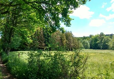
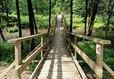
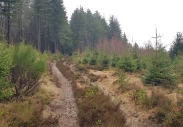
Belle balade d'abord sur le Ravel vers Vielsalm puis dans les bois et les petits villages proches de Saint Vith. quelques passages caillouteux.
Itineraire points noeuds sauf entre la zone industrielle de Burtonville et le haut du village de Burtonville.
Départ 56 > 61 > 89 puis continuer sur le ravel jusqu'au rond point de la Z.I. de Burtonville. Ensuite monter tout droit vers le village de Burtonville . en haut du village, prendre à gauche et suivre les points noeuds 20 >25 >180 > 181 > 165 > 160 et 56
Plaatsbepaling
Opmerkingen
Wandeltochten in de omgeving
![Tocht Stappen Amel - 2021-05-17_18h56m57_montenau - Photo](https://media.geolcdn.com/t/375/260/39077950-0e33-4cc7-ace0-3c1287257ee0.jpg&format=jpg&maxdim=2)
![Stappen Stappen](https://static1.geolcdn.com/sitytour/trail-icons/101.png)
Stappen
![](/images/other/stat-length.png)
![](https://static1.geolcdn.com/siteimages/upload/files/16400158638029165_repeat_loop_refresh_sync_direction_icon.png)
![Tocht Stappen Sankt Vith - 2021-05-17_18h38m48_recht - Photo](https://media.geolcdn.com/t/375/260/df57db6f-82de-45d3-a1f9-f0242505f9de.jpg&format=jpg&maxdim=2)
![Stappen Stappen](https://static1.geolcdn.com/sitytour/trail-icons/101.png)
Stappen
![](/images/other/stat-length.png)
![](https://static1.geolcdn.com/siteimages/upload/files/16400158638029165_repeat_loop_refresh_sync_direction_icon.png)
![Tocht Stappen Malmedy - ligneuville - ondeval aller retour - Photo](https://media.geolcdn.com/t/375/260/5d217ee2-30bd-4bc8-82e6-a4da860aa974.jpg&format=jpg&maxdim=2)
![Stappen Stappen](https://static1.geolcdn.com/sitytour/trail-icons/101.png)
Stappen
![](/images/other/stat-length.png)
![](https://static1.geolcdn.com/siteimages/upload/files/16400158638029165_repeat_loop_refresh_sync_direction_icon.png)
![Tocht Rolschaatsen Malmedy - Vallée de l'Amblève - Photo](https://media.geolcdn.com/t/375/260/ext.jpg?maxdim=2&url=https%3A%2F%2Fservices.sitytrail.com%2FGeolivesWS%2FDownloadMedia.ashx%3FTrailID%3D767158%26Media%3Dfix__20170605123453.jpg)
![Rolschaatsen Rolschaatsen](https://static1.geolcdn.com/sitytour/trail-icons/901.png)
Rolschaatsen
![](/images/other/stat-length.png)
![](https://static1.geolcdn.com/siteimages/upload/files/16400158638029165_repeat_loop_refresh_sync_direction_icon.png)
![Tocht Stappen Amel - La rivière d'or (9km) - Photo](https://media.geolcdn.com/t/375/260/eac006de-c0aa-46b2-933f-e559c8a45d2b.jpg&format=jpg&maxdim=2)
![Stappen Stappen](https://static1.geolcdn.com/sitytour/trail-icons/101.png)
Stappen
![](/images/other/stat-length.png)
![](https://static1.geolcdn.com/siteimages/upload/files/16400158638029165_repeat_loop_refresh_sync_direction_icon.png)
![Tocht Stappen Sankt Vith - Rodt - Chiens de traineau - Photo](https://media.geolcdn.com/t/375/260/1e66ffeb-aa18-4dc8-9647-91e8788c7358.jpg&format=jpg&maxdim=2)
![Stappen Stappen](https://static1.geolcdn.com/sitytour/trail-icons/101.png)
Stappen
![](/images/other/stat-length.png)
![](https://static1.geolcdn.com/siteimages/upload/files/16400158638029165_repeat_loop_refresh_sync_direction_icon.png)
![Stappen Stappen](https://static1.geolcdn.com/sitytour/trail-icons/101.png)
Stappen
![](/images/other/stat-length.png)
![](https://static1.geolcdn.com/siteimages/upload/files/16400158638029165_repeat_loop_refresh_sync_direction_icon.png)
![Tocht Stappen Sankt Vith - Recht 22 km - Photo](https://media.geolcdn.com/t/375/260/a9f794ab-d5e8-4cf0-8525-510ce3401da7.jpeg&format=jpg&maxdim=2)
![Stappen Stappen](https://static1.geolcdn.com/sitytour/trail-icons/101.png)
Stappen
![](/images/other/stat-length.png)
![](https://static1.geolcdn.com/siteimages/upload/files/16400158638029165_repeat_loop_refresh_sync_direction_icon.png)
![Tocht Stappen Stavelot - Refat 17,3km - Photo](https://media.geolcdn.com/t/375/260/ext.jpg?maxdim=2&url=https%3A%2F%2Fstatic1.geolcdn.com%2Fsiteimages%2Fupload%2Ffiles%2F1553511878bg_sport_marche.png)
![Stappen Stappen](https://static1.geolcdn.com/sitytour/trail-icons/101.png)
Stappen
![](/images/other/stat-length.png)
![](https://static1.geolcdn.com/siteimages/upload/files/16400158638029165_repeat_loop_refresh_sync_direction_icon.png)