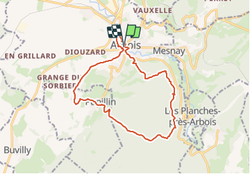
![](/images/other/stat-length.png)
![Tocht Stappen Arbois - Arbois Pupillin Arbois - Photo](https://media.geolcdn.com/t/1900/400/d8b4c5eb-e163-47d4-aaaf-96dbcfbb358f.jpg&format=pjpeg&maxdim=2)
Arbois Pupillin Arbois
thierry cachot
Gebruiker
![Lengte](/images/other/stat-length.png)
![Max. hoogte](https://static1.geolcdn.com/siteimages/upload/files/1508320355ic_sort_altitude_max_24dp.png)
![Positief hoogteverschil](https://static1.geolcdn.com/siteimages/upload/files/1508320355ic_sort_den_pos_24dp.png)
![Km-Effort](/images/other/stat-length.png)
![Min. hoogte](https://static1.geolcdn.com/siteimages/upload/files/1508320355ic_sort_altitude_min_24dp.png)
![Negatief hoogteverschil](https://static1.geolcdn.com/siteimages/upload/files/1508320355ic_sort_den_neg_24dp.png)
![Boucle](https://static1.geolcdn.com/siteimages/upload/files/16400158638029165_repeat_loop_refresh_sync_direction_icon.png)
![Stappen](https://static1.geolcdn.com/sitytour/trail-icons/101.png)
5h00
Moeilijkheid : Moeilijk
![Scan deze QR-code om de tocht te openen in de SityTrail-applicatie](https://capi.geolives.com/qq0zvz2zws4bq2lad0pu/sitytour/trails/3806113/qr.png?size=200)
Gratisgps-wandelapplicatie
Over ons
Tocht Stappen van 16,2 km beschikbaar op Bourgondië-Franche-Comté, Jura, Arbois. Deze tocht wordt voorgesteld door thierry cachot.
Beschrijving
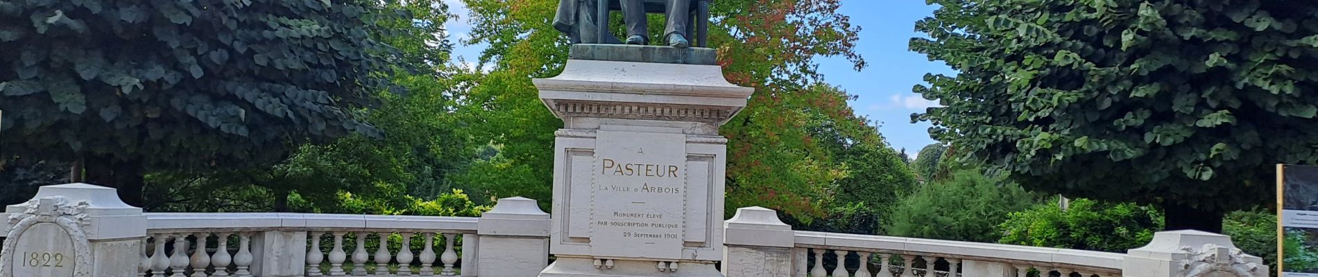
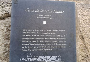
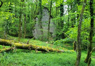
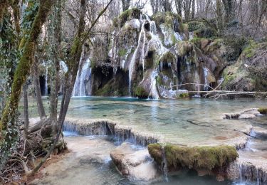
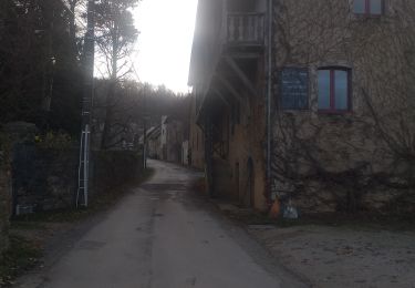
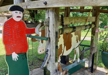
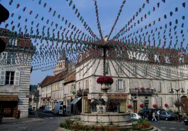
Arbois Pupillin Arbois en passant via la Tour Gloriette, La chapelle Notre Dame de l'Ermitage, le doyen des Hêtres, la clairière des baraques, Pupillin et la traversée des vignes, Arbois en passant par l'église Saint Just, le chemin champêtre qui longe Cuisance et arrive à la Maison Pasteur .
Plaatsbepaling
Opmerkingen
Wandeltochten in de omgeving
![Tocht Stappen Arbois - Arbois Église Saint Just / Chapelle Notre Dame de l'Ermitage/ Cascade des Tufs/ Les Planches près d'Arbois / Cirque du Fer à Cheval / Belvédère de la Châtelaine/ La Roche du Feu/ Meslay/ Arbois - Photo](https://media.geolcdn.com/t/375/260/c57ab660-fec2-47a8-a9d2-fa1865f963db.jpg&format=jpg&maxdim=2)
![Stappen Stappen](https://static1.geolcdn.com/sitytour/trail-icons/101.png)
Stappen
![](/images/other/stat-length.png)
![](https://static1.geolcdn.com/siteimages/upload/files/16400158638029165_repeat_loop_refresh_sync_direction_icon.png)
![Tocht Stappen Arbois - Arbois Belvédère du Fer à Cheval Belvédère Châtelaine Cascade des Tufs Planches près d'Arbois La Roche du Feu Mesnay Arbois - Photo](https://media.geolcdn.com/t/375/260/71353c7e-d6a4-47bd-b061-6c2048e62167.jpg&format=jpg&maxdim=2)
![Stappen Stappen](https://static1.geolcdn.com/sitytour/trail-icons/101.png)
Stappen
![](/images/other/stat-length.png)
![](https://static1.geolcdn.com/siteimages/upload/files/16400158638029165_repeat_loop_refresh_sync_direction_icon.png)
![Tocht Stappen Les Planches-près-Arbois - la reculée des planches - Photo](https://media.geolcdn.com/t/375/260/54dcee1d-d6c8-429f-ae87-1dad41ae6b91.jpg&format=jpg&maxdim=2)
![Stappen Stappen](https://static1.geolcdn.com/sitytour/trail-icons/101.png)
Stappen
![](/images/other/stat-length.png)
![](https://static1.geolcdn.com/siteimages/upload/files/16400158638029165_repeat_loop_refresh_sync_direction_icon.png)
![Tocht Stappen Arbois - Arbois Reculée des Planches - Photo](https://media.geolcdn.com/t/375/260/3029e893-3181-453d-94ab-d00d63b05373.jpg&format=jpg&maxdim=2)
![Stappen Stappen](https://static1.geolcdn.com/sitytour/trail-icons/101.png)
Stappen
![](/images/other/stat-length.png)
![](https://static1.geolcdn.com/siteimages/upload/files/16400158638029165_repeat_loop_refresh_sync_direction_icon.png)
![Tocht Stappen Montigny-lès-Arsures - Montigny les Arsures - Photo](https://media.geolcdn.com/t/375/260/43ca39b3-8483-4e13-bdbd-587ac00b0f2b.jpg&format=jpg&maxdim=2)
![Stappen Stappen](https://static1.geolcdn.com/sitytour/trail-icons/101.png)
Stappen
![](/images/other/stat-length.png)
![](https://static1.geolcdn.com/siteimages/upload/files/16400158638029165_repeat_loop_refresh_sync_direction_icon.png)
![Tocht Stappen La Châtelaine - Cirque du Fer à Cheval - cascade des Tufs - Arbois - Photo](https://media.geolcdn.com/t/375/260/ff46c3de-3ecb-478e-8c38-198244ccc0e5.jpg&format=jpg&maxdim=2)
![Stappen Stappen](https://static1.geolcdn.com/sitytour/trail-icons/101.png)
Stappen
![](/images/other/stat-length.png)
![](https://static1.geolcdn.com/siteimages/upload/files/16400158638029165_repeat_loop_refresh_sync_direction_icon.png)
![Tocht Stappen La Châtelaine - les planches d'Arbois restaurant le fer à cheval - Photo](https://media.geolcdn.com/t/375/260/e63ffc4f-ef96-4146-b1da-ac690db78307.jpg&format=jpg&maxdim=2)
![Stappen Stappen](https://static1.geolcdn.com/sitytour/trail-icons/101.png)
Stappen
![](/images/other/stat-length.png)
![](https://static1.geolcdn.com/siteimages/upload/files/16400158638029165_repeat_loop_refresh_sync_direction_icon.png)
![Tocht Paardrijden Les Planches-près-Arbois - EQU-INTEGRALE-2021 - Photo](https://media.geolcdn.com/t/375/260/ext.jpg?maxdim=2&url=https%3A%2F%2Fstatic1.geolcdn.com%2Fsiteimages%2Fupload%2Ffiles%2F1524743154cheval.jpg)
![Paardrijden Paardrijden](https://static1.geolcdn.com/sitytour/trail-icons/301.png)
Paardrijden
![](/images/other/stat-length.png)
![](https://static1.geolcdn.com/siteimages/upload/files/16400158638029165_repeat_loop_refresh_sync_direction_icon.png)
![Tocht Te voet Arbois - Entre Bois et Vignes - Photo](https://media.geolcdn.com/t/375/260/b888b267-0603-40a3-9d6a-bea2390f444d.jpeg&format=jpg&maxdim=2)
![Te voet Te voet](https://static1.geolcdn.com/sitytour/trail-icons/100.png)
Te voet
![](/images/other/stat-length.png)
![](https://static1.geolcdn.com/siteimages/upload/files/16400158638029165_repeat_loop_refresh_sync_direction_icon.png)
Très sympa.