26 km | 38 km-effort
Randonnée Monchique
avit46
Gebruiker
Lengte
6,9 km
Max. hoogte
818 m
Positief hoogteverschil
393 m
Km-Effort
12,1 km
Min. hoogte
449 m
Negatief hoogteverschil
385 m
Boucle
Ja
Datum van aanmaak :
2023-09-08 11:22:22.0
Laatste wijziging :
2023-09-08 14:38:35.784
Gratisgps-wandelapplicatie
Over ons
Tocht van 6,9 km beschikbaar op Algarve, Faro, Monchique. Deze tocht wordt voorgesteld door avit46.
Beschrijving
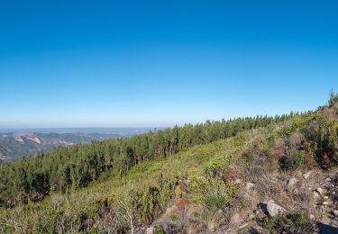
Balade d’environ 2heures avec un dénivelé de difficulté moyen. Attention aux cailloux !
Plaatsbepaling
Land:
Portugal
Regio :
Algarve
Departement/Provincie :
Faro
Gemeente :
Monchique
Locatie:
Unknown
Vertrek:(Dec)
Vertrek:(UTM)
539422 ; 4130415 (29S) N.
Opmerkingen
Wandeltochten in de omgeving
Circuito da Picota (Rota das Árvores Monumentais)
Te voet
Moeilijk
Monchique,
Algarve,
Faro,
Portugal
8h 38min
Ja
Circuito da Fóia (Rota das Árvores Monumentais)
Te voet
Medium
Monchique,
Algarve,
Faro,
Portugal
15,8 km | 24 km-effort
5h 29min
Ja
Árvores da Vila (Rota das Árvores Monumentais)
Te voet
Gemakkelijk
Monchique,
Algarve,
Faro,
Portugal
6,4 km | 9,2 km-effort
2h 6min
Ja
Fóia e área envolvente (Rota da Geologia)
Te voet
Medium
Monchique,
Algarve,
Faro,
Portugal
15,7 km | 22 km-effort
4h 59min
Ja
Algarve - Monchique n°15
Stappen
Gemakkelijk
(1)
Monchique,
Algarve,
Faro,
Portugal
7,8 km | 11,8 km-effort
2h 19min
Ja
ALGARVE - Le Chemin des cascades dans la Serra de Monchique
Stappen
Medium
Monchique,
Algarve,
Faro,
Portugal
18,5 km | 28 km-effort
5h 32min
Neen
Trilho dos Moinhos
Te voet
Gemakkelijk
Monchique,
Algarve,
Faro,
Portugal
9,3 km | 14,2 km-effort
3h 13min
Ja
Trilho da Fóia
Te voet
Gemakkelijk
(1)
Monchique,
Algarve,
Faro,
Portugal
6,5 km | 10,7 km-effort
2h 26min
Ja
Caminho das Caldas - Picota
Te voet
Medium
Monchique,
Algarve,
Faro,
Portugal
18,6 km | 30 km-effort
6h 42min
Ja