![](/images/other/stat-length.png)
![Tocht Stappen Saint-Chély-d'Aubrac - Compostelle / Chemin du Puy : de Aubrac à Bonneval - Photo](https://media.geolcdn.com/t/1900/400/dbc34bf8-a914-4f2b-98e8-658766b11ec6.jpg&format=pjpeg&maxdim=2)
Compostelle / Chemin du Puy : de Aubrac à Bonneval
webmammuth
Gebruiker
![Lengte](/images/other/stat-length.png)
![Max. hoogte](https://static1.geolcdn.com/siteimages/upload/files/1508320355ic_sort_altitude_max_24dp.png)
![Positief hoogteverschil](https://static1.geolcdn.com/siteimages/upload/files/1508320355ic_sort_den_pos_24dp.png)
![Km-Effort](/images/other/stat-length.png)
![Min. hoogte](https://static1.geolcdn.com/siteimages/upload/files/1508320355ic_sort_altitude_min_24dp.png)
![Negatief hoogteverschil](https://static1.geolcdn.com/siteimages/upload/files/1508320355ic_sort_den_neg_24dp.png)
![Boucle](https://static1.geolcdn.com/siteimages/upload/files/16400158638029165_repeat_loop_refresh_sync_direction_icon.png)
![Stappen](https://static1.geolcdn.com/sitytour/trail-icons/101.png)
11h00
Moeilijkheid : Moeilijk
![Scan deze QR-code om de tocht te openen in de SityTrail-applicatie](https://capi.geolives.com/qq0zvz2zws4bq2lad0pu/sitytour/trails/3783637/qr.png?size=200)
Gratisgps-wandelapplicatie
Over ons
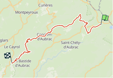
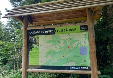
Tocht Stappen van 33 km beschikbaar op Occitanië, Aveyron, Saint-Chély-d'Aubrac. Deze tocht wordt voorgesteld door webmammuth.
Beschrijving
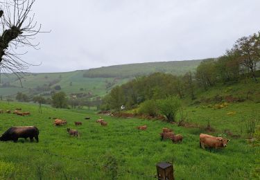
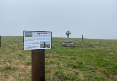
Attention, marche magnifique, mais difficile.
Le gps indique 33,4km en 2D, et 37km en 3D, car 2200m de dénivelé.
Les descentes sont très difficiles, et dangereuses : chaussures fermées, bien serrées, pointure et demie au dessus de votre taille.
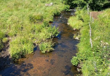
Sac allégé si possible (portage à prévoir sur cette rando). D'autant plus qu'un minimum de 2 litres d'eau sera nécessaire à partir de Condom.
Plaatsbepaling
Opmerkingen
Wandeltochten in de omgeving
![Tocht Stappen Saint-Chély-d'Aubrac - Aubrac - St Côme d'Olt - Chemin de St-Jacques de Compostelle - Photo](https://media.geolcdn.com/t/375/260/ext.jpg?maxdim=2&url=https%3A%2F%2Fservices.sitytrail.com%2FGeolivesWS%2FDownloadMedia.ashx%3FTrailID%3D108743%26Media%3D1838_2.jpg)
![Stappen Stappen](https://static1.geolcdn.com/sitytour/trail-icons/101.png)
Stappen
![](/images/other/stat-length.png)
![](https://static1.geolcdn.com/siteimages/upload/files/16400158638029165_repeat_loop_refresh_sync_direction_icon.png)
![Tocht Stappen Nasbinals - Nasbinals Montorzier Aubrac GR65 - Photo](https://media.geolcdn.com/t/375/260/1ac3a438-86b6-472c-99e2-7da904ac9db5.jpg&format=jpg&maxdim=2)
![Stappen Stappen](https://static1.geolcdn.com/sitytour/trail-icons/101.png)
Stappen
![](/images/other/stat-length.png)
![](https://static1.geolcdn.com/siteimages/upload/files/16400158638029165_repeat_loop_refresh_sync_direction_icon.png)
![Tocht Stappen Saint-Chély-d'Aubrac - Mon chemin de St Guilhem étape 3 - Photo](https://media.geolcdn.com/t/375/260/decc6e0e-cc63-493a-98a1-a20926931e85.jpg&format=jpg&maxdim=2)
![Stappen Stappen](https://static1.geolcdn.com/sitytour/trail-icons/101.png)
Stappen
![](/images/other/stat-length.png)
![](https://static1.geolcdn.com/siteimages/upload/files/16400158638029165_repeat_loop_refresh_sync_direction_icon.png)
![Tocht Stappen Curières - Le Devez cascade et forêts - Photo](https://media.geolcdn.com/t/375/260/7d8f35a5-9c7c-4d32-ad85-47f2399701b0.jpg&format=jpg&maxdim=2)
![Stappen Stappen](https://static1.geolcdn.com/sitytour/trail-icons/101.png)
Stappen
![](/images/other/stat-length.png)
![](https://static1.geolcdn.com/siteimages/upload/files/16400158638029165_repeat_loop_refresh_sync_direction_icon.png)
![Tocht Te voet Nasbinals - chemin de Saint-Jacques-de-Compostelle pour randonneurs avec animaux (chien, ane, cheval) ou VTT - Photo](https://media.geolcdn.com/t/375/260/ce1c8375-c87d-45df-90e9-7235318ed55e.jpeg&format=jpg&maxdim=2)
![Te voet Te voet](https://static1.geolcdn.com/sitytour/trail-icons/100.png)
Te voet
![](/images/other/stat-length.png)
![](https://static1.geolcdn.com/siteimages/upload/files/16400158638029165_repeat_loop_refresh_sync_direction_icon.png)
![Tocht Stappen Curières - Truques d’Aubrac Pas de Mathieu - Photo](https://media.geolcdn.com/t/375/260/943ba7fb-dc01-4617-b5be-555fb9d2d35b.jpg&format=jpg&maxdim=2)
![Stappen Stappen](https://static1.geolcdn.com/sitytour/trail-icons/101.png)
Stappen
![](/images/other/stat-length.png)
![](https://static1.geolcdn.com/siteimages/upload/files/16400158638029165_repeat_loop_refresh_sync_direction_icon.png)
![Tocht Stappen Saint-Chély-d'Aubrac - Étape 3 Saint Gilhem - Photo](https://media.geolcdn.com/t/375/260/2821279b-f5ae-4989-8e19-441e200f8ae5.jpg&format=jpg&maxdim=2)
![Stappen Stappen](https://static1.geolcdn.com/sitytour/trail-icons/101.png)
Stappen
![](/images/other/stat-length.png)
![](https://static1.geolcdn.com/siteimages/upload/files/16400158638029165_repeat_loop_refresh_sync_direction_icon.png)
![Tocht sport Nasbinals - Nasbinal - Aubrac - Photo](https://media.geolcdn.com/t/375/260/ext.jpg?maxdim=2&url=https%3A%2F%2Fsecurestorage.geolives.com%2Fsitytour%2Ftrail-bg%2Fdefault.jpg)
sport
![](/images/other/stat-length.png)
![](https://static1.geolcdn.com/siteimages/upload/files/16400158638029165_repeat_loop_refresh_sync_direction_icon.png)
![Tocht Stappen Nasbinals - Nasbinals col d’Aubrac Montorzier - Photo](https://media.geolcdn.com/t/375/260/70da54ba-061f-4983-848e-b1aa9d3ce041.jpg&format=jpg&maxdim=2)
![Stappen Stappen](https://static1.geolcdn.com/sitytour/trail-icons/101.png)
Stappen
![](/images/other/stat-length.png)
![](https://static1.geolcdn.com/siteimages/upload/files/16400158638029165_repeat_loop_refresh_sync_direction_icon.png)