

Entre vallées du Rechter Bach et de l'Amblève

Nico222
Gebruiker

Lengte
36 km

Max. hoogte
599 m

Positief hoogteverschil
889 m

Km-Effort
48 km

Min. hoogte
341 m

Negatief hoogteverschil
883 m
Boucle
Ja
Datum van aanmaak :
2015-01-22 00:00:00.0
Laatste wijziging :
2015-01-22 00:00:00.0
3h03
Moeilijkheid : Medium

Gratisgps-wandelapplicatie
Over ons
Tocht Mountainbike van 36 km beschikbaar op Wallonië, Luxemburg, Vielsalm. Deze tocht wordt voorgesteld door Nico222.
Beschrijving
Rejoindre le guide au départ du parking de l'Eglise de Petit-Thier. Attention ce parcours peut être physique à certains endroits. Ne convient pas pour un public familiale.
Plaatsbepaling
Land:
Belgium
Regio :
Wallonië
Departement/Provincie :
Luxemburg
Gemeente :
Vielsalm
Locatie:
Petit-Thier
Vertrek:(Dec)
Vertrek:(UTM)
711277 ; 5577022 (31U) N.
Opmerkingen
Wandeltochten in de omgeving
Logbiermé. Natura 2000, des sites qui valent le détour ! Lg5


Stappen
Gemakkelijk
(10)
Trois-Ponts,
Wallonië,
Luik,
Belgium

8,4 km | 10,9 km-effort
Onbekend
Ja
2023-04-02_15h38m24_Cirkwi-Vielsalm___Pays_du_bois,_de_la_pierre_de_l_eau


Stappen
Medium
(2)
Vielsalm,
Wallonië,
Luxemburg,
Belgium

11,6 km | 15,6 km-effort
3h 32min
Ja
GG-Lu-16_Vielsalm - Gouvy


Stappen
Zeer moeilijk
(3)
Vielsalm,
Wallonië,
Luxemburg,
Belgium

16 km | 22 km-effort
4h 48min
Neen
RB-LUX-03 - Raccourci - Dans les vallées de la Salm et du Glain


Stappen
Gemakkelijk
(4)
Vielsalm,
Wallonië,
Luxemburg,
Belgium

16,8 km | 23 km-effort
3h 36min
Ja
RB-LUX-03 - Dans les vallées de la Salm et du Glain


Stappen
Medium
(4)
Vielsalm,
Wallonië,
Luxemburg,
Belgium

22 km | 30 km-effort
6h 10min
Ja
Balade à Salmchateau


Stappen
Moeilijk
Vielsalm,
Wallonië,
Luxemburg,
Belgium

9,8 km | 13,4 km-effort
3h 2min
Ja
La nature en questions


Stappen
Medium
Vielsalm,
Wallonië,
Luxemburg,
Belgium

7 km | 9,8 km-effort
2h 13min
Ja
Forêt domaniale du Grand-Bois


Stappen
Gemakkelijk
Vielsalm,
Wallonië,
Luxemburg,
Belgium

4,1 km | 4,9 km-effort
1h 7min
Ja
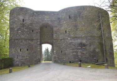
20220504 - TOTEMUS Salmchateau 4.3 Km


Stappen
Medium
Vielsalm,
Wallonië,
Luxemburg,
Belgium

4,2 km | 5,4 km-effort
1h 36min
Ja


 SityTrail


