![](/images/other/stat-length.png)
![Tocht Noords wandelen Trélans - Trélans Aubrac - Croix du Pal - Photo](https://media.geolcdn.com/t/1900/400/693ad15b-186e-4874-89e5-6809bb1e1e64.jpg&format=pjpeg&maxdim=2)
Trélans Aubrac - Croix du Pal
mdauzat
Gebruiker
![Lengte](/images/other/stat-length.png)
![Max. hoogte](https://static1.geolcdn.com/siteimages/upload/files/1508320355ic_sort_altitude_max_24dp.png)
![Positief hoogteverschil](https://static1.geolcdn.com/siteimages/upload/files/1508320355ic_sort_den_pos_24dp.png)
![Km-Effort](/images/other/stat-length.png)
![Min. hoogte](https://static1.geolcdn.com/siteimages/upload/files/1508320355ic_sort_altitude_min_24dp.png)
![Negatief hoogteverschil](https://static1.geolcdn.com/siteimages/upload/files/1508320355ic_sort_den_neg_24dp.png)
![Boucle](https://static1.geolcdn.com/siteimages/upload/files/16400158638029165_repeat_loop_refresh_sync_direction_icon.png)
![Noords wandelen](https://static1.geolcdn.com/sitytour/trail-icons/102.png)
2h30
Moeilijkheid : Gemakkelijk
![Scan deze QR-code om de tocht te openen in de SityTrail-applicatie](https://capi.geolives.com/qq0zvz2zws4bq2lad0pu/sitytour/trails/3775399/qr.png?size=200)
Gratisgps-wandelapplicatie
Over ons
Tocht Noords wandelen van 10,3 km beschikbaar op Occitanië, Lozère, Trélans. Deze tocht wordt voorgesteld door mdauzat.
Beschrijving
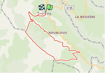
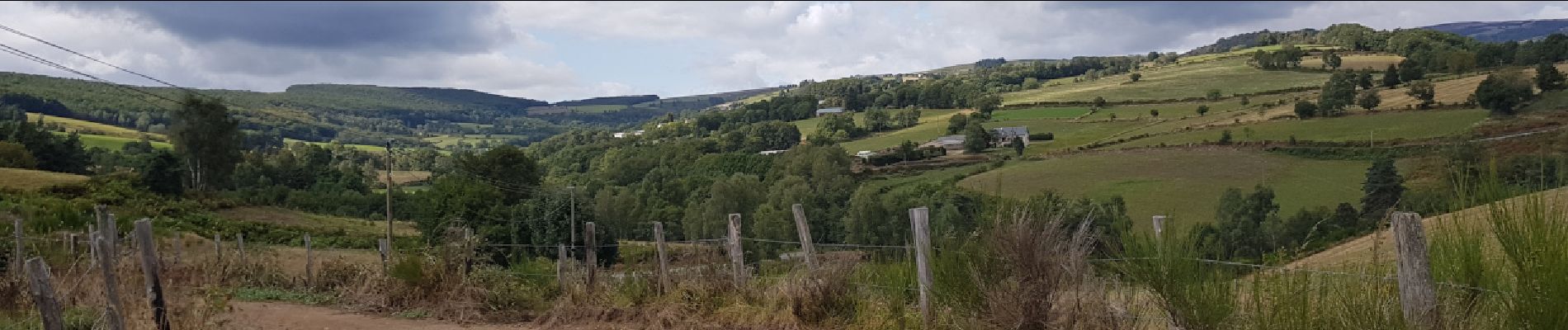
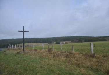
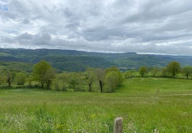
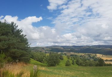
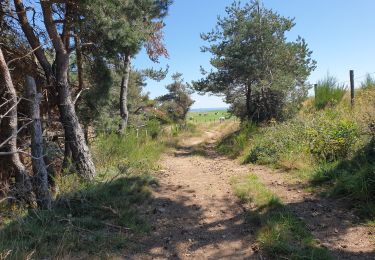
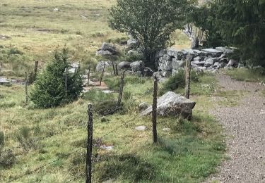
Cette belle boucle, tantôt dans de très agréables sous-bois, mais plus souvent au travers de vastes et vertes prairies, emprunte de larges et belles pistes convenant parfaitement à la marche nordique.
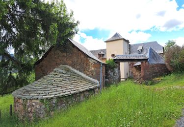
A partir du stationnement disponible à l'entrée de Trélans lorsque l'on quitte la D56, on traverse le village en passant devant la mairie pour se diriger vers l'ouest et rejoindre la piste qui franchit le petit ruisseau de Caldeyrac. On se dirige alors vers l'est pour monter en sous-bois vers le Puech de Falguières et longer les prairies sur lesquelles nous attendent d'innombrables vaches paisibles mais dont le passage des marcheurs constitue manifestement la principale distraction. Sur ce parcours sur la crête en direction du Puech Grond, le panorama s'étend dans toutes les directions sur un paysage magnifique, généreusement vallonné et résolument bucolique. On prend ensuite à gauche pour descendre vers La Devèze. A hauteur de Prat del Mouly, on prend encore à gauche pour revenir vers Trélans en suivant le cours du ruisseau de Caldeyrac.
Ce très beau parcours, sans difficulté, donne un bel aperçu de l'Aubrac... et de ses vaches.
Plaatsbepaling
Opmerkingen
Wandeltochten in de omgeving
![Tocht Noords wandelen Saint-Pierre-de-Nogaret - SityTrail - Le Brouillet - Cascade du Saltou - Photo](https://media.geolcdn.com/t/375/260/9822abe2-4c8b-4b7c-84d0-1c52daa9f381.jpg&format=jpg&maxdim=2)
![Noords wandelen Noords wandelen](https://static1.geolcdn.com/sitytour/trail-icons/102.png)
Noords wandelen
![](/images/other/stat-length.png)
![](https://static1.geolcdn.com/siteimages/upload/files/16400158638029165_repeat_loop_refresh_sync_direction_icon.png)
![Tocht Stappen Trélans - Mon chemin de St Guilhem étape 4 - Photo](https://media.geolcdn.com/t/375/260/9dac2029-d636-4d16-9493-ea0b171f0b7e.jpg&format=jpg&maxdim=2)
![Stappen Stappen](https://static1.geolcdn.com/sitytour/trail-icons/101.png)
Stappen
![](/images/other/stat-length.png)
![](https://static1.geolcdn.com/siteimages/upload/files/16400158638029165_repeat_loop_refresh_sync_direction_icon.png)
![Tocht Stappen Trélans - Étape 4 Saint Gilhem - Photo](https://media.geolcdn.com/t/375/260/0a97a0ec-c8ee-4fcf-a11b-a8c4289b3e19.jpg&format=jpg&maxdim=2)
![Stappen Stappen](https://static1.geolcdn.com/sitytour/trail-icons/101.png)
Stappen
![](/images/other/stat-length.png)
![](https://static1.geolcdn.com/siteimages/upload/files/16400158638029165_repeat_loop_refresh_sync_direction_icon.png)
![Tocht Stappen Les Hermaux - Lou saltou - Photo](https://media.geolcdn.com/t/375/260/5ac28f7d-bfae-45d7-a4b8-1fed8d14ded9.jpg&format=jpg&maxdim=2)
![Stappen Stappen](https://static1.geolcdn.com/sitytour/trail-icons/101.png)
Stappen
![](/images/other/stat-length.png)
![](https://static1.geolcdn.com/siteimages/upload/files/16400158638029165_repeat_loop_refresh_sync_direction_icon.png)
![Tocht Stappen Saint-Pierre-de-Nogaret - la croix du Pal - Photo](https://media.geolcdn.com/t/375/260/d088fef4-0f11-4766-8d65-ca428d53f2e4.jpg&format=jpg&maxdim=2)
![Stappen Stappen](https://static1.geolcdn.com/sitytour/trail-icons/101.png)
Stappen
![](/images/other/stat-length.png)
![](https://static1.geolcdn.com/siteimages/upload/files/16400158638029165_repeat_loop_refresh_sync_direction_icon.png)
![Tocht Stappen Trélans - Les plagnes à Saint Chely l'aubrac - Photo](https://media.geolcdn.com/t/375/260/20046715-4144-406f-96f7-d9ec6ecee00d.jpg&format=jpg&maxdim=2)
![Stappen Stappen](https://static1.geolcdn.com/sitytour/trail-icons/101.png)
Stappen
![](/images/other/stat-length.png)
![](https://static1.geolcdn.com/siteimages/upload/files/16400158638029165_repeat_loop_refresh_sync_direction_icon.png)
![Tocht Stappen Saint-Pierre-de-Nogaret - nogardel in live - Photo](https://media.geolcdn.com/t/375/260/2875934f-0225-437c-b6dc-6ec6b893dc30.jpg&format=jpg&maxdim=2)
![Stappen Stappen](https://static1.geolcdn.com/sitytour/trail-icons/101.png)
Stappen
![](/images/other/stat-length.png)
![](https://static1.geolcdn.com/siteimages/upload/files/16400158638029165_repeat_loop_refresh_sync_direction_icon.png)
![Tocht Andere activiteiten Trélans - Atlamed - Plagnes - La Canourgue - Photo](https://media.geolcdn.com/t/375/260/ext.jpg?maxdim=2&url=https%3A%2F%2Fservices.sitytrail.com%2FGeolivesWS%2FDownloadMedia.ashx%3FTrailID%3D811665%26Media%3D20170817144533.jpg)
![Andere activiteiten Andere activiteiten](https://static1.geolcdn.com/sitytour/trail-icons/900.png)
Andere activiteiten
![](/images/other/stat-length.png)
![](https://static1.geolcdn.com/siteimages/upload/files/16400158638029165_repeat_loop_refresh_sync_direction_icon.png)
![Tocht Paard Trélans - Aubrac 2017 - jour 5 - Photo](https://media.geolcdn.com/t/375/260/ext.jpg?maxdim=2&url=https%3A%2F%2Fservices.sitytrail.com%2FGeolivesWS%2FDownloadMedia.ashx%3FTrailID%3D809139%26Media%3D20170811120956.jpg)
![Paard Paard](https://static1.geolcdn.com/sitytour/trail-icons/300.png)
Paard
![](/images/other/stat-length.png)
![](https://static1.geolcdn.com/siteimages/upload/files/16400158638029165_repeat_loop_refresh_sync_direction_icon.png)