


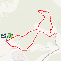

24 km | 25 km-effort


Gebruiker


Gratisgps-wandelapplicatie
 SityTrail
IGN / Geografische instituten
SityTrail World
De wereld gaat voor u open
Tocht Stappen van 4,8 km beschikbaar op Provence-Alpes-Côte d'Azur, Vaucluse, Velleron. Deze tocht wordt voorgesteld door clanglume.
Randonnée facile. Selon les randonneurs la durée peut aller jusqu'à 2 h 20' à cause du dénivelé.
Paysage très agréable.
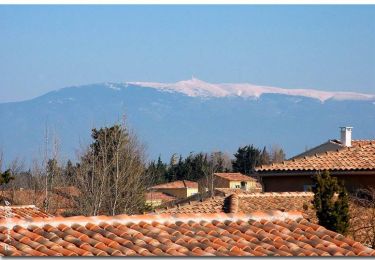
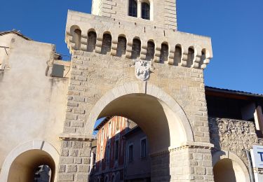
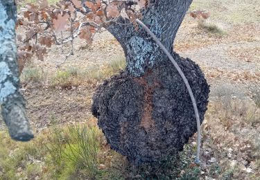
 Pont des Arrayies - Photo 1")
 Pont des Arrayies - Photo 2")
 Pont des Arrayies - Photo 3")
 Pont des Arrayies - Photo 4")
 Pont des Arrayies - Photo 5")
Fiets

Stappen

Stappen

Stappen
Hybride fiets

Stappen
Stappen
Stappen
Stappen