Tocht Stappen Allauch - Pilon du Roi - Photo
 aja
aja

Gebruiker

© OpenStreetMap contributors
Lengte
Lengte
14,2 km
Max. hoogte
Max. hoogte
669 m
Positief hoogteverschil
541 m
Km-Effort
Km-Effort  
21 km
Min. hoogte
Min. hoogte
294 m
Negatief hoogteverschil
540 m
Boucle
Boucle
Ja
Datum van aanmaak :
2015-01-10 00:00:00.0
Laatste wijziging :
2015-01-10 00:00:00.0

(0 Bericht)

Stappen
Stappen
4h24
Moeilijkheid : Medium

Scan deze QR-code om de tocht te openen in de SityTrail-applicatie

Gratisgps-wandelapplicatie

Logo SityTrail SityTrail

IGN / Geografische instituten

SityTrail uit de App Store downloaden SityTrail uit Google Play downloaden

Logo SityTrail SityTrail World

De wereld gaat voor u open

SityTrail uit de App Store downloaden SityTrail uit Google Play downloaden SityTrail op Huawei AppGallery downloaden

Over ons

Tocht Stappen van 14,2 km beschikbaar op Provence-Alpes-Côte d'Azur, Bouches-du-Rhône, Allauch. Deze tocht wordt voorgesteld door aja.

Beschrijving

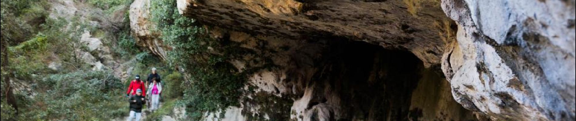
Cette boucle de 14 km longe la crête Nord de la chaîne de l'Étoile. Elle fait passer au pied des Santons et offres de magnifiques panoramas au Nord sur la Sainte Victoire et le Mont Ventoux, à l'Est vers la Sainte Baume, au Sud sur Marseille et la chaîne des Calanques, à l'Ouest vers l'étang de Berre.

Hoogteprofiel

Foto's

POI's

POI Simiane-Collongue - Vue du Pilon du Roi - Photo
aja
SIMIANE-COLLONGUE 
POI Simiane-Collongue - Vallon du Pilon du Roi - Photo
aja
SIMIANE-COLLONGUE 
POI Simiane-Collongue - Les Santons - Photo
aja
SIMIANE-COLLONGUE 
POI Simiane-Collongue - Notre-Dame du Rot - Photo
aja
SIMIANE-COLLONGUE 

Plaatsbepaling

Land:
France
Regio :
Provence-Alpes-Côte d'Azur
Departement/Provincie :
Bouches-du-Rhône
Gemeente :
Allauch
Locatie:
Unknown
Vertrek:(Dec)
Vertrek:(UTM)
701276 ; 4804984 (31T) N.

Wandeltochten in de omgeving

Tocht Stappen Allauch - Le tour des Grands Ubacs au départ de Pichauris - Photo
Stappen
Coqorico

Stappen

Gemakkelijk
(1)
Allauch, Provence-Alpes-Côte d'Azur, Bouches-du-Rhône, France
13,3 km | 20 km-effort
4h 25min
Ja
Tocht Stappen Allauch - Domaine de Pichauris - Allauch - Photo
Stappen
tracegps

Stappen

Medium
(1)
Allauch, Provence-Alpes-Côte d'Azur, Bouches-du-Rhône, France
10,5 km | 15 km-effort
2h 30min
Ja
Tocht Stappen Allauch - le pic du Taoumé par Pichauris - Photo
Stappen
GUIDE
amiral13

Stappen

Gemakkelijk
Allauch, Provence-Alpes-Côte d'Azur, Bouches-du-Rhône, France
13,3 km | 20 km-effort
4h 32min
Ja
Tocht Mountainbike Allauch - les antennes du garlaban à modifier - Photo
Mountainbike
GUIDE
harydh

Mountainbike

Medium
Allauch, Provence-Alpes-Côte d'Azur, Bouches-du-Rhône, France
19,3 km | 28 km-effort
2h 8min
Ja
Tocht Mountainbike Allauch - les antennes du garlaban - Photo
Mountainbike
GUIDE
harydh

Mountainbike

Medium
Allauch, Provence-Alpes-Côte d'Azur, Bouches-du-Rhône, France
19,3 km | 28 km-effort
2h 8min
Ja
Tocht Mountainbike Allauch - de Pichauris au mont du Marseillais - Photo
Mountainbike
GUIDE
amiral13

Mountainbike

Medium
Allauch, Provence-Alpes-Côte d'Azur, Bouches-du-Rhône, France
14 km | 19,2 km-effort
2h 34min
Ja
Tocht Stappen Allauch - Pic du Taoumé - Photo
Stappen
GUIDE
amiral13

Stappen

Gemakkelijk
Allauch, Provence-Alpes-Côte d'Azur, Bouches-du-Rhône, France
9,2 km | 15,2 km-effort
5h 5min
Ja
Tocht Stappen Marseille - La Grande Etoile - Photo
Stappen
GUIDE
lhomme.ph

Stappen

Medium
Marseille, Provence-Alpes-Côte d'Azur, Bouches-du-Rhône, France
15,4 km | 23 km-effort
4h 48min
Ja
Tocht Stappen Allauch - allauch amandiers - Photo
Stappen
lhags

Stappen

Medium
(1)
Allauch, Provence-Alpes-Côte d'Azur, Bouches-du-Rhône, France
12,6 km | 19,5 km-effort
3h 37min
Ja


Sluiten
Mijn abonnementen