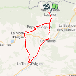
![](/images/other/stat-length.png)
![Tocht Fiets Vitrolles-en-Luberon - Parcours n°22 - Vitrolles-en-Luberon - Photo](https://media.geolcdn.com/t/1900/400/ext.pjpeg?maxdim=2&url=https%3A%2F%2Fservices.sitytrail.com%2FGeolivesWS%2FDownloadMedia.ashx%3FTrailID%3D375423%26Media%3Dabe80b42-5943-4ed1-8e3d-fcd3906b8bf1.jpg)
Parcours n°22 - Vitrolles-en-Luberon
Vélo Loisir Provence
Randonnées de Vélo Loisir Provence GUIDE+
![Lengte](/images/other/stat-length.png)
![Max. hoogte](https://static1.geolcdn.com/siteimages/upload/files/1508320355ic_sort_altitude_max_24dp.png)
![Positief hoogteverschil](https://static1.geolcdn.com/siteimages/upload/files/1508320355ic_sort_den_pos_24dp.png)
![Km-Effort](/images/other/stat-length.png)
![Min. hoogte](https://static1.geolcdn.com/siteimages/upload/files/1508320355ic_sort_altitude_min_24dp.png)
![Negatief hoogteverschil](https://static1.geolcdn.com/siteimages/upload/files/1508320355ic_sort_den_neg_24dp.png)
![Boucle](https://static1.geolcdn.com/siteimages/upload/files/16400158638029165_repeat_loop_refresh_sync_direction_icon.png)
![Fiets](https://static1.geolcdn.com/sitytour/trail-icons/200.png)
1h50
Moeilijkheid : Medium
![Scan deze QR-code om de tocht te openen in de SityTrail-applicatie](https://capi.geolives.com/qq0zvz2zws4bq2lad0pu/sitytour/trails/375423/qr.png?size=200)
Gratisgps-wandelapplicatie
Over ons
Tocht Fiets van 27 km beschikbaar op Provence-Alpes-Côte d'Azur, Vaucluse, Vitrolles-en-Luberon. Deze tocht wordt voorgesteld door Vélo Loisir Provence.
Beschrijving
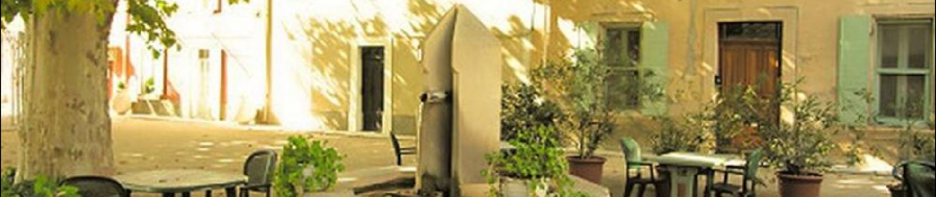
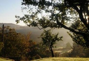
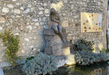
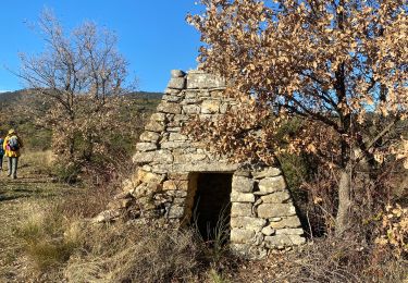
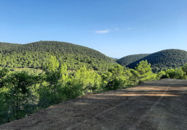
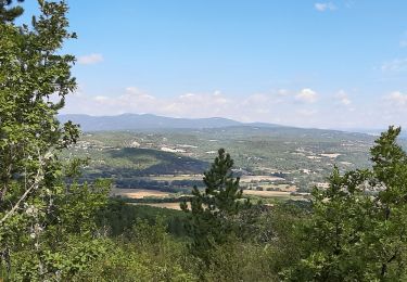
A ride in the Pays d’Aigues among AOC vineyards and throughout villages. In the background the Luberon mountains dominate the plain. Direction of the itinerary : Vitrolles-en-Luberon => Grambois => La Tour-d’Aigues => Saint-Martin-de-la-Brasque => Peypin-d’Aigues => Vitrolles-en-Luberon
Plaatsbepaling
Opmerkingen
Wandeltochten in de omgeving
![Tocht Fiets La Bastide-des-Jourdans - Parcours n°21 - La Bastide-des-Jourdans - Photo](https://media.geolcdn.com/t/375/260/ext.jpg?maxdim=2&url=https%3A%2F%2Fservices.sitytrail.com%2FGeolivesWS%2FDownloadMedia.ashx%3FTrailID%3D375422%26Media%3D1467258b-98e5-4d9c-94cd-785fe12c6f05.jpg)
![Fiets Fiets](https://static1.geolcdn.com/sitytour/trail-icons/200.png)
Fiets
![](/images/other/stat-length.png)
![](https://static1.geolcdn.com/siteimages/upload/files/16400158638029165_repeat_loop_refresh_sync_direction_icon.png)
![Tocht Stappen Peypin-d'Aigues - peypin d'aygues - Photo](https://media.geolcdn.com/t/375/260/ext.jpg?maxdim=2&url=https%3A%2F%2Fstatic1.geolcdn.com%2Fsiteimages%2Fupload%2Ffiles%2F1553511878bg_sport_marche.png)
![Stappen Stappen](https://static1.geolcdn.com/sitytour/trail-icons/101.png)
Stappen
![](/images/other/stat-length.png)
![](https://static1.geolcdn.com/siteimages/upload/files/16400158638029165_repeat_loop_refresh_sync_direction_icon.png)
![Tocht Stappen La Bastide-des-Jourdans - Balade autour de la Bastide des Jourdans - Photo](https://media.geolcdn.com/t/375/260/d4cfc590-8e9f-4255-80a4-7ad9e09071c1.jpg&format=jpg&maxdim=2)
![Stappen Stappen](https://static1.geolcdn.com/sitytour/trail-icons/101.png)
Stappen
![](/images/other/stat-length.png)
![](https://static1.geolcdn.com/siteimages/upload/files/16400158638029165_repeat_loop_refresh_sync_direction_icon.png)
![Tocht Stappen La Bastide-des-Jourdans - Les Collets du Luberon Est - Photo](https://media.geolcdn.com/t/375/260/ext.jpg?maxdim=2&url=https%3A%2F%2Fstatic1.geolcdn.com%2Fsiteimages%2Fupload%2Ffiles%2F1553511878bg_sport_marche.png)
![Stappen Stappen](https://static1.geolcdn.com/sitytour/trail-icons/101.png)
Stappen
![](/images/other/stat-length.png)
![](https://static1.geolcdn.com/siteimages/upload/files/16400158638029165_repeat_loop_refresh_sync_direction_icon.png)
![Tocht Stappen Peypin-d'Aigues - Peypin-d’Aigues d’Aigues les Dones nord - Photo](https://media.geolcdn.com/t/375/260/fa0bd2de-5f61-4792-be9f-c1323b66629c.jpg&format=jpg&maxdim=2)
![Stappen Stappen](https://static1.geolcdn.com/sitytour/trail-icons/101.png)
Stappen
![](/images/other/stat-length.png)
![](https://static1.geolcdn.com/siteimages/upload/files/16400158638029165_repeat_loop_refresh_sync_direction_icon.png)
![Tocht Stappen Vitrolles-en-Luberon - Mascas Mourre negre - Photo](https://media.geolcdn.com/t/375/260/ec51df23-2df3-41b4-a86b-282bb2a3d7ef.jpg&format=jpg&maxdim=2)
![Stappen Stappen](https://static1.geolcdn.com/sitytour/trail-icons/101.png)
Stappen
![](/images/other/stat-length.png)
![](https://static1.geolcdn.com/siteimages/upload/files/16400158638029165_repeat_loop_refresh_sync_direction_icon.png)
![Tocht Stappen La Bastide-des-Jourdans - la bastide des jourdan. - Photo](https://media.geolcdn.com/t/375/260/87f7b02c-aed9-4ecd-a2a8-daef0175ce5e.jpg&format=jpg&maxdim=2)
![Stappen Stappen](https://static1.geolcdn.com/sitytour/trail-icons/101.png)
Stappen
![](/images/other/stat-length.png)
![](https://static1.geolcdn.com/siteimages/upload/files/16400158638029165_repeat_loop_refresh_sync_direction_icon.png)
![Tocht Stappen Vitrolles-en-Luberon - vitrolles en Lubéron. aire des mascas - Photo](https://media.geolcdn.com/t/375/260/0ccb0f0d-bff8-46ee-add9-4b453c363566.jpg&format=jpg&maxdim=2)
![Stappen Stappen](https://static1.geolcdn.com/sitytour/trail-icons/101.png)
Stappen
![](/images/other/stat-length.png)
![](https://static1.geolcdn.com/siteimages/upload/files/16400158638029165_repeat_loop_refresh_sync_direction_icon.png)
![Tocht Stappen Céreste - Col des Mascas 84 - Photo](https://media.geolcdn.com/t/375/260/5f8a8e95-e4b9-4f51-b3ee-2dd34976b29d.jpg&format=jpg&maxdim=2)
![Stappen Stappen](https://static1.geolcdn.com/sitytour/trail-icons/101.png)
Stappen
![](/images/other/stat-length.png)
![](https://static1.geolcdn.com/siteimages/upload/files/16400158638029165_repeat_loop_refresh_sync_direction_icon.png)