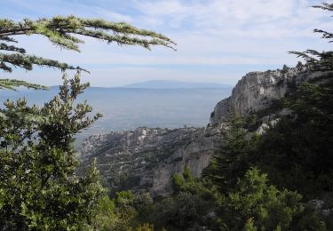
Tocht Fiets Ménerbes - Parcours n°5 - Ménerbes - Photo

Randonnées de Vélo Loisir Provence GUIDE+

© OpenStreetMap contributors
Lengte
Lengte
47 km
Max. hoogte
Max. hoogte
508 m
Positief hoogteverschil
805 m
Km-Effort
Km-Effort  
58 km
Min. hoogte
Min. hoogte
122 m
Negatief hoogteverschil
803 m
Boucle
Boucle
Ja
Datum van aanmaak :
2015-01-07 00:00:00.0
Laatste wijziging :
2015-01-07 00:00:00.0

(1 Bericht)

Fiets
Fiets
3h19
Moeilijkheid : Moeilijk

Scan deze QR-code om de tocht te openen in de SityTrail-applicatie

Gratisgps-wandelapplicatie

Logo SityTrail SityTrail

IGN / Geografische instituten

SityTrail uit de App Store downloaden SityTrail uit Google Play downloaden

Logo SityTrail SityTrail World

De wereld gaat voor u open

SityTrail uit de App Store downloaden SityTrail uit Google Play downloaden SityTrail op Huawei AppGallery downloaden

Over ons

Tocht Fiets van 47 km beschikbaar op Provence-Alpes-Côte d'Azur, Vaucluse, Ménerbes. Deze tocht wordt voorgesteld door Vélo Loisir Provence.

Beschrijving

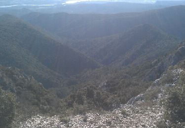
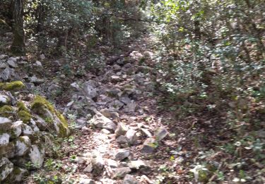
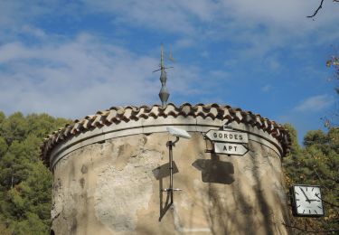
From one bank to the other of the Calavon River, the itinerary takes you through the perched villages between the Luberon and the Monts de Vaucluse. This circuit follows in the steps of an agrarian civilisation which knew the best ways to enhance and tame stone (bories, terraces, small walls). Direction of the itinerary : Ménerbes => Goult => Murs => Joucas => Saint-Pantaléon => Les Beaumettes => Ménerbes

Hoogteprofiel

Foto's

Plaatsbepaling

Land:
France
Regio :
Provence-Alpes-Côte d'Azur
Departement/Provincie :
Vaucluse
Gemeente :
Ménerbes
Locatie:
Unknown
Vertrek:(Dec)
Vertrek:(UTM)
677395 ; 4855628 (31T) N.

Opmerkingen

Gelieve in te loggen om een commentaar of een beoordeling achter te laten


Très beau parcours. Typique du Lubéron. Avec quelques beaux villages perchés. Nous y avons ajouté un détour vers Gordes. C'est un plus. 4/5


Wandeltochten in de omgeving

Tocht Stappen Oppède - PF-Oppède - Le Vallon de Combrès - Le Sautadou du Bausset - Photo
Stappen
GUIDE
MicDul

Stappen

Moeilijk
(1)
Oppède, Provence-Alpes-Côte d'Azur, Vaucluse, France
13,6 km | 23 km-effort
4h 45min
Ja
Tocht Stappen Ménerbes - tt - Photo
Stappen
woody85

Stappen

Moeilijk
(2)
Ménerbes, Provence-Alpes-Côte d'Azur, Vaucluse, France
25 km | 37 km-effort
4h 37min
Ja
Tocht Stappen Ménerbes - Gde rando Ménerbes-Oppède-Les hautes Plaines-Abbayes de saint hillaire  - Photo
Stappen
woody85

Stappen

Moeilijk
(1)
Ménerbes, Provence-Alpes-Côte d'Azur, Vaucluse, France
23 km | 35 km-effort
2h 48min
Ja
Tocht Stappen Ménerbes - 84 Vallon du bausset (menerbes) et arche - Photo
Stappen
GUIDE
randodyssée

Stappen

Gemakkelijk
Ménerbes, Provence-Alpes-Côte d'Azur, Vaucluse, France
8,5 km | 14,9 km-effort
4h 25min
Ja
Tocht Wegfiets Ménerbes - 84 menerbes saignon Apt voie verte - Photo
Wegfiets
GUIDE
randodyssée

Wegfiets

Medium
Ménerbes, Provence-Alpes-Côte d'Azur, Vaucluse, France
90 km | 109 km-effort
8h 55min
Neen
Tocht Mountainbike Beaumettes - vttpll_47_LES_BEAUMETTES_Du_Calavon_au_col_de_Gordes - Photo
Mountainbike
denel

Mountainbike

Gemakkelijk
(1)
Beaumettes, Provence-Alpes-Côte d'Azur, Vaucluse, France
13,1 km | 16,6 km-effort
1h 8min
Ja
Tocht Stappen Beaumettes - PF-Beaumettes - La Virginière - Photo
Stappen
GUIDE
MicDul

Stappen

Gemakkelijk
Beaumettes, Provence-Alpes-Côte d'Azur, Vaucluse, France
6,4 km | 7,5 km-effort
1h 45min
Ja
Tocht Stappen Oppède - PF-Oppède le Vieux - Sentier vigneron - Photo
Stappen
GUIDE
MicDul

Stappen

Gemakkelijk
(1)
Oppède, Provence-Alpes-Côte d'Azur, Vaucluse, France
6,6 km | 8,7 km-effort
1h 54min
Ja
Tocht Stappen Oppède - PF-Oppède-le-Vieux - Sentier vigneron - Forteresse et Collégiale - Photo
Stappen
GUIDE
MicDul

Stappen

Gemakkelijk
Oppède, Provence-Alpes-Côte d'Azur, Vaucluse, France
6,2 km | 8,5 km-effort
2h 6min
Ja


Sluiten
Mijn abonnementen