![](/images/other/stat-length.png)
![Tocht Stappen Pagolle - G4 pagolle Gastelusare 2023 - Photo](https://media.geolcdn.com/t/1900/400/27382910-353f-491b-8428-7ce9017053ba.jpg&format=pjpeg&maxdim=2)
G4 pagolle Gastelusare 2023
LouisROGER
Gebruiker GUIDE
![Lengte](/images/other/stat-length.png)
![Max. hoogte](https://static1.geolcdn.com/siteimages/upload/files/1508320355ic_sort_altitude_max_24dp.png)
![Positief hoogteverschil](https://static1.geolcdn.com/siteimages/upload/files/1508320355ic_sort_den_pos_24dp.png)
![Km-Effort](/images/other/stat-length.png)
![Min. hoogte](https://static1.geolcdn.com/siteimages/upload/files/1508320355ic_sort_altitude_min_24dp.png)
![Negatief hoogteverschil](https://static1.geolcdn.com/siteimages/upload/files/1508320355ic_sort_den_neg_24dp.png)
![Boucle](https://static1.geolcdn.com/siteimages/upload/files/16400158638029165_repeat_loop_refresh_sync_direction_icon.png)
![Stappen](https://static1.geolcdn.com/sitytour/trail-icons/101.png)
3h19
Moeilijkheid : Moeilijk
![Scan deze QR-code om de tocht te openen in de SityTrail-applicatie](https://capi.geolives.com/qq0zvz2zws4bq2lad0pu/sitytour/trails/3744578/qr.png?size=200)
Gratisgps-wandelapplicatie
Over ons
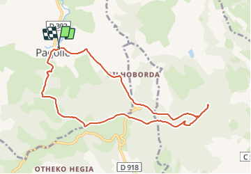
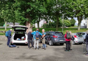
Tocht Stappen van 9,6 km beschikbaar op Nieuw-Aquitanië, Pyrénées-Atlantiques, Pagolle. Deze tocht wordt voorgesteld door LouisROGER.
Beschrijving
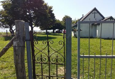
Au départ de Pagolle monter par la D302 vers l'est au carrefour prendre par la barrière et suivre la piste jusqu'aux abreuvoirs .
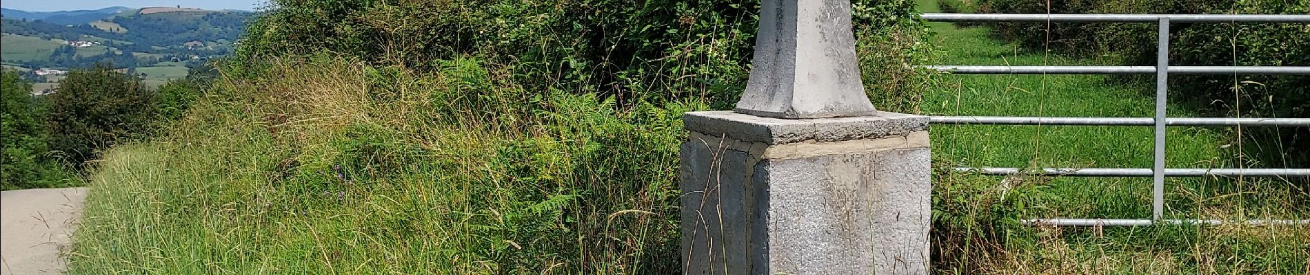
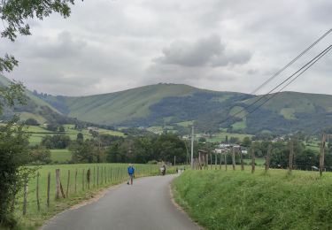
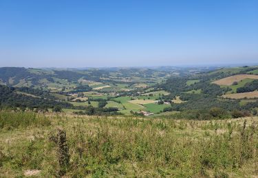
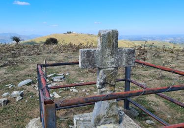
monter à la chapelle saint Grégoire où l'ombre vous attend, puis redescendre et remonter au site protohistorique de Gastelusare , le chemin des crêtes vous permettra d'admirer les collines souletines et au loin sud est une chapelle Saint Antoine (pour retrouver l'esprit?) et retour à Pagolle .
Plaatsbepaling
Opmerkingen
Wandeltochten in de omgeving
![Tocht Stappen Pagolle - G4 Pagolle gastellusare la chapelle - Photo](https://media.geolcdn.com/t/375/260/ext.jpg?maxdim=2&url=https%3A%2F%2Fstatic1.geolcdn.com%2Fsiteimages%2Fupload%2Ffiles%2F1553511878bg_sport_marche.png)
![Stappen Stappen](https://static1.geolcdn.com/sitytour/trail-icons/101.png)
Stappen
![](/images/other/stat-length.png)
![](https://static1.geolcdn.com/siteimages/upload/files/16400158638029165_repeat_loop_refresh_sync_direction_icon.png)
![Tocht Stappen Arhansus - Balade autour d'Arhansus - Photo](https://media.geolcdn.com/t/375/260/ext.jpg?maxdim=2&url=https%3A%2F%2Fservices.sitytrail.com%2FGeolivesWS%2FDownloadMedia.ashx%3FTrailID%3D111306%26Media%3D6955_1.jpg)
![Stappen Stappen](https://static1.geolcdn.com/sitytour/trail-icons/101.png)
Stappen
![](/images/other/stat-length.png)
![](https://static1.geolcdn.com/siteimages/upload/files/16400158638029165_repeat_loop_refresh_sync_direction_icon.png)
![Tocht Stappen Musculdy - MUSCULUDY du col d'Osquich à la chapelle Saint-Antoine](https://media.geolcdn.com/t/375/260/0cdf3b06-90b3-43fa-99a7-e69d840c8f75.jpg&format=jpg&maxdim=2)
![Stappen Stappen](https://static1.geolcdn.com/sitytour/trail-icons/101.png)
Stappen
![](/images/other/stat-length.png)
![](https://static1.geolcdn.com/siteimages/upload/files/16400158638029165_repeat_loop_refresh_sync_direction_icon.png)
![Tocht Stappen Ordiarp - ORDIARP la chapelle st Gregoire G3 4082977 - Photo](https://media.geolcdn.com/t/375/260/69f9a433-761a-4dab-85bf-268ab4f86849.jpg&format=jpg&maxdim=2)
![Stappen Stappen](https://static1.geolcdn.com/sitytour/trail-icons/101.png)
Stappen
![](/images/other/stat-length.png)
![](https://static1.geolcdn.com/siteimages/upload/files/16400158638029165_repeat_loop_refresh_sync_direction_icon.png)
![Tocht Stappen Pagolle - PAGOLLE et la chapelle St gregoire G3](https://media.geolcdn.com/t/375/260/d636e3ad-a870-4d12-8ae0-446d5bf0f2bc.jpg&format=jpg&maxdim=2)
![Stappen Stappen](https://static1.geolcdn.com/sitytour/trail-icons/101.png)
Stappen
![](/images/other/stat-length.png)
![](https://static1.geolcdn.com/siteimages/upload/files/16400158638029165_repeat_loop_refresh_sync_direction_icon.png)
![Tocht Stappen Ordiarp - ORDIARP le Kaskaborro G4 4079186 - Photo](https://media.geolcdn.com/t/375/260/71036ec1-6837-455a-bad4-847d1d3f0ecb.jpg&format=jpg&maxdim=2)
![Stappen Stappen](https://static1.geolcdn.com/sitytour/trail-icons/101.png)
Stappen
![](/images/other/stat-length.png)
![](https://static1.geolcdn.com/siteimages/upload/files/16400158638029165_repeat_loop_refresh_sync_direction_icon.png)
![Tocht Te voet Musculdy - MUSCULDY col d'Osquich journée des presidents et animateurs du 9/11/2024](https://media.geolcdn.com/t/375/260/ext.jpg?maxdim=2&url=https%3A%2F%2Fstatic1.geolcdn.com%2Fsiteimages%2Fupload%2Ffiles%2F1545311037marcheuse_200dpi.jpg)
![Te voet Te voet](https://static1.geolcdn.com/sitytour/trail-icons/100.png)
Te voet
![](/images/other/stat-length.png)
![](https://static1.geolcdn.com/siteimages/upload/files/16400158638029165_repeat_loop_refresh_sync_direction_icon.png)
![Tocht Stappen Pagolle - Pagolle G3 2023 - Photo](https://media.geolcdn.com/t/375/260/76a8c22a-f96d-43ea-ac22-7014257b25b3.jpg&format=jpg&maxdim=2)
![Stappen Stappen](https://static1.geolcdn.com/sitytour/trail-icons/101.png)
Stappen
![](/images/other/stat-length.png)
![](https://static1.geolcdn.com/siteimages/upload/files/16400158638029165_repeat_loop_refresh_sync_direction_icon.png)
![Tocht Stappen Musculdy - chapelle st Antoine - Photo](https://media.geolcdn.com/t/375/260/dc895e6c-4e35-4a62-b2b9-d14859e5472e.jpg&format=jpg&maxdim=2)
![Stappen Stappen](https://static1.geolcdn.com/sitytour/trail-icons/101.png)
Stappen
![](/images/other/stat-length.png)
![](https://static1.geolcdn.com/siteimages/upload/files/16400158638029165_repeat_loop_refresh_sync_direction_icon.png)