


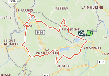

10,8 km | 13,4 km-effort


Gebruiker


Gratisgps-wandelapplicatie
 SityTrail
IGN / Geografische instituten
SityTrail World
De wereld gaat voor u open
Tocht Te voet van 10,6 km beschikbaar op Nieuw-Aquitanië, Creuse, Vallière. Deze tocht wordt voorgesteld door Surot.
Une dizaine de km en bords d'étangs, en forêt et au milieu des champs, en suivant bien les indications, trait jaune, de PR. Avant le pont de bois, prendre à droite vers le Gour en aller-retour puis on traverse le pont, circuit en sous bois très agréable passage aux rares maisons de Vaux puis retour vers le pt de départ avec malheureusement pas mal de cheminement sur route, mais beaux paysages , étang, vaches et chevaux
Stappen

Stappen
Stappen
Stappen
Stappen
Stappen
Stappen
Stappen
Stappen
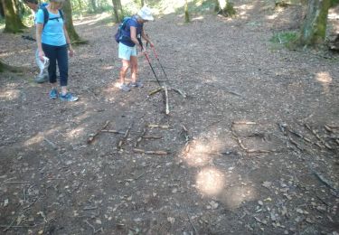
Très belle randonnée dans cette magnifique région doucement vallonnée et aux beaux villages et maisons de pierre. Sans difficultés importantes.