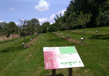
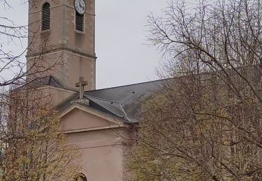
Tocht Stappen Laives - G . Lacs de Laives - Beaumont - Laives et retour . - Photo

G . Lacs de Laives - Beaumont - Laives et retour .

© OpenStreetMap contributors
Lengte
Lengte
11,2 km
Max. hoogte
Max. hoogte
215 m
Positief hoogteverschil
82 m
Km-Effort
Km-Effort  
12,3 km
Min. hoogte
Min. hoogte
175 m
Negatief hoogteverschil
82 m
Boucle
Boucle
Ja
Datum van aanmaak :
2023-07-21 09:19:28.038
Laatste wijziging :
2023-07-21 09:23:09.738

(0 Bericht)

Stappen
Stappen
2h47
Moeilijkheid : Moeilijk

Scan deze QR-code om de tocht te openen in de SityTrail-applicatie

Gratisgps-wandelapplicatie

Logo SityTrail SityTrail

IGN / Geografische instituten

SityTrail uit de App Store downloaden SityTrail uit Google Play downloaden

Logo SityTrail SityTrail World

De wereld gaat voor u open

SityTrail uit de App Store downloaden SityTrail uit Google Play downloaden SityTrail op Huawei AppGallery downloaden

Over ons

Tocht Stappen van 11,2 km beschikbaar op Bourgondië-Franche-Comté, Saône-et-Loire, Laives. Deze tocht wordt voorgesteld door jeanpaulcheyssac.

Beschrijving

Départ : Parking au lacs de Laives

Hoogteprofiel

Plaatsbepaling

Land:
France
Regio :
Bourgondië-Franche-Comté
Departement/Provincie :
Saône-et-Loire
Gemeente :
Laives
Locatie:
Unknown
Vertrek:(UTM)
640091 ; 5170343 (31T) N.

Wandeltochten in de omgeving

Tocht Stappen Laives - Laives  Montceau ragny page 106 - Photo
Stappen
grasgilbert

Stappen

Moeilijk
(6)
Laives, Bourgondië-Franche-Comté, Saône-et-Loire, France
11,4 km | 15,3 km-effort
3h 28min
Ja
Tocht Stappen Laives - laives - Photo
Stappen
Vivi71

Stappen

Moeilijk
Laives, Bourgondië-Franche-Comté, Saône-et-Loire, France
10,8 km | 12,3 km-effort
2h 15min
Ja
Tocht Stappen Sennecey-le-Grand - randonnée autour de Ruffey - Photo
Stappen
charlolga

Stappen

Gemakkelijk
(1)
Sennecey-le-Grand, Bourgondië-Franche-Comté, Saône-et-Loire, France
12 km | 17,1 km-effort
3h 12min
Ja
Tocht Noords wandelen Laives - Laives - Photo
Noords wandelen
hubert REVILLOT 2

Noords wandelen

Heel gemakkelijk
Laives, Bourgondië-Franche-Comté, Saône-et-Loire, France
11,4 km | 15,8 km-effort
2h 10min
Ja
Tocht Stappen Laives - Laives Vincelles St Michel Moyenne - Photo
Stappen
mic210pie

Stappen

Moeilijk
Laives, Bourgondië-Franche-Comté, Saône-et-Loire, France
10,5 km | 12,6 km-effort
2h 52min
Ja
Tocht Te voet Sennecey-le-Grand - G . Sennecey le Grand - Le Chemin Ferré - La male campagne - Les Teppes - et retour par maison Dieu .  - Photo
Te voet
jeanpaulcheyssac

Te voet

Gemakkelijk
(1)
Sennecey-le-Grand, Bourgondië-Franche-Comté, Saône-et-Loire, France
10,2 km | 11,1 km-effort
2h 30min
Ja
Tocht Stappen Saint-Ambreuil - G . St Ambreuil - Carré aux loups - Les mouilles - Sommière de la GD Toile - Sommière de la Gd Manche - Retour  par St Eloi .  - Photo
Stappen
jeanpaulcheyssac

Stappen

Medium
Saint-Ambreuil, Bourgondië-Franche-Comté, Saône-et-Loire, France
10,8 km | 11,6 km-effort
2h 37min
Ja
Tocht Stappen Lalheue - G . Lalheue - Laives - Vincelles et retour par Le Vernoy . - Photo
Stappen
jeanpaulcheyssac

Stappen

Moeilijk
Lalheue, Bourgondië-Franche-Comté, Saône-et-Loire, France
11,7 km | 12,5 km-effort
2h 50min
Ja
Tocht Stappen Saint-Cyr - G . St Cyr - Nully et retour  - Photo
Stappen
jeanpaulcheyssac

Stappen

Medium
(1)
Saint-Cyr, Bourgondië-Franche-Comté, Saône-et-Loire, France
10,1 km | 10,8 km-effort
2h 27min
Ja


Sluiten
Mijn abonnementen