![](/images/other/stat-length.png)
![Tocht Huifkarwandeling Garnerans - Beau Dimanche 2023 attelages-16167373 - Photo](https://media.geolcdn.com/t/1900/400/ext.pjpeg?maxdim=2&url=https%3A%2F%2Fstatic1.geolcdn.com%2Fsiteimages%2Fupload%2Ffiles%2F1524743154cheval.jpg)
Beau Dimanche 2023 attelages-16167373
Ferme-Passion
Gebruiker
![Lengte](/images/other/stat-length.png)
Lengte
28 km
![Max. hoogte](https://static1.geolcdn.com/siteimages/upload/files/1508320355ic_sort_altitude_max_24dp.png)
Max. hoogte
214 m
![Positief hoogteverschil](https://static1.geolcdn.com/siteimages/upload/files/1508320355ic_sort_den_pos_24dp.png)
Positief hoogteverschil
258 m
![Km-Effort](/images/other/stat-length.png)
Km-Effort
32 km
![Min. hoogte](https://static1.geolcdn.com/siteimages/upload/files/1508320355ic_sort_altitude_min_24dp.png)
Min. hoogte
158 m
![Negatief hoogteverschil](https://static1.geolcdn.com/siteimages/upload/files/1508320355ic_sort_den_neg_24dp.png)
Negatief hoogteverschil
259 m
![Boucle](https://static1.geolcdn.com/siteimages/upload/files/16400158638029165_repeat_loop_refresh_sync_direction_icon.png)
Boucle
Ja
Datum van aanmaak :
2023-07-05 21:10:15.883
Laatste wijziging :
2023-09-07 08:47:15.049
![Huifkarwandeling](https://static1.geolcdn.com/sitytour/trail-icons/302.png)
0m
Moeilijkheid : Heel gemakkelijk
![Scan deze QR-code om de tocht te openen in de SityTrail-applicatie](https://capi.geolives.com/qq0zvz2zws4bq2lad0pu/sitytour/trails/3724080/qr.png?size=200)
Gratisgps-wandelapplicatie
Over ons
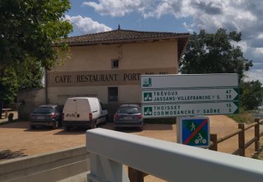
Tocht Huifkarwandeling van 28 km beschikbaar op Auvergne-Rhône-Alpes, Ain, Garnerans. Deze tocht wordt voorgesteld door Ferme-Passion.
Beschrijving
Beau dimanche Cheval en Chalaronne du 10 septembre avec Pique nique en bord de Saône au bois Perraud (sens marche inversée)
Plaatsbepaling
Land:
France
Regio :
Auvergne-Rhône-Alpes
Departement/Provincie :
Ain
Gemeente :
Garnerans
Locatie:
Unknown
Vertrek:(Dec)
Vertrek:(UTM)
641975 ; 5118426 (31T) N.
Opmerkingen
Wandeltochten in de omgeving
![Tocht Wegfiets Cormoranche-sur-Saône - 01 voie verte et bleue macon - Photo](https://media.geolcdn.com/t/375/260/ext.jpg?maxdim=2&url=https%3A%2F%2Fmedia.geolcdn.com%2Ff%2Fdb10580d-accf-4352-a58c-c49df6817574.jpg)
![Wegfiets Wegfiets](https://static1.geolcdn.com/sitytour/trail-icons/201.png)
01 voie verte et bleue macon
Wegfiets
Medium
Cormoranche-sur-Saône,
Auvergne-Rhône-Alpes,
Ain,
France
![](/images/other/stat-length.png)
74 km | 84 km-effort
4h 45min
![](https://static1.geolcdn.com/siteimages/upload/files/16400158638029165_repeat_loop_refresh_sync_direction_icon.png)
Ja
![Tocht Stappen Saint-Symphorien-d'Ancelles - St romain - Photo](https://media.geolcdn.com/t/375/260/ext.jpg?maxdim=2&url=https%3A%2F%2Fmedia.geolcdn.com%2Ff%2Fcc60e8e3-a2ff-438f-881b-036173e96d98.jpg)
![Stappen Stappen](https://static1.geolcdn.com/sitytour/trail-icons/101.png)
St romain
Stappen
Medium
Saint-Symphorien-d'Ancelles,
Bourgondië-Franche-Comté,
Saône-et-Loire,
France
![](/images/other/stat-length.png)
7,1 km | 7,6 km-effort
1h 51min
![](https://static1.geolcdn.com/siteimages/upload/files/16400158638029165_repeat_loop_refresh_sync_direction_icon.png)
Ja
![Tocht Stappen Saint-Didier-sur-Chalaronne - Saint-Étienne-sur- Chalaronne (9,8 km D. 75 m) - Photo](https://media.geolcdn.com/t/375/260/ext.jpg?maxdim=2&url=https%3A%2F%2Fmedia.geolcdn.com%2Ff%2F36c64291-f9d0-4900-b9fa-55746a87a4aa.jpg)
![Stappen Stappen](https://static1.geolcdn.com/sitytour/trail-icons/101.png)
Saint-Étienne-sur- Chalaronne (9,8 km D. 75 m)
Stappen
Gemakkelijk
Saint-Didier-sur-Chalaronne,
Auvergne-Rhône-Alpes,
Ain,
France
![](/images/other/stat-length.png)
9,8 km | 10,8 km-effort
2h 48min
![](https://static1.geolcdn.com/siteimages/upload/files/16400158638029165_repeat_loop_refresh_sync_direction_icon.png)
Ja
![Tocht Stappen Cormoranche-sur-Saône - À la recherche des eaux de Cormoranche - Photo](https://media.geolcdn.com/t/375/260/ext.jpg?maxdim=2&url=https%3A%2F%2Fstatic1.geolcdn.com%2Fsiteimages%2Fupload%2Ffiles%2F1553511878bg_sport_marche.png)
![Stappen Stappen](https://static1.geolcdn.com/sitytour/trail-icons/101.png)
À la recherche des eaux de Cormoranche
Stappen
Cormoranche-sur-Saône,
Auvergne-Rhône-Alpes,
Ain,
France
![](/images/other/stat-length.png)
17 km | 18,5 km-effort
1h 45min
![](https://static1.geolcdn.com/siteimages/upload/files/16400158638029165_repeat_loop_refresh_sync_direction_icon.png)
Neen
![Tocht Stappen Cormoranche-sur-Saône - Cormoranche /Saône: voie bleue et village - Photo](https://media.geolcdn.com/t/375/260/ext.jpg?maxdim=2&url=https%3A%2F%2Fstatic1.geolcdn.com%2Fsiteimages%2Fupload%2Ffiles%2F1553511878bg_sport_marche.png)
![Stappen Stappen](https://static1.geolcdn.com/sitytour/trail-icons/101.png)
Cormoranche /Saône: voie bleue et village
Stappen
Heel gemakkelijk
Cormoranche-sur-Saône,
Auvergne-Rhône-Alpes,
Ain,
France
![](/images/other/stat-length.png)
7,6 km | 8,2 km-effort
1h 57min
![](https://static1.geolcdn.com/siteimages/upload/files/16400158638029165_repeat_loop_refresh_sync_direction_icon.png)
Ja
![Tocht Stappen Saint-Didier-sur-Chalaronne - 2022-10-28_07h07m24_5-stDidier-les moulins - Photo](https://media.geolcdn.com/t/375/260/ext.jpg?maxdim=2&url=https%3A%2F%2Fstatic1.geolcdn.com%2Fsiteimages%2Fupload%2Ffiles%2F1553511878bg_sport_marche.png)
![Stappen Stappen](https://static1.geolcdn.com/sitytour/trail-icons/101.png)
2022-10-28_07h07m24_5-stDidier-les moulins
Stappen
Moeilijk
Saint-Didier-sur-Chalaronne,
Auvergne-Rhône-Alpes,
Ain,
France
![](/images/other/stat-length.png)
12,2 km | 13,5 km-effort
3h 3min
![](https://static1.geolcdn.com/siteimages/upload/files/16400158638029165_repeat_loop_refresh_sync_direction_icon.png)
Ja
![Tocht Stappen Saint-Symphorien-d'Ancelles - bord de saone - Photo](https://media.geolcdn.com/t/375/260/ext.jpg?maxdim=2&url=https%3A%2F%2Fmedia.geolcdn.com%2Ff%2F6d8db43b-0411-4da1-9ef9-47d160e5eb6f.jpg)
![Stappen Stappen](https://static1.geolcdn.com/sitytour/trail-icons/101.png)
bord de saone
Stappen
Gemakkelijk
Saint-Symphorien-d'Ancelles,
Bourgondië-Franche-Comté,
Saône-et-Loire,
France
![](/images/other/stat-length.png)
4,7 km | 5,1 km-effort
1h 15min
![](https://static1.geolcdn.com/siteimages/upload/files/16400158638029165_repeat_loop_refresh_sync_direction_icon.png)
Ja
![Tocht Stappen Cormoranche-sur-Saône - Arciat - Photo](https://media.geolcdn.com/t/375/260/ext.jpg?maxdim=2&url=https%3A%2F%2Fstatic1.geolcdn.com%2Fsiteimages%2Fupload%2Ffiles%2F1553511878bg_sport_marche.png)
![Stappen Stappen](https://static1.geolcdn.com/sitytour/trail-icons/101.png)
Arciat
Stappen
Heel gemakkelijk
Cormoranche-sur-Saône,
Auvergne-Rhône-Alpes,
Ain,
France
![](/images/other/stat-length.png)
7,9 km | 8,5 km-effort
2h 0min
![](https://static1.geolcdn.com/siteimages/upload/files/16400158638029165_repeat_loop_refresh_sync_direction_icon.png)
Ja
![Tocht Stappen Illiat - Illat - Photo](https://media.geolcdn.com/t/375/260/ext.jpg?maxdim=2&url=https%3A%2F%2Fstatic1.geolcdn.com%2Fsiteimages%2Fupload%2Ffiles%2F1553511878bg_sport_marche.png)
![Stappen Stappen](https://static1.geolcdn.com/sitytour/trail-icons/101.png)
Illat
Stappen
Gemakkelijk
Illiat,
Auvergne-Rhône-Alpes,
Ain,
France
![](/images/other/stat-length.png)
4,9 km | 5,7 km-effort
1h 15min
![](https://static1.geolcdn.com/siteimages/upload/files/16400158638029165_repeat_loop_refresh_sync_direction_icon.png)
Ja