


Thaïlande: Mae Sakut Nature Trail

MathieuBourgois
Gebruiker
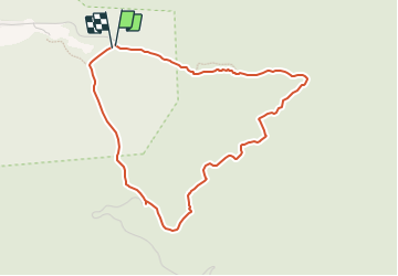

Lengte
5,7 km

Max. hoogte
690 m

Positief hoogteverschil
306 m
Km-Effort
9,8 km

Min. hoogte
378 m

Negatief hoogteverschil
309 m
Boucle
Ja
Datum van aanmaak :
2023-07-04 08:49:48.923
Laatste wijziging :
2023-07-04 08:55:32.267
2h13
Moeilijkheid : Gemakkelijk

Gratisgps-wandelapplicatie
 SityTrail
IGN / Geografische instituten
SityTrail World
De wereld gaat voor u open
Over ons
Tocht Te voet van 5,7 km beschikbaar op จังหวัดแม่ฮ่องสอน. Deze tocht wordt voorgesteld door MathieuBourgois.
Beschrijving
5.7km et 300D
Plaatsbepaling
Land:
Thailand
Regio :
จังหวัดแม่ฮ่องสอน
Departement/Provincie :
Unknown
Gemeente :
Unknown
Locatie:
Unknown
Vertrek:(Dec)
Vertrek:(UTM)
394400 ; 2129337 (47Q) N.
Opmerkingen
Wandeltochten in de omgeving