


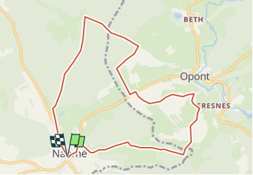


11,5 km | 14,5 km-effort


Gebruiker


Gratisgps-wandelapplicatie
 SityTrail
IGN / Geografische instituten
SityTrail World
De wereld gaat voor u open
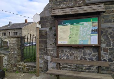
Tocht Te voet van 9,6 km beschikbaar op Wallonië, Namen, Bièvre. Deze tocht wordt voorgesteld door Tourisme5555.
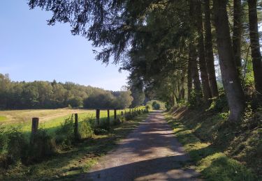
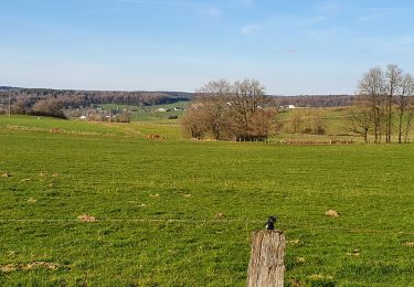
Promenade de 10 km sur les pas des Seigneurs à Naomé.
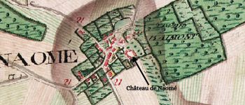
Le village de Naomé a possédé plusieurs noms. Retenons le premier ALDEMEGA (770-779) qui signifie "la manse de l'homme libre" (manse : maison familiale d'une terre agricole au Moyen Age).


Stappen

Stappen

Stappen
Stappen
Te voet
Te voet

Mountainbike

Mountainbike
Te voet