![](/images/other/stat-length.png)
![Tocht Stappen Fresnay-sur-Sarthe - 3 = Fresnay sur Sarthe - St Léonard des bois - Photo](https://media.geolcdn.com/t/1900/400/8019252f-6fee-4100-8366-490c156746e2.jpg&format=pjpeg&maxdim=2)
3 = Fresnay sur Sarthe - St Léonard des bois
meunier.ph.
Gebruiker
![Lengte](/images/other/stat-length.png)
Lengte
30 km
![Max. hoogte](https://static1.geolcdn.com/siteimages/upload/files/1508320355ic_sort_altitude_max_24dp.png)
Max. hoogte
223 m
![Positief hoogteverschil](https://static1.geolcdn.com/siteimages/upload/files/1508320355ic_sort_den_pos_24dp.png)
Positief hoogteverschil
510 m
![Km-Effort](/images/other/stat-length.png)
Km-Effort
36 km
![Min. hoogte](https://static1.geolcdn.com/siteimages/upload/files/1508320355ic_sort_altitude_min_24dp.png)
Min. hoogte
71 m
![Negatief hoogteverschil](https://static1.geolcdn.com/siteimages/upload/files/1508320355ic_sort_den_neg_24dp.png)
Negatief hoogteverschil
487 m
![Boucle](https://static1.geolcdn.com/siteimages/upload/files/16400158638029165_repeat_loop_refresh_sync_direction_icon.png)
Boucle
Neen
Datum van aanmaak :
2023-06-28 06:21:31.004
Laatste wijziging :
2023-06-30 15:19:26.43
![Stappen](https://static1.geolcdn.com/sitytour/trail-icons/101.png)
5h05
Moeilijkheid : Gemakkelijk
![Scan deze QR-code om de tocht te openen in de SityTrail-applicatie](https://capi.geolives.com/qq0zvz2zws4bq2lad0pu/sitytour/trails/3715786/qr.png?size=200)
Gratisgps-wandelapplicatie
Over ons
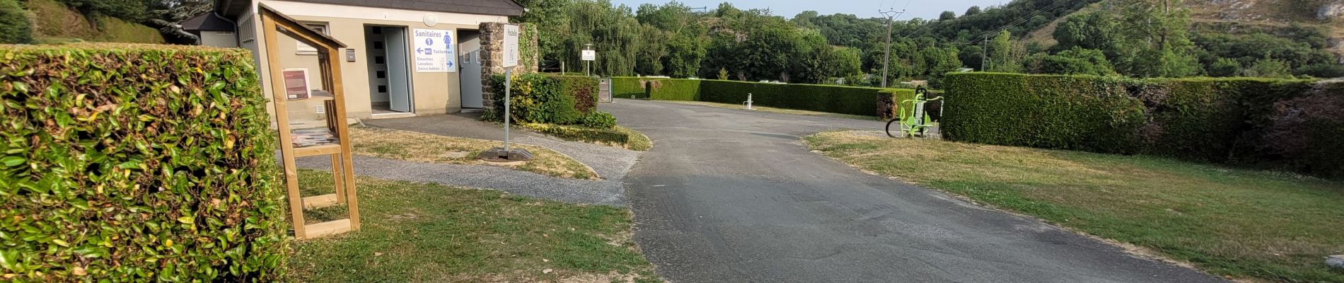
Tocht Stappen van 30 km beschikbaar op Pays de la Loire, Sarthe, Fresnay-sur-Sarthe. Deze tocht wordt voorgesteld door meunier.ph..
Beschrijving
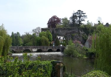
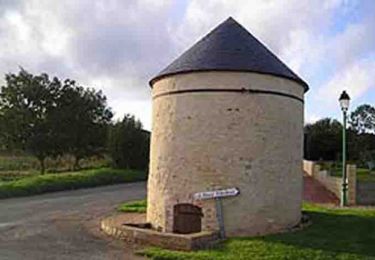
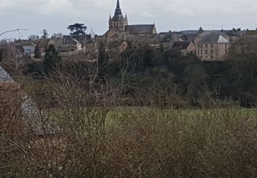
Etape 3 de mon tour des Alpes Mancelles. Beaux villages de Fresnay, St Cenéri et St Léonard. Alternances de chemins creux ombragés et de routes goudronnées mais de façon acceptable.
La plus belle et longue étape de ce tour.
Plaatsbepaling
Land:
France
Regio :
Pays de la Loire
Departement/Provincie :
Sarthe
Gemeente :
Fresnay-sur-Sarthe
Locatie:
Fresnay-sur-Sarthe
Vertrek:(Dec)
Vertrek:(UTM)
278372 ; 5352216 (31U) N.
Opmerkingen
Wandeltochten in de omgeving
![Tocht Stappen Fresnay-sur-Sarthe - Fresnay sur Sarthe - Photo](https://media.geolcdn.com/t/375/260/5bc53c6e-12a6-4586-ad59-c8b145c59d11.jpg&format=jpg&maxdim=2)
![Stappen Stappen](https://static1.geolcdn.com/sitytour/trail-icons/101.png)
Fresnay sur Sarthe
Stappen
Moeilijk
Fresnay-sur-Sarthe,
Pays de la Loire,
Sarthe,
France
![](/images/other/stat-length.png)
23 km | 27 km-effort
4h 29min
![](https://static1.geolcdn.com/siteimages/upload/files/16400158638029165_repeat_loop_refresh_sync_direction_icon.png)
Ja
![Tocht Mountainbike Saint-Victeur - La Balade - Saint-Victeur - Photo](https://media.geolcdn.com/t/375/260/ext.jpg?maxdim=2&url=https%3A%2F%2Fservices.sitytrail.com%2FGeolivesWS%2FDownloadMedia.ashx%3FTrailID%3D172587%26Media%3D13953_1.jpg)
![Mountainbike Mountainbike](https://static1.geolcdn.com/sitytour/trail-icons/202.png)
La Balade - Saint-Victeur
Mountainbike
Gemakkelijk
Saint-Victeur,
Pays de la Loire,
Sarthe,
France
![](/images/other/stat-length.png)
4,9 km | 5,8 km-effort
30min
![](https://static1.geolcdn.com/siteimages/upload/files/16400158638029165_repeat_loop_refresh_sync_direction_icon.png)
Ja
![Tocht Stappen Saint-Victeur - La Balade - Saint-Victeur - Photo](https://media.geolcdn.com/t/375/260/ext.jpg?maxdim=2&url=https%3A%2F%2Fservices.sitytrail.com%2FGeolivesWS%2FDownloadMedia.ashx%3FTrailID%3D172586%26Media%3D13953_1.jpg)
![Stappen Stappen](https://static1.geolcdn.com/sitytour/trail-icons/101.png)
La Balade - Saint-Victeur
Stappen
Gemakkelijk
(1)
Saint-Victeur,
Pays de la Loire,
Sarthe,
France
![](/images/other/stat-length.png)
4,9 km | 5,8 km-effort
1h 15min
![](https://static1.geolcdn.com/siteimages/upload/files/16400158638029165_repeat_loop_refresh_sync_direction_icon.png)
Ja
![Tocht Mountainbike Fresnay-sur-Sarthe - Espace VTT FFC des Alpes Mancelles- Circuit n° 10 - Vaux - Photo](https://media.geolcdn.com/t/375/260/ext.jpg?maxdim=2&url=https%3A%2F%2Fservices.sitytrail.com%2FGeolivesWS%2FDownloadMedia.ashx%3FTrailID%3D101655%26Media%3D1869_1.jpg)
![Mountainbike Mountainbike](https://static1.geolcdn.com/sitytour/trail-icons/202.png)
Espace VTT FFC des Alpes Mancelles- Circuit n° 10 - Vaux
Mountainbike
Medium
Fresnay-sur-Sarthe,
Pays de la Loire,
Sarthe,
France
![](/images/other/stat-length.png)
29 km | 34 km-effort
2h 30min
![](https://static1.geolcdn.com/siteimages/upload/files/16400158638029165_repeat_loop_refresh_sync_direction_icon.png)
Ja
![Tocht Noords wandelen Fresnay-sur-Sarthe - FR Fresnay sur Sarthe 7.4 km RS 12-03-2021 - Photo](https://media.geolcdn.com/t/375/260/f0f69bcd-a12f-40e7-befc-e1acfb23d31b.jpg&format=jpg&maxdim=2)
![Noords wandelen Noords wandelen](https://static1.geolcdn.com/sitytour/trail-icons/102.png)
FR Fresnay sur Sarthe 7.4 km RS 12-03-2021
Noords wandelen
Heel gemakkelijk
Fresnay-sur-Sarthe,
Pays de la Loire,
Sarthe,
France
![](/images/other/stat-length.png)
7,6 km | 9 km-effort
1h 59min
![](https://static1.geolcdn.com/siteimages/upload/files/16400158638029165_repeat_loop_refresh_sync_direction_icon.png)
Ja
![Tocht Te voet Fresnay-sur-Sarthe - au détour d'une petite cité de caractère - Photo](https://media.geolcdn.com/t/375/260/ext.jpg?maxdim=2&url=https%3A%2F%2Fstatic1.geolcdn.com%2Fsiteimages%2Fupload%2Ffiles%2F1545311037marcheuse_200dpi.jpg)
![Te voet Te voet](https://static1.geolcdn.com/sitytour/trail-icons/100.png)
au détour d'une petite cité de caractère
Te voet
Medium
Fresnay-sur-Sarthe,
Pays de la Loire,
Sarthe,
France
![](/images/other/stat-length.png)
19,3 km | 22 km-effort
5h 0min
![](https://static1.geolcdn.com/siteimages/upload/files/16400158638029165_repeat_loop_refresh_sync_direction_icon.png)
Ja
![Tocht Fiets Sougé-le-Ganelon - Alpes Mancelles VTTAE - Photo](https://media.geolcdn.com/t/375/260/ext.jpg?maxdim=2&url=https%3A%2F%2Fstatic1.geolcdn.com%2Fsiteimages%2Fupload%2Ffiles%2F1524743154velo.jpg)
![Fiets Fiets](https://static1.geolcdn.com/sitytour/trail-icons/200.png)
Alpes Mancelles VTTAE
Fiets
Medium
Sougé-le-Ganelon,
Pays de la Loire,
Sarthe,
France
![](/images/other/stat-length.png)
48 km | 61 km-effort
3h 55min
![](https://static1.geolcdn.com/siteimages/upload/files/16400158638029165_repeat_loop_refresh_sync_direction_icon.png)
Ja
![Tocht Stappen Fresnay-sur-Sarthe - La Sarthe-02-Fresnay - Beaumont - Photo](https://media.geolcdn.com/t/375/260/ext.jpg?maxdim=2&url=https%3A%2F%2Fstatic1.geolcdn.com%2Fsiteimages%2Fupload%2Ffiles%2F1553511878bg_sport_marche.png)
![Stappen Stappen](https://static1.geolcdn.com/sitytour/trail-icons/101.png)
La Sarthe-02-Fresnay - Beaumont
Stappen
Gemakkelijk
Fresnay-sur-Sarthe,
Pays de la Loire,
Sarthe,
France
![](/images/other/stat-length.png)
18,7 km | 19,8 km-effort
4h 25min
![](https://static1.geolcdn.com/siteimages/upload/files/16400158638029165_repeat_loop_refresh_sync_direction_icon.png)
Neen
![Tocht Stappen Saint-Ouen-de-Mimbré - 1er Soleil - Photo](https://media.geolcdn.com/t/375/260/ext.jpg?maxdim=2&url=https%3A%2F%2Fstatic1.geolcdn.com%2Fsiteimages%2Fupload%2Ffiles%2F1553511878bg_sport_marche.png)
![Stappen Stappen](https://static1.geolcdn.com/sitytour/trail-icons/101.png)
1er Soleil
Stappen
Heel gemakkelijk
Saint-Ouen-de-Mimbré,
Pays de la Loire,
Sarthe,
France
![](/images/other/stat-length.png)
8,8 km | 9,7 km-effort
2h 3min
![](https://static1.geolcdn.com/siteimages/upload/files/16400158638029165_repeat_loop_refresh_sync_direction_icon.png)
Ja