
Pray

guydu41
Gebruiker

Lengte
11,3 km

Max. hoogte
140 m

Positief hoogteverschil
64 m

Km-Effort
12,1 km

Min. hoogte
114 m

Negatief hoogteverschil
63 m
Boucle
Ja
Datum van aanmaak :
2023-06-27 06:09:02.621
Laatste wijziging :
2023-06-27 13:42:45.133
2h45
Moeilijkheid : Gemakkelijk

Gratisgps-wandelapplicatie
Over ons
Tocht Stappen van 11,3 km beschikbaar op Centre-Val de Loire, Loir-et-Cher, Pray. Deze tocht wordt voorgesteld door guydu41.
Beschrijving
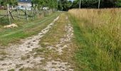
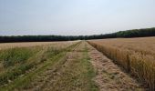
Petite randonnée très agréable sur des chemins et sentiers dans les bois et champs au Sud-Ouest de Pray.
Le plus étonnant, c'est la fontaine à manivelle en bordure de la D71 au milieu des champs ?
Note : A ne pas faire en période de chasse
Plaatsbepaling
Land:
France
Regio :
Centre-Val de Loire
Departement/Provincie :
Loir-et-Cher
Gemeente :
Pray
Locatie:
Unknown
Vertrek:(Dec)
Vertrek:(UTM)
358535 ; 5281950 (31T) N.
Opmerkingen
Wandeltochten in de omgeving

Pray


Stappen
Heel gemakkelijk
Pray,
Centre-Val de Loire,
Loir-et-Cher,
France

18,7 km | 20 km-effort
4h 9min
Ja

Landes le Gaulois BF


Stappen
Moeilijk
Landes-le-Gaulois,
Centre-Val de Loire,
Loir-et-Cher,
France

14,6 km | 15,9 km-effort
3h 0min
Ja


 SityTrail


