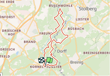
![](/images/other/stat-length.png)
![Tocht Stappen Aken - Kornelimünster - Photo](https://media.geolcdn.com/t/1900/400/5caf8e34-5825-43c1-849c-6d076a59c5fa.jpg&format=pjpeg&maxdim=2)
Kornelimünster
mumu.larandonneuse
Gebruiker GUIDE
![Lengte](/images/other/stat-length.png)
![Max. hoogte](https://static1.geolcdn.com/siteimages/upload/files/1508320355ic_sort_altitude_max_24dp.png)
![Positief hoogteverschil](https://static1.geolcdn.com/siteimages/upload/files/1508320355ic_sort_den_pos_24dp.png)
![Km-Effort](/images/other/stat-length.png)
![Min. hoogte](https://static1.geolcdn.com/siteimages/upload/files/1508320355ic_sort_altitude_min_24dp.png)
![Negatief hoogteverschil](https://static1.geolcdn.com/siteimages/upload/files/1508320355ic_sort_den_neg_24dp.png)
![Boucle](https://static1.geolcdn.com/siteimages/upload/files/16400158638029165_repeat_loop_refresh_sync_direction_icon.png)
![Stappen](https://static1.geolcdn.com/sitytour/trail-icons/101.png)
4h30
Moeilijkheid : Medium
![Scan deze QR-code om de tocht te openen in de SityTrail-applicatie](https://capi.geolives.com/qq0zvz2zws4bq2lad0pu/sitytour/trails/3713580/qr.png?size=200)
Gratisgps-wandelapplicatie
Over ons
Tocht Stappen van 15,5 km beschikbaar op Noordrijn-Westfalen, Städteregion Aachen, Aken. Deze tocht wordt voorgesteld door mumu.larandonneuse.
Beschrijving
Parcours retracé sur base des sentiers locaux.
💚 Une rando coup de cœur !
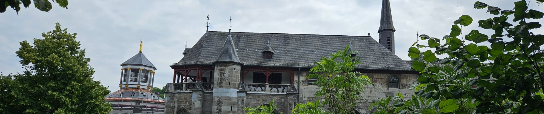
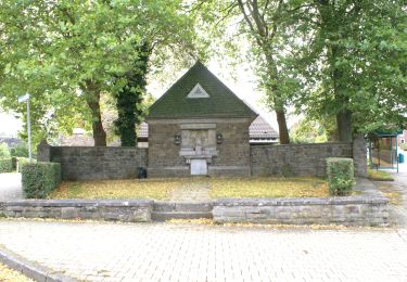
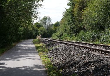
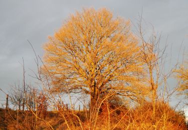
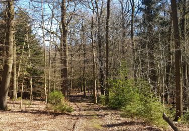
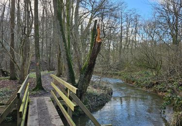
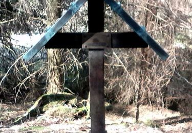
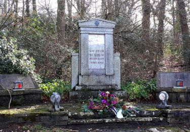
➡️ Juste au sud d'Aix-la-Chapelle se trouve la ville touristique de Kornelimünster avec son centre historique. Au cours de cette promenade vallonnée, vous marchez d'abord sur un chemin forestier le long de l'Inde à travers le Klauserwäldchen, puis vous montez à travers le Frankenwäldchen, jusqu'à une chapelle forestière. Par des routes de campagne et des sentiers pédestres, vous marchez jusqu'à un musée du textile, puis vous traversez le Branderwald. L'itinéraire fait demi-tour dans la belle Indedal où vous vous promenez dans les prairies le long de l'Inde. Vous passerez également devant un ancien réservoir de tigre et une cascade. Vous marchez jusqu'au village de Kupferstadt puis vous montez sur un plateau avec la très profonde carrière Steinbruch Hoven. Par des chemins herbeux avec de belles vues et quelques routes de campagne, vous atteindrez les vestiges d'un temple romain. Vous passez devant l'église avec une belle vue sur la ville, puis vous descendez par un escalier vers l'agréable Marktpleintje et la terrasse du café Napoléon. Prenez vos propres provisions pour la route, il y a de nombreux bancs à mi-parcours, mais il y a aussi de belles aires de pique-nique sur l'Inde.
ℹ️ www.wandelgidszuidlimburg.com n° 1035
Plaatsbepaling
Opmerkingen
Wandeltochten in de omgeving
![Tocht Stappen Raeren - 2022-01-18_14h11m36_lichtenbusch - Photo](https://media.geolcdn.com/t/375/260/83311396-e126-40d9-b822-9da5f0d28323.jpg&format=jpg&maxdim=2)
![Stappen Stappen](https://static1.geolcdn.com/sitytour/trail-icons/101.png)
Stappen
![](/images/other/stat-length.png)
![](https://static1.geolcdn.com/siteimages/upload/files/16400158638029165_repeat_loop_refresh_sync_direction_icon.png)
![Tocht Te voet Aken - Rundweg um Eilendorf - Photo](https://media.geolcdn.com/t/375/260/87580b8e-9a60-47cb-a755-acb46765e988.jpeg&format=jpg&maxdim=2)
![Te voet Te voet](https://static1.geolcdn.com/sitytour/trail-icons/100.png)
Te voet
![](/images/other/stat-length.png)
![](https://static1.geolcdn.com/siteimages/upload/files/16400158638029165_repeat_loop_refresh_sync_direction_icon.png)
![Tocht Te voet Roetgen - Rott Rundweg A3 - Photo](https://media.geolcdn.com/t/375/260/68d54c01-37fc-4225-b77f-3c3692b6e11c.jpeg&format=jpg&maxdim=2)
![Te voet Te voet](https://static1.geolcdn.com/sitytour/trail-icons/100.png)
Te voet
![](/images/other/stat-length.png)
![](https://static1.geolcdn.com/siteimages/upload/files/16400158638029165_repeat_loop_refresh_sync_direction_icon.png)
![Tocht Te voet Aken - Kalkofenweg - Photo](https://media.geolcdn.com/t/375/260/0acf23cd-5e55-42e1-90ae-3e15385deef5.jpeg&format=jpg&maxdim=2)
![Te voet Te voet](https://static1.geolcdn.com/sitytour/trail-icons/100.png)
Te voet
![](/images/other/stat-length.png)
![](https://static1.geolcdn.com/siteimages/upload/files/16400158638029165_repeat_loop_refresh_sync_direction_icon.png)
![Tocht Te voet Aken - IndeRoute - Photo](https://media.geolcdn.com/t/375/260/5b45f3d2-bacb-401d-82e5-6a813ae291fc.jpeg&format=jpg&maxdim=2)
![Te voet Te voet](https://static1.geolcdn.com/sitytour/trail-icons/100.png)
Te voet
![](/images/other/stat-length.png)
![](https://static1.geolcdn.com/siteimages/upload/files/16400158638029165_repeat_loop_refresh_sync_direction_icon.png)
![Tocht Stappen Raeren - 2021-03-04_18h10m39_1023 - Photo](https://media.geolcdn.com/t/375/260/e5c92a16-1a79-4bf9-bcd2-21508d76292d.jpg&format=jpg&maxdim=2)
![Stappen Stappen](https://static1.geolcdn.com/sitytour/trail-icons/101.png)
Stappen
![](/images/other/stat-length.png)
![](https://static1.geolcdn.com/siteimages/upload/files/16400158638029165_repeat_loop_refresh_sync_direction_icon.png)
![Tocht Stappen Raeren - A la découverte de Lichtenbusch 🥾 - Photo](https://media.geolcdn.com/t/375/260/d85f3b38-8057-41c0-b7d8-4d0370e979ce.jpg&format=jpg&maxdim=2)
![Stappen Stappen](https://static1.geolcdn.com/sitytour/trail-icons/101.png)
Stappen
![](/images/other/stat-length.png)
![](https://static1.geolcdn.com/siteimages/upload/files/16400158638029165_repeat_loop_refresh_sync_direction_icon.png)
![Tocht Te voet Roetgen - Mulartshütte A2 - Photo](https://media.geolcdn.com/t/375/260/88899e7d-f5cf-4aa4-8dfd-83c652889fdc.jpeg&format=jpg&maxdim=2)
![Te voet Te voet](https://static1.geolcdn.com/sitytour/trail-icons/100.png)
Te voet
![](/images/other/stat-length.png)
![](https://static1.geolcdn.com/siteimages/upload/files/16400158638029165_repeat_loop_refresh_sync_direction_icon.png)
![Tocht Te voet Stolberg - Venwegen Rundweg A3 - Photo](https://media.geolcdn.com/t/375/260/50d1d550-bd7a-423b-a8fd-bc16beb3fd83.jpeg&format=jpg&maxdim=2)
![Te voet Te voet](https://static1.geolcdn.com/sitytour/trail-icons/100.png)
Te voet
![](/images/other/stat-length.png)
![](https://static1.geolcdn.com/siteimages/upload/files/16400158638029165_repeat_loop_refresh_sync_direction_icon.png)
Superbe parcours varié.