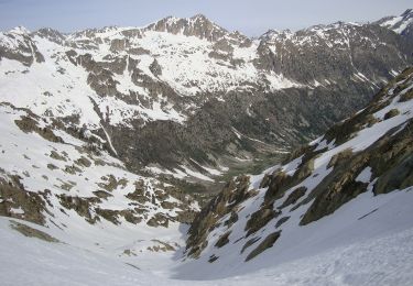
13,3 km | 20 km-effort
retour arete so cougourde
Tomara
Gebruiker
Lengte
6,8 km
Max. hoogte
2900 m
Positief hoogteverschil
5 m
Km-Effort
11,1 km
Min. hoogte
1614 m
Negatief hoogteverschil
1281 m
Boucle
Neen
Datum van aanmaak :
2023-06-10 12:40:33.871
Laatste wijziging :
2023-06-10 15:56:45.615
3h15
Moeilijkheid : Heel gemakkelijk
Gratisgps-wandelapplicatie
Over ons
Tocht Trail van 6,8 km beschikbaar op Piëmont, Cuneo, Entracque. Deze tocht wordt voorgesteld door Tomara.
Plaatsbepaling
Land:
Italy
Regio :
Piëmont
Departement/Provincie :
Cuneo
Gemeente :
Entracque
Locatie:
Unknown
Vertrek:(Dec)
Vertrek:(UTM)
367688 ; 4888369 (32T) N.
Opmerkingen
Wandeltochten in de omgeving
Lac de Trécolpas
Stappen
Medium
(2)
Saint-Martin-Vésubie,
Provence-Alpes-Côte d'Azur,
Alpes-Maritimes,
France
4h 17min
Ja
SityTrail - Lacs de Prals
Te voet
Gemakkelijk
(1)
Saint-Martin-Vésubie,
Provence-Alpes-Côte d'Azur,
Alpes-Maritimes,
France
6,7 km | 13,6 km-effort
3h 5min
Ja
lacs bessons
Stappen
Heel gemakkelijk
(1)
Saint-Martin-Vésubie,
Provence-Alpes-Côte d'Azur,
Alpes-Maritimes,
France
13,1 km | 0 m-effort
7h 36min
Ja
Col de Cerise
Te voet
Medium
Saint-Martin-Vésubie,
Provence-Alpes-Côte d'Azur,
Alpes-Maritimes,
France
9,7 km | 23 km-effort
5h 18min
Ja
Circuit de Fenestre
Te voet
Gemakkelijk
Saint-Martin-Vésubie,
Provence-Alpes-Côte d'Azur,
Alpes-Maritimes,
France
8,1 km | 16,4 km-effort
3h 44min
Ja
Circuit de Trécolpas
Te voet
Gemakkelijk
Saint-Martin-Vésubie,
Provence-Alpes-Côte d'Azur,
Alpes-Maritimes,
France
8,9 km | 15,8 km-effort
3h 35min
Ja
(SI E09) Rifugio Rifugio Soria-Ellena - Rifugio Genova-Figari
Te voet
Gemakkelijk
Entracque,
Piëmont,
Cuneo,
Italy
7,1 km | 15,6 km-effort
3h 32min
Neen
Col de cerise et lac du Mercantour
Ski randonnée
Medium
Saint-Martin-Vésubie,
Provence-Alpes-Côte d'Azur,
Alpes-Maritimes,
France
11,9 km | 29 km-effort
7h 39min
Ja
Cime de Juisse
Ski randonnée
Medium
Saint-Martin-Vésubie,
Provence-Alpes-Côte d'Azur,
Alpes-Maritimes,
France
14,1 km | 29 km-effort
6h 52min
Ja