![](/images/other/stat-length.png)
![Tocht Stappen Boutigny-sur-Essonne - Boutigny-sur-Essonne - Photo](https://media.geolcdn.com/t/1900/400/35e7e1a4-0e81-4101-ba61-582eb9cd50f0.jpg&format=pjpeg&maxdim=2)
Boutigny-sur-Essonne
guydu41
Gebruiker
![Lengte](/images/other/stat-length.png)
![Max. hoogte](https://static1.geolcdn.com/siteimages/upload/files/1508320355ic_sort_altitude_max_24dp.png)
![Positief hoogteverschil](https://static1.geolcdn.com/siteimages/upload/files/1508320355ic_sort_den_pos_24dp.png)
![Km-Effort](/images/other/stat-length.png)
![Min. hoogte](https://static1.geolcdn.com/siteimages/upload/files/1508320355ic_sort_altitude_min_24dp.png)
![Negatief hoogteverschil](https://static1.geolcdn.com/siteimages/upload/files/1508320355ic_sort_den_neg_24dp.png)
![Boucle](https://static1.geolcdn.com/siteimages/upload/files/16400158638029165_repeat_loop_refresh_sync_direction_icon.png)
![Stappen](https://static1.geolcdn.com/sitytour/trail-icons/101.png)
1h56
Moeilijkheid : Medium
![Scan deze QR-code om de tocht te openen in de SityTrail-applicatie](https://capi.geolives.com/qq0zvz2zws4bq2lad0pu/sitytour/trails/3673797/qr.png?size=200)
Gratisgps-wandelapplicatie
Over ons
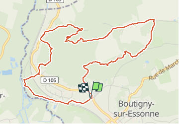
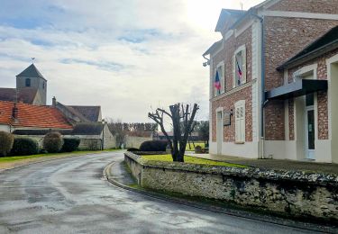
Tocht Stappen van 6,4 km beschikbaar op Île-de-France, Essonne, Boutigny-sur-Essonne. Deze tocht wordt voorgesteld door guydu41.
Beschrijving
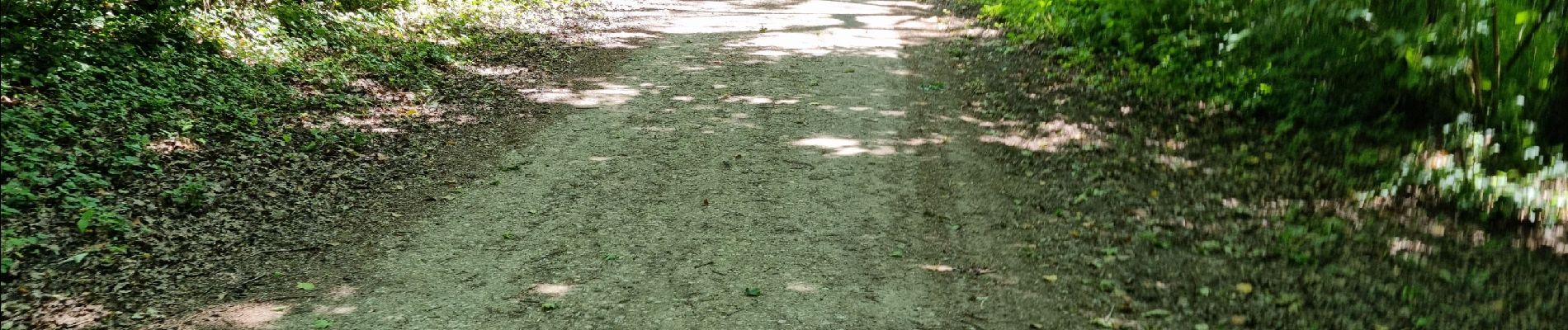
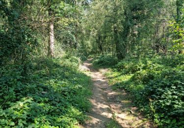
Très belle petite randonnée sur des chemins et des sentiers tortueux dans le massif boisé au Nord de Boutigny-sur-Essonne.
Le circuit longe et domine plusieurs vallées encaissées et carrières de grès.
Un petit crochet permet de voir la base d'un ancien bloc gréseux exploité par les carriers.
Plaatsbepaling
Opmerkingen
Wandeltochten in de omgeving
![Tocht Stappen Vayres-sur-Essonne - Boucle 22 km Boutigny Vayres Courdimanche - Photo](https://media.geolcdn.com/t/375/260/4b667bc1-98a4-484c-a9ef-d48797f8b1d6.jpg&format=jpg&maxdim=2)
![Stappen Stappen](https://static1.geolcdn.com/sitytour/trail-icons/101.png)
Stappen
![](/images/other/stat-length.png)
![](https://static1.geolcdn.com/siteimages/upload/files/16400158638029165_repeat_loop_refresh_sync_direction_icon.png)
![Tocht Stappen Vayres-sur-Essonne - Boucle 30 km à partir de Vayres / Essonne - Photo](https://media.geolcdn.com/t/375/260/99723d7b-eef1-42c9-a80a-6ef415a50d61.jpg&format=jpg&maxdim=2)
![Stappen Stappen](https://static1.geolcdn.com/sitytour/trail-icons/101.png)
Stappen
![](/images/other/stat-length.png)
![](https://static1.geolcdn.com/siteimages/upload/files/16400158638029165_repeat_loop_refresh_sync_direction_icon.png)
![Tocht Stappen La Ferté-Alais - Boucle Cerny - Photo](https://media.geolcdn.com/t/375/260/562ec7de-aba0-410b-b341-a4b4bf98c65c.jpg&format=jpg&maxdim=2)
![Stappen Stappen](https://static1.geolcdn.com/sitytour/trail-icons/101.png)
Stappen
![](/images/other/stat-length.png)
![](https://static1.geolcdn.com/siteimages/upload/files/16400158638029165_repeat_loop_refresh_sync_direction_icon.png)
![Tocht Stappen Boutigny-sur-Essonne - Le tour du Grand Paris via le GR1 Etape 16 Boutigny /essonne - Lardy - Photo](https://media.geolcdn.com/t/375/260/120031b3-84d9-4df8-a3d3-f842b8d2e855.jpg&format=jpg&maxdim=2)
![Stappen Stappen](https://static1.geolcdn.com/sitytour/trail-icons/101.png)
Stappen
![](/images/other/stat-length.png)
![](https://static1.geolcdn.com/siteimages/upload/files/16400158638029165_repeat_loop_refresh_sync_direction_icon.png)
![Tocht Te voet La Ferté-Alais - Boucle Orveau - Ferté Alais 27 km - Photo](https://media.geolcdn.com/t/375/260/7e0587a3-b381-4c51-bb59-08cb2434ad69.jpg&format=jpg&maxdim=2)
![Te voet Te voet](https://static1.geolcdn.com/sitytour/trail-icons/100.png)
Te voet
![](/images/other/stat-length.png)
![](https://static1.geolcdn.com/siteimages/upload/files/16400158638029165_repeat_loop_refresh_sync_direction_icon.png)
![Tocht Stappen La Ferté-Alais - la ferté alais la sablière - Photo](https://media.geolcdn.com/t/375/260/ext.jpg?maxdim=2&url=https%3A%2F%2Fstatic1.geolcdn.com%2Fsiteimages%2Fupload%2Ffiles%2F1553511878bg_sport_marche.png)
![Stappen Stappen](https://static1.geolcdn.com/sitytour/trail-icons/101.png)
Stappen
![](/images/other/stat-length.png)
![](https://static1.geolcdn.com/siteimages/upload/files/16400158638029165_repeat_loop_refresh_sync_direction_icon.png)
![Tocht Stappen Maisse - Maisse - Forêt communale de Milly-la-Forêt - Photo](https://media.geolcdn.com/t/375/260/ac13d570-05a3-405f-b57f-b7a0251ed338.jpg&format=jpg&maxdim=2)
![Stappen Stappen](https://static1.geolcdn.com/sitytour/trail-icons/101.png)
Stappen
![](/images/other/stat-length.png)
![](https://static1.geolcdn.com/siteimages/upload/files/16400158638029165_repeat_loop_refresh_sync_direction_icon.png)
![Tocht Stappen Videlles - Videlles - Exploration d'un chaos rocheux au hameau](https://media.geolcdn.com/t/375/260/28cf3a42-58a0-4885-b69e-366feb563ae7.jpg&format=jpg&maxdim=2)
![Stappen Stappen](https://static1.geolcdn.com/sitytour/trail-icons/101.png)
Stappen
![](/images/other/stat-length.png)
![](https://static1.geolcdn.com/siteimages/upload/files/16400158638029165_repeat_loop_refresh_sync_direction_icon.png)
![Tocht Stappen Moigny-sur-École - Moigny-sur-École - Photo](https://media.geolcdn.com/t/375/260/e39b79dd-0698-47d1-a993-eeec2e342c98.jpg&format=jpg&maxdim=2)
![Stappen Stappen](https://static1.geolcdn.com/sitytour/trail-icons/101.png)
Stappen
![](/images/other/stat-length.png)
![](https://static1.geolcdn.com/siteimages/upload/files/16400158638029165_repeat_loop_refresh_sync_direction_icon.png)