![](/images/other/stat-length.png)
![Tocht Stappen Unknown - Ballade le long de la voie ferrée du train touristique de Caernarfon - Photo](https://media.geolcdn.com/t/1900/400/0b69132b-64e8-46fa-8547-c6751813d1ed.jpg&format=pjpeg&maxdim=2)
Ballade le long de la voie ferrée du train touristique de Caernarfon
dudu42
Gebruiker GUIDE
![Lengte](/images/other/stat-length.png)
![Max. hoogte](https://static1.geolcdn.com/siteimages/upload/files/1508320355ic_sort_altitude_max_24dp.png)
![Positief hoogteverschil](https://static1.geolcdn.com/siteimages/upload/files/1508320355ic_sort_den_pos_24dp.png)
![Km-Effort](/images/other/stat-length.png)
![Min. hoogte](https://static1.geolcdn.com/siteimages/upload/files/1508320355ic_sort_altitude_min_24dp.png)
![Negatief hoogteverschil](https://static1.geolcdn.com/siteimages/upload/files/1508320355ic_sort_den_neg_24dp.png)
![Boucle](https://static1.geolcdn.com/siteimages/upload/files/16400158638029165_repeat_loop_refresh_sync_direction_icon.png)
![Stappen](https://static1.geolcdn.com/sitytour/trail-icons/101.png)
2h23
Moeilijkheid : Gemakkelijk
![Scan deze QR-code om de tocht te openen in de SityTrail-applicatie](https://capi.geolives.com/qq0zvz2zws4bq2lad0pu/sitytour/trails/3660696/qr.png?size=200)
Gratisgps-wandelapplicatie
Over ons
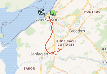
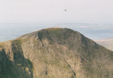
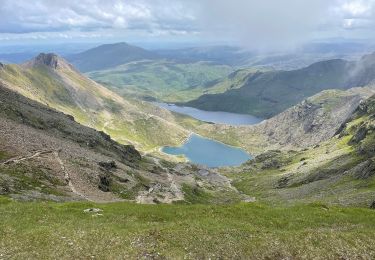
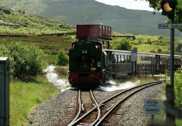
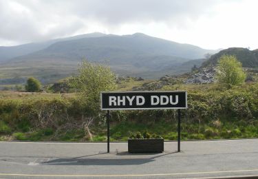
Tocht Stappen van 10 km beschikbaar op Wales, Gwynedd. Deze tocht wordt voorgesteld door dudu42.
Beschrijving
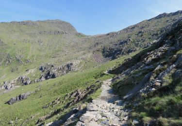
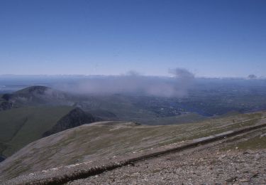
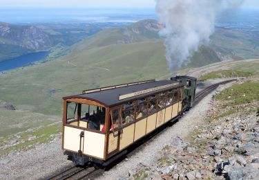
Promenade sur piste cyclable donc attention.Parcours très agréable le long de la voie du train touristique. Végétation avec fougères et fleurs de sous bois. Attention , vers la fin de la moitié du parcours ,si vous n aller pas dans le parc ( payant avec résa en ligne) faire demi-tour dans le hameau car les chemins et routes sont privées.
Plaatsbepaling
Opmerkingen
Wandeltochten in de omgeving
![Tocht Te voet - Welsh Three Thousands - Photo](https://media.geolcdn.com/t/375/260/5ab8a0aa-99ee-4595-9df2-2d73ae24b2ac.jpeg&format=jpg&maxdim=2)
![Te voet Te voet](https://static1.geolcdn.com/sitytour/trail-icons/100.png)
Te voet
![](/images/other/stat-length.png)
![](https://static1.geolcdn.com/siteimages/upload/files/16400158638029165_repeat_loop_refresh_sync_direction_icon.png)
![Tocht Te voet - Snowdon Ranger Path - Photo](https://media.geolcdn.com/t/375/260/faa58f12-38d5-4b1e-960c-3efae5abce00.jpeg&format=jpg&maxdim=2)
![Te voet Te voet](https://static1.geolcdn.com/sitytour/trail-icons/100.png)
Te voet
![](/images/other/stat-length.png)
![](https://static1.geolcdn.com/siteimages/upload/files/16400158638029165_repeat_loop_refresh_sync_direction_icon.png)
![Tocht Te voet - Rhyd Ddu Path - Photo](https://media.geolcdn.com/t/375/260/48131255-60b4-495f-ae0b-0d9605dc65fa.jpeg&format=jpg&maxdim=2)
![Te voet Te voet](https://static1.geolcdn.com/sitytour/trail-icons/100.png)
Te voet
![](/images/other/stat-length.png)
![](https://static1.geolcdn.com/siteimages/upload/files/16400158638029165_repeat_loop_refresh_sync_direction_icon.png)
![Tocht Te voet - Watkin Path - Photo](https://media.geolcdn.com/t/375/260/c6a48fa0-6308-465e-8d71-d7620c3f9fb4.jpeg&format=jpg&maxdim=2)
![Te voet Te voet](https://static1.geolcdn.com/sitytour/trail-icons/100.png)
Te voet
![](/images/other/stat-length.png)
![](https://static1.geolcdn.com/siteimages/upload/files/16400158638029165_repeat_loop_refresh_sync_direction_icon.png)
![Tocht Te voet - Pyg Track - Photo](https://media.geolcdn.com/t/375/260/e6c4d3cb-2f7d-4836-aef6-035ad12e948d.jpeg&format=jpg&maxdim=2)
![Te voet Te voet](https://static1.geolcdn.com/sitytour/trail-icons/100.png)
Te voet
![](/images/other/stat-length.png)
![](https://static1.geolcdn.com/siteimages/upload/files/16400158638029165_repeat_loop_refresh_sync_direction_icon.png)
![Tocht Te voet - Llanberis Path - Photo](https://media.geolcdn.com/t/375/260/5412c483-5e3d-4c06-9307-04cd80856ea2.jpeg&format=jpg&maxdim=2)
![Te voet Te voet](https://static1.geolcdn.com/sitytour/trail-icons/100.png)
Te voet
![](/images/other/stat-length.png)
![](https://static1.geolcdn.com/siteimages/upload/files/16400158638029165_repeat_loop_refresh_sync_direction_icon.png)
![Tocht Te voet - Miners' Track - Photo](https://media.geolcdn.com/t/375/260/585d4134-e4aa-421b-b710-2084706a950f.jpeg&format=jpg&maxdim=2)
![Te voet Te voet](https://static1.geolcdn.com/sitytour/trail-icons/100.png)
Te voet
![](/images/other/stat-length.png)
![](https://static1.geolcdn.com/siteimages/upload/files/16400158638029165_repeat_loop_refresh_sync_direction_icon.png)
![Tocht Te voet - Lôn Gwyrfai - Photo](https://media.geolcdn.com/t/375/260/3e9fc225-b0d6-4154-a17e-6406d8f46b95.jpeg&format=jpg&maxdim=2)
![Te voet Te voet](https://static1.geolcdn.com/sitytour/trail-icons/100.png)
Te voet
![](/images/other/stat-length.png)
![](https://static1.geolcdn.com/siteimages/upload/files/16400158638029165_repeat_loop_refresh_sync_direction_icon.png)
![Tocht Stappen - Aber falls - Photo](https://media.geolcdn.com/t/375/260/ext.jpg?maxdim=2&url=https%3A%2F%2Fstatic1.geolcdn.com%2Fsiteimages%2Fupload%2Ffiles%2F1553511878bg_sport_marche.png)
![Stappen Stappen](https://static1.geolcdn.com/sitytour/trail-icons/101.png)