Tocht Stappen Toledo - Tolède- Torrijo - Photo
 dagobert5612
dagobert5612

Gebruiker

© OpenStreetMap contributors
Lengte
Lengte
37 km
Max. hoogte
Max. hoogte
541 m
Positief hoogteverschil
320 m
Km-Effort
Km-Effort  
41 km
Min. hoogte
Min. hoogte
432 m
Negatief hoogteverschil
329 m
Boucle
Boucle
Neen
Datum van aanmaak :
2023-05-14 03:40:40.23
Laatste wijziging :
2023-05-14 14:18:36.071

(0 Bericht)

Stappen
Stappen
8h13
Moeilijkheid : Gemakkelijk

Scan deze QR-code om de tocht te openen in de SityTrail-applicatie

Gratisgps-wandelapplicatie

Logo SityTrail SityTrail

IGN / Geografische instituten

SityTrail uit de App Store downloaden SityTrail uit Google Play downloaden

Logo SityTrail SityTrail World

De wereld gaat voor u open

SityTrail uit de App Store downloaden SityTrail uit Google Play downloaden SityTrail op Huawei AppGallery downloaden

Over ons

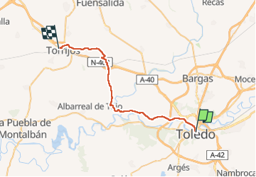
Tocht Stappen van 37 km beschikbaar op Castilië-La Mancha, Toledo, Toledo. Deze tocht wordt voorgesteld door dagobert5612.

Beschrijving

camino de levante

Hoogteprofiel

Plaatsbepaling

Land:
Spain
Regio :
Castilië-La Mancha
Departement/Provincie :
Toledo
Gemeente :
Toledo
Locatie:
Unknown
Vertrek:(UTM)
412476 ; 4412567 (30S) N.

Wandeltochten in de omgeving

Tocht Stappen Toledo - Toledo - Photo
Stappen
adamfv

Stappen

Gemakkelijk
Toledo, Castilië-La Mancha, Toledo, Spain
3,8 km | 4,7 km-effort
2h 59min
Ja


Sluiten
Mijn abonnementen