


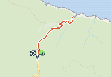

5,8 km | 8,4 km-effort

Gebruiker


Gratisgps-wandelapplicatie
 SityTrail
IGN / Geografische instituten
SityTrail World
De wereld gaat voor u open
Tocht Stappen van 4,5 km beschikbaar op Kreta, Περιφερειακή Ενότητα Χανίων. Deze tocht wordt voorgesteld door Bart2015.
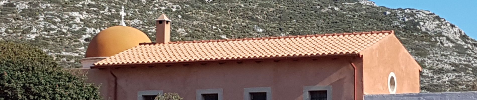
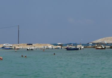
Petite balade dans la presqu'île d'Akrotiri au nord-est de Chania pour découvrir 2 monastères et entre les deux la grotte d'Arkoudiotissa. La balade d'origine est prolongée jusqu'à la mer ...
Bonne balade ...
 - Photo 1")
 - Photo 2")
 - Photo 3")
 - Photo 4")
 - Photo 5")
 - Photo 6")
 - Photo 7")
 - Photo 8")
 - Photo 9")
 - Photo 10")
 - Photo 11")
 - Photo 12")
 - Photo 13")
 - Photo 14")
 - Photo 15")
 - Photo 16")
 - Photo 17")
 - Photo 18")
 - Photo 19")
 - Photo 20")
Te voet

Stappen
Stappen